Property Record
2630 Tanglewilde St, Houston, TX 77063
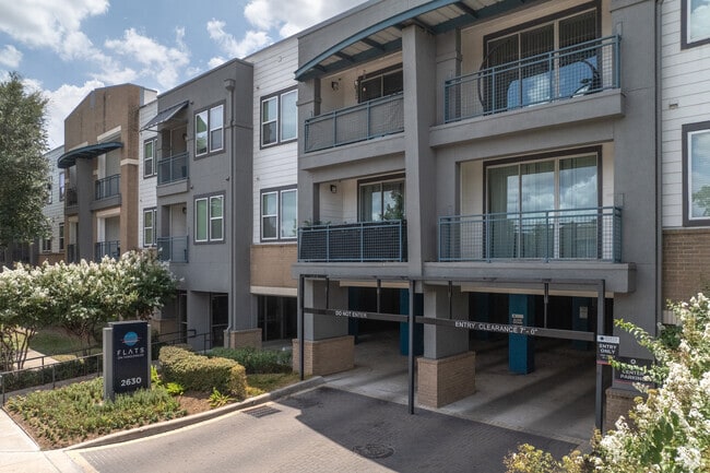

Property Detail
2630 Tanglewilde St
1049130000016
RES A1 BLK1 WOODLAKE SEC 7 PAR R/P
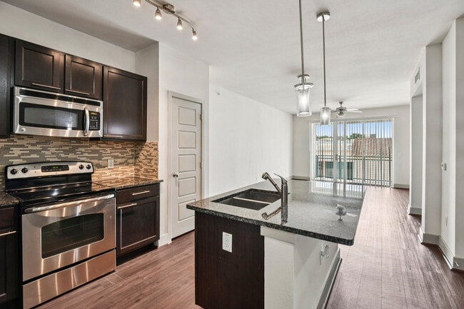
Apartment
HARRIS
B and X Area of moderate flood hazard, usually the area between the limits of the 100-year and 500-year floods.
Texas
2025
4.78 AC
2025
Woodlake-Briar Meadow
431101
Houston
337,962 SF
Houston-Pasadena-The Woodlands, TX
NEARBY LISTINGS FOR SALE OR LEASE
DEMOGRAPHICS near 2630 Tanglewilde St
1 mile
3 mile
5 mile
2025 Total Population
27,100
212,419
588,276
2030 Population
28,970
227,048
628,612
Pop Growth 2025-2030
+ 6.90%
+ 6.89%
+ 6.86%
Average Age
38
37
37
2025 Total Households
13,256
91,617
240,250
HH Growth 2025-2030
+ 6.87%
+ 7.11%
+ 7.09%
Median Household Inc
$57,218
$59,355
$60,518
Avg Household Size
2.00
2.30
2.40
2025 Avg HH Vehicles
1.00
1.00
1.00
Median Home Value
$337,500
$455,401
$401,975
Median Year Built
1980
1979
1980
Nearby Places
Map Layers
Map Styles
 Street
 Aerial
Layers
 Traffic
 Biking
Places
Listings with unknown addresses are not visible on the map
- Restaurants
- Banks
- Shops
- Fitness
- Groceries
PUBLIC TRANSPORTATION
AIRPORT
William P Hobby
Drive
Walk
Distance
William P Hobby
39 min
23.7 mi
George Bush Intcntl/Houston
Drive
Walk
Distance
George Bush Intcntl/Houston
39 min
31.5 mi
Freight Ports
Port of Houston
Drive
Walk
Distance
Port of Houston
35 min
23.0 mi
SALE & LEASE HISTORY
LISTING DATE
SALE/LEASE

Aug 23, 2018
For Sale
Apr 15, 2019
For Sale
Nearby Properties
Address
Land Use
TOTAL SIZE
Lot Size
Zoning
Address
Land Use
TOTAL SIZE
Lot Size
Zoning
2,198,376 SF
14.18 AC
Address
Land Use
TOTAL SIZE
Lot Size
Zoning
935,613 SF
27.93 AC
Address
Land Use
TOTAL SIZE
Lot Size
Zoning
542,880 SF
1.22 AC
Address
Land Use
TOTAL SIZE
Lot Size
Zoning
527,312 SF
2.58 AC
Address
Land Use
TOTAL SIZE
Lot Size
Zoning
1,020,766 SF
3.08 AC
Address
Land Use
TOTAL SIZE
Lot Size
Zoning
1,082,545 SF
7.22 AC
Address
Land Use
TOTAL SIZE
Lot Size
Zoning
306,572 SF
25.46 AC
Address
Land Use
TOTAL SIZE
Lot Size
Zoning
507,014 SF
2.93 AC
Address
Land Use
TOTAL SIZE
Lot Size
Zoning
1,053,492 SF
9.34 AC
Address
Land Use
TOTAL SIZE
Lot Size
Zoning
878,129 SF
11.69 AC
Address
Land Use
TOTAL SIZE
Lot Size
Zoning
357,280 SF
1.72 AC
Address
Land Use
TOTAL SIZE
Lot Size
Zoning
794,526 SF
21.25 AC
Address
Land Use
TOTAL SIZE
Lot Size
Zoning
1,172,310 SF
8.17 AC
Address
Land Use
TOTAL SIZE
Lot Size
Zoning
686,506 SF
1.56 AC
Address
Land Use
TOTAL SIZE
Lot Size
Zoning
702,286 SF
15.67 AC
Address
Land Use
TOTAL SIZE
Lot Size
Zoning
561,732 SF
6.10 AC
Address
Land Use
TOTAL SIZE
Lot Size
Zoning
385,587 SF
3.08 AC
Address
Land Use
TOTAL SIZE
Lot Size
Zoning
544,102 SF
2.99 AC
Address
Land Use
TOTAL SIZE
Lot Size
Zoning
337,964 SF
9.30 AC
Address
Land Use
TOTAL SIZE
Lot Size
Zoning
967,728 SF
7.40 AC
Address
Land Use
TOTAL SIZE
Lot Size
Zoning
324,600 SF
2.06 AC
Address
Land Use
TOTAL SIZE
Lot Size
Zoning
511,262 SF
6.60 AC
Address
Land Use
TOTAL SIZE
Lot Size
Zoning
972,984 SF
30.18 AC
Address
Land Use
TOTAL SIZE
Lot Size
Zoning
729,149 SF
2.32 AC
Address
Land Use
TOTAL SIZE
Lot Size
Zoning
361,954 SF
14.43 AC
Address
Land Use
TOTAL SIZE
Lot Size
Zoning
291,829 SF
4.22 AC
Address
Land Use
TOTAL SIZE
Lot Size
Zoning
526,410 SF
20.43 AC
Address
Land Use
TOTAL SIZE
Lot Size
Zoning
649,992 SF
19.81 AC
Address
Land Use
TOTAL SIZE
Lot Size
Zoning
845,371 SF
32.37 AC
Address
Land Use
TOTAL SIZE
Lot Size
Zoning
596,920 SF
2.38 AC
The World's #1 Commercial Real Estate Marketplace
Connect with us
© 2026 CoStar Group
The information above has been obtained from sources believed reliable. While we do not doubt its accuracy we have not verified it and make no guarantee, warranty or representation about it. It is your responsibility to independently confirm its accuracy and completeness. Any projections, opinions, assumptions, or estimates used are for example only and do not represent the current or future performance of the property. The value of this transaction to you depends on tax and other factors which should be evaluated by your tax, financial, and legal advisors. You and your advisors should conduct a careful, independent investigation of the property to determine to your satisfaction the suitability of the property for your needs.