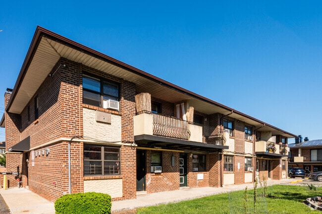
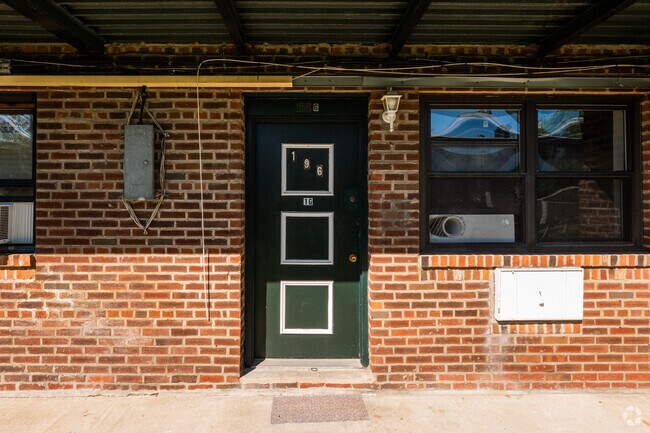
Property Record
2631 Schurz Ave, Bronx, NY 10465


NEARBY LISTINGS FOR SALE OR LEASE
Property Detail
2631 Schurz Ave
05606-0001
Bronx
Apartment
New York
AE
1
3604970104F
1.45 AC
2024
Throgs Neck-Edgewater Park
2025
Westchester/So Connecticut
013200
New York-Jersey City-White Plains, NY-NJ
46,832 SF
DEMOGRAPHICS near 2631 Schurz Ave
1 mile
3 mile
5 mile
2024 Total Population
17,337
302,688
1,259,182
2029 Population
15,424
273,280
1,163,056
Pop Growth 2024-2029
(11.03%)
(9.72%)
(7.63%)
Average Age
40
40
39
2024 Total Households
6,245
106,690
434,737
HH Growth 2024-2029
(11.93%)
(10.41%)
(8.24%)
Median Household Inc
$62,812
$59,003
$49,142
Avg Household Size
2.60
2.70
2.70
2024 Avg HH Vehicles
1.00
1.00
1.00
Median Home Value
$652,025
$659,373
$648,334
Median Year Built
1957
1954
1956
Nearby Places
Map Layers
Map Styles
 Street
 Aerial
Transit
 Traffic
 Biking
Places
Listings with unknown addresses are not visible on the map
- Restaurants
- Banks
- Shops
- Fitness
- Groceries
PUBLIC TRANSPORTATION
COMMUTER RAIL
Auburndale Station (Port Washington Branch - Long Island Rail Road)
Drive
Walk
Distance
Auburndale Station (Port Washington Branch - Long Island Rail Road)
11 min
5.9 mi
Murray Hill Station (Port Washington Branch - Long Island Rail Road)
Drive
Walk
Distance
Murray Hill Station (Port Washington Branch - Long Island Rail Road)
14 min
7.1 mi
AIRPORT
LaGuardia
Drive
Walk
Distance
LaGuardia
21 min
9.4 mi
John F Kennedy International
Drive
Walk
Distance
John F Kennedy International
27 min
17.3 mi
Westchester County
Drive
Walk
Distance
Westchester County
39 min
24.4 mi
Freight Ports
NY - Red Hook Container Terminal
Drive
Walk
Distance
NY - Red Hook Container Terminal
35 min
22.1 mi
Nearby Properties
Address
Land Use
TOTAL SIZE
Lot Size
Zoning
Address
Land Use
TOTAL SIZE
Lot Size
Zoning
550,000 SF
8.75 AC
M1-1
Address
Land Use
TOTAL SIZE
Lot Size
Zoning
5,000 SF
363.58 AC
PARK
Address
Land Use
TOTAL SIZE
Lot Size
Zoning
1,012,000 SF
7.79 AC
R6
Address
Land Use
TOTAL SIZE
Lot Size
Zoning
485,484 SF
39.63 AC
R5
Address
Land Use
TOTAL SIZE
Lot Size
Zoning
667,405 SF
5.51 AC
R6
Address
Land Use
TOTAL SIZE
Lot Size
Zoning
703,265 SF
83.45 AC
R4
Address
Land Use
TOTAL SIZE
Lot Size
Zoning
421,996 SF
136.05 AC
R3-1
Address
Land Use
TOTAL SIZE
Lot Size
Zoning
4,050 SF
113.40 AC
PARK
Address
Land Use
TOTAL SIZE
Lot Size
Zoning
480 SF
55.26 AC
R4A
Address
Land Use
TOTAL SIZE
Lot Size
Zoning
480 SF
55.26 AC
R4A
Address
Land Use
TOTAL SIZE
Lot Size
Zoning
480 SF
55.26 AC
R4A
Address
Land Use
TOTAL SIZE
Lot Size
Zoning
480 SF
55.26 AC
R4A
Address
Land Use
TOTAL SIZE
Lot Size
Zoning
480 SF
55.26 AC
R4A
Address
Land Use
TOTAL SIZE
Lot Size
Zoning
480 SF
55.26 AC
R4A
Address
Land Use
TOTAL SIZE
Lot Size
Zoning
480 SF
55.26 AC
R4A
Address
Land Use
TOTAL SIZE
Lot Size
Zoning
480 SF
55.26 AC
R4A
Address
Land Use
TOTAL SIZE
Lot Size
Zoning
480 SF
55.26 AC
R4A
Address
Land Use
TOTAL SIZE
Lot Size
Zoning
480 SF
55.26 AC
R4A
Address
Land Use
TOTAL SIZE
Lot Size
Zoning
480 SF
55.26 AC
R4A
Address
Land Use
TOTAL SIZE
Lot Size
Zoning
480 SF
55.26 AC
R4A
Address
Land Use
TOTAL SIZE
Lot Size
Zoning
480 SF
55.26 AC
R4A
Address
Land Use
TOTAL SIZE
Lot Size
Zoning
480 SF
55.26 AC
R4A
Address
Land Use
TOTAL SIZE
Lot Size
Zoning
480 SF
55.26 AC
R4A
Address
Land Use
TOTAL SIZE
Lot Size
Zoning
480 SF
55.26 AC
R4A
Address
Land Use
TOTAL SIZE
Lot Size
Zoning
480 SF
55.26 AC
R4A
Address
Land Use
TOTAL SIZE
Lot Size
Zoning
480 SF
55.26 AC
R4A
Address
Land Use
TOTAL SIZE
Lot Size
Zoning
480 SF
55.26 AC
R4A
Address
Land Use
TOTAL SIZE
Lot Size
Zoning
480 SF
55.26 AC
R4A
Address
Land Use
TOTAL SIZE
Lot Size
Zoning
480 SF
55.26 AC
R4A
Address
Land Use
TOTAL SIZE
Lot Size
Zoning
480 SF
55.26 AC
R4A
The World's #1 Commercial Real Estate Marketplace
Connect with us
© 2026 CoStar Group
The information above has been obtained from sources believed reliable. While we do not doubt its accuracy we have not verified it and make no guarantee, warranty or representation about it. It is your responsibility to independently confirm its accuracy and completeness. Any projections, opinions, assumptions, or estimates used are for example only and do not represent the current or future performance of the property. The value of this transaction to you depends on tax and other factors which should be evaluated by your tax, financial, and legal advisors. You and your advisors should conduct a careful, independent investigation of the property to determine to your satisfaction the suitability of the property for your needs.