Property Record
2632 Via Del Robles, Fallbrook, CA 92028
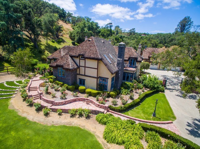

Property Detail
2632 Via Del Robles
107-400-14
PAR 2 (EX ST) TR PM05778
Multifamilydwelling
San Diego
A70
California
B and X Area of moderate flood hazard, usually the area between the limits of the 100-year and 500-year floods.
9.56 AC
2024
Outlying SD County N
2025
San Diego
018801
San Diego-Chula Vista-Carlsbad, CA
7,329 SF
NEARBY LISTINGS FOR SALE OR LEASE
DEMOGRAPHICS near 2632 Via Del Robles
1 mile
3 mile
5 mile
2025 Total Population
1,603
27,973
54,617
2030 Population
1,605
28,252
55,300
Pop Growth 2025-2030
+ 0.12%
+ 1.00%
+ 1.25%
Average Age
50
45
42
2025 Total Households
609
9,684
18,455
HH Growth 2025-2030
0.00%
+ 0.84%
+ 1.08%
Median Household Inc
$129,545
$112,711
$103,994
Avg Household Size
2.60
2.80
2.90
2025 Avg HH Vehicles
3.00
2.00
2.00
Median Home Value
$943,140
$839,550
$832,208
Median Year Built
1986
1985
1985
Nearby Places
Map Layers
Map Styles
 Street
 Aerial
Layers
 Traffic
 Biking
Places
Listings with unknown addresses are not visible on the map
- Restaurants
- Banks
- Shops
- Fitness
- Groceries
SALE & LEASE HISTORY
LISTING DATE
SALE/LEASE

Oct 12, 2018
For Sale
Nearby Properties
Address
Land Use
TOTAL SIZE
Lot Size
Zoning
Address
Land Use
TOTAL SIZE
Lot Size
Zoning
88,892 SF
2.71 AC
C34
Address
Land Use
TOTAL SIZE
Lot Size
Zoning
82,240 SF
5.65 AC
RU
Address
Land Use
TOTAL SIZE
Lot Size
Zoning
1,200 SF
13.11 AC
RMH8
Address
Land Use
TOTAL SIZE
Lot Size
Zoning
7.81 AC
RR
Address
Land Use
TOTAL SIZE
Lot Size
Zoning
53,958 SF
2.92 AC
C46
Address
Land Use
TOTAL SIZE
Lot Size
Zoning
40,115 SF
6.15 AC
C36
Address
Land Use
TOTAL SIZE
Lot Size
Zoning
29,736 SF
1.68 AC
M52
Address
Land Use
TOTAL SIZE
Lot Size
Zoning
32,760 SF
1.55 AC
C46
Address
Land Use
TOTAL SIZE
Lot Size
Zoning
50,801 SF
2.34 AC
C46
Address
Land Use
TOTAL SIZE
Lot Size
Zoning
56,364 SF
3.28 AC
RU
Address
Land Use
TOTAL SIZE
Lot Size
Zoning
30,048 SF
1.33 AC
C36
Address
Land Use
TOTAL SIZE
Lot Size
Zoning
11,840 SF
6.59 AC
A70
Address
Land Use
TOTAL SIZE
Lot Size
Zoning
39.82 AC
RMH5
Address
Land Use
TOTAL SIZE
Lot Size
Zoning
10,000 SF
1.12 AC
C37
Address
Land Use
TOTAL SIZE
Lot Size
Zoning
16,708 SF
1.77 AC
C36
Address
Land Use
TOTAL SIZE
Lot Size
Zoning
13,202 SF
0.53 AC
RU
Address
Land Use
TOTAL SIZE
Lot Size
Zoning
18,840 SF
0.72 AC
RU
Address
Land Use
TOTAL SIZE
Lot Size
Zoning
50,170 SF
1.38 AC
C31
Address
Land Use
TOTAL SIZE
Lot Size
Zoning
63,000 SF
4.52 AC
C
Address
Land Use
TOTAL SIZE
Lot Size
Zoning
18,627 SF
0.66 AC
RU
Address
Land Use
TOTAL SIZE
Lot Size
Zoning
39.77 AC
RS
Address
Land Use
TOTAL SIZE
Lot Size
Zoning
56,448 SF
2.77 AC
C31
Address
Land Use
TOTAL SIZE
Lot Size
Zoning
24,183 SF
100.90 AC
RRO
Address
Land Use
TOTAL SIZE
Lot Size
Zoning
1,512 SF
0.44 AC
C37
Address
Land Use
TOTAL SIZE
Lot Size
Zoning
21,440 SF
0.52 AC
C36
Address
Land Use
TOTAL SIZE
Lot Size
Zoning
19,391 SF
1.71 AC
C36
Address
Land Use
TOTAL SIZE
Lot Size
Zoning
19.76 AC
S88
Address
Land Use
TOTAL SIZE
Lot Size
Zoning
19,968 SF
1.31 AC
C36
Address
Land Use
TOTAL SIZE
Lot Size
Zoning
26,663 SF
1.86 AC
C31
Address
Land Use
TOTAL SIZE
Lot Size
Zoning
5.83 AC
RR
The World's #1 Commercial Real Estate Marketplace
Connect with us
© 2026 CoStar Group
The information above has been obtained from sources believed reliable. While we do not doubt its accuracy we have not verified it and make no guarantee, warranty or representation about it. It is your responsibility to independently confirm its accuracy and completeness. Any projections, opinions, assumptions, or estimates used are for example only and do not represent the current or future performance of the property. The value of this transaction to you depends on tax and other factors which should be evaluated by your tax, financial, and legal advisors. You and your advisors should conduct a careful, independent investigation of the property to determine to your satisfaction the suitability of the property for your needs.