Property Record
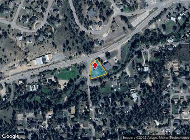
26390 State Highway 74, Kittredge, CO 80457

NEARBY LISTINGS FOR SALE OR LEASE
Property Detail
26390 State Highway 74
Denver-Aurora-Lakewood, CO
Kittredge Resub
41-354-04-006
SECTION 35 TOWNSHIP 04 RANGE 71 SUBDIVISIONCD 425200 SUBDIVISIONNAME KITTREDGE RESUB BLOCK 001 LOT 000A SIZE: 20822 TRACT VALUE: .478
Commercialnec
Jefferson
AE
Colorado
08059C0270F
a
2023
0.48 AC
2024
West
012026
Denver
2,460 SF
DEMOGRAPHICS near 26390 State Highway 74
1 Mile
3 Mile
5 Mile
2024 Total Population
1,109
11,487
23,605
2029 Population
1,058
11,249
23,179
Pop Growth 2024-2029
(4.60%)
(2.07%)
(1.80%)
Average Age
42
46
46
2024 Total Households
433
4,710
9,513
HH Growth 2024-2029
(5.08%)
(2.25%)
(1.98%)
Median Household Inc
$178,693
$141,414
$142,202
Avg Household Size
2.50
2.40
2.40
2024 Avg HH Vehicles
3.00
2.00
2.00
Median Home Value
$792,525
$789,319
$823,659
Median Year Built
1983
1979
1981
Nearby Places
Map Layers
Map Styles
 Street
 Aerial
- Restaurants
- Banks
- Shops
- Fitness
- Groceries
Nearby Properties
Address
Land Use
TOTAL SIZE
Lot Size
Zoning
Address
Land Use
TOTAL SIZE
Lot Size
Zoning
360 AC
CO
Address
Land Use
TOTAL SIZE
Lot Size
Zoning
769.90 AC
CO
Address
Land Use
TOTAL SIZE
Lot Size
Zoning
480 AC
CO
Address
Land Use
TOTAL SIZE
Lot Size
Zoning
54,443 SF
4.16 AC
PD
Address
Land Use
TOTAL SIZE
Lot Size
Zoning
44,100 SF
4.86 AC
PD
Address
Land Use
TOTAL SIZE
Lot Size
Zoning
116.70 AC
CO
Address
Land Use
TOTAL SIZE
Lot Size
Zoning
17,554 SF
25.57 AC
A2
Address
Land Use
TOTAL SIZE
Lot Size
Zoning
31,437 SF
12.36 AC
PD
Address
Land Use
TOTAL SIZE
Lot Size
Zoning
320 AC
CO
Address
Land Use
TOTAL SIZE
Lot Size
Zoning
43,212 SF
169.48 AC
PD
Address
Land Use
TOTAL SIZE
Lot Size
Zoning
53,371 SF
3.69 AC
C1
Address
Land Use
TOTAL SIZE
Lot Size
Zoning
59,012 SF
2.40 AC
PD
Address
Land Use
TOTAL SIZE
Lot Size
Zoning
34,581 SF
1.98 AC
PD
Address
Land Use
TOTAL SIZE
Lot Size
Zoning
51,104 SF
5.57 AC
PD
Address
Land Use
TOTAL SIZE
Lot Size
Zoning
53,106 SF
3.19 AC
C1
Address
Land Use
TOTAL SIZE
Lot Size
Zoning
37,332 SF
5.06 AC
PD
Address
Land Use
TOTAL SIZE
Lot Size
Zoning
5,298 SF
147.29 AC
CO
Address
Land Use
TOTAL SIZE
Lot Size
Zoning
256.19 AC
CO
Address
Land Use
TOTAL SIZE
Lot Size
Zoning
25,104 SF
1.47 AC
PD
Address
Land Use
TOTAL SIZE
Lot Size
Zoning
23,124 SF
5 AC
A2
Address
Land Use
TOTAL SIZE
Lot Size
Zoning
11,317 SF
1.45 AC
C1
Address
Land Use
TOTAL SIZE
Lot Size
Zoning
17,230 SF
1.85 AC
C1
Address
Land Use
TOTAL SIZE
Lot Size
Zoning
311.44 AC
PD
Address
Land Use
TOTAL SIZE
Lot Size
Zoning
5,753 SF
1.37 AC
PD
Address
Land Use
TOTAL SIZE
Lot Size
Zoning
35,890 SF
1.84 AC
PD
Address
Land Use
TOTAL SIZE
Lot Size
Zoning
32,461 SF
3.92 AC
C1
Address
Land Use
TOTAL SIZE
Lot Size
Zoning
15,005 SF
1.17 AC
Address
Land Use
TOTAL SIZE
Lot Size
Zoning
42,360 SF
3.02 AC
PD
Address
Land Use
TOTAL SIZE
Lot Size
Zoning
27,699 SF
2.59 AC
PD
Address
Land Use
TOTAL SIZE
Lot Size
Zoning
23,354 SF
0.71 AC
I1
The World's #1 Commercial Real Estate Marketplace
Connect with us
© 2025 CoStar Group
The information above has been obtained from sources believed reliable. While we do not doubt its accuracy we have not verified it and make no guarantee, warranty or representation about it. It is your responsibility to independently confirm its accuracy and completeness. Any projections, opinions, assumptions, or estimates used are for example only and do not represent the current or future performance of the property. The value of this transaction to you depends on tax and other factors which should be evaluated by your tax, financial, and legal advisors. You and your advisors should conduct a careful, independent investigation of the property to determine to your satisfaction the suitability of the property for your needs.