Property Record
2640 General Mills Way, Murfreesboro, TN 37127
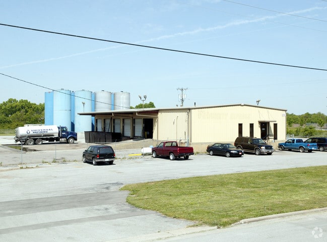

Property Detail
2640 General Mills Way
113-020.06-000
RUTHERFORD
Warehouse
Tennessee
HI
2
AE The base floodplain where base flood elevations are provided. AE Zones are now used on new format FIRMs instead of A1-A30 Zones.
4.01 AC
2025
Southeast
2025
Nashville
041201
Nashville-Davidson--Murfreesboro--Franklin, TN
5,000 SF
NEARBY LISTINGS FOR SALE OR LEASE
DEMOGRAPHICS near 2640 General Mills Way
1 mile
3 mile
5 mile
2024 Total Population
6,952
44,981
126,283
2029 Population
7,444
48,793
136,477
Pop Growth 2024-2029
+ 7.08%
+ 8.47%
+ 8.07%
Average Age
37
37
36
2024 Total Households
2,807
17,196
48,751
HH Growth 2024-2029
+ 7.27%
+ 8.68%
+ 8.29%
Median Household Inc
$71,249
$71,787
$72,014
Avg Household Size
2.40
2.50
2.50
2024 Avg HH Vehicles
2.00
2.00
2.00
Median Home Value
$376,325
$385,184
$391,566
Median Year Built
1997
1997
1998
Nearby Places
Map Layers
Map Styles
 Street
 Aerial
Transit
 Traffic
 Biking
Places
Listings with unknown addresses are not visible on the map
- Restaurants
- Banks
- Shops
- Fitness
- Groceries
PUBLIC TRANSPORTATION
AIRPORT
Nashville International
Drive
Walk
Distance
Nashville International
39 min
30.3 mi
Nearby Properties
Address
Land Use
TOTAL SIZE
Lot Size
Zoning
Address
Land Use
TOTAL SIZE
Lot Size
Zoning
1,015,800 SF
83.85 AC
Address
Land Use
TOTAL SIZE
Lot Size
Zoning
520,119 SF
34.82 AC
Address
Land Use
TOTAL SIZE
Lot Size
Zoning
844,480 SF
49.10 AC
Address
Land Use
TOTAL SIZE
Lot Size
Zoning
295,095 SF
80 AC
Address
Land Use
TOTAL SIZE
Lot Size
Zoning
10,760 SF
19.48 AC
Address
Land Use
TOTAL SIZE
Lot Size
Zoning
160,540 SF
20.19 AC
Address
Land Use
TOTAL SIZE
Lot Size
Zoning
120,225 SF
20.40 AC
Address
Land Use
TOTAL SIZE
Lot Size
Zoning
381,749 SF
74.59 AC
Address
Land Use
TOTAL SIZE
Lot Size
Zoning
172,096 SF
25 AC
Address
Land Use
TOTAL SIZE
Lot Size
Zoning
5,130 SF
17.07 AC
RM16
Address
Land Use
TOTAL SIZE
Lot Size
Zoning
479,592 SF
56.83 AC
I
Address
Land Use
TOTAL SIZE
Lot Size
Zoning
120,638 SF
20.55 AC
Address
Land Use
TOTAL SIZE
Lot Size
Zoning
6,253 SF
38.80 AC
RM16
Address
Land Use
TOTAL SIZE
Lot Size
Zoning
123,688 SF
15.27 AC
Address
Land Use
TOTAL SIZE
Lot Size
Zoning
379,080 SF
24.20 AC
Address
Land Use
TOTAL SIZE
Lot Size
Zoning
1,945 SF
16.22 AC
RM16
Address
Land Use
TOTAL SIZE
Lot Size
Zoning
110,449 SF
7.29 AC
Address
Land Use
TOTAL SIZE
Lot Size
Zoning
121,104 SF
24.92 AC
Address
Land Use
TOTAL SIZE
Lot Size
Zoning
3,147 SF
8.51 AC
Address
Land Use
TOTAL SIZE
Lot Size
Zoning
230,940 SF
20.70 AC
Address
Land Use
TOTAL SIZE
Lot Size
Zoning
364,000 SF
24.15 AC
Address
Land Use
TOTAL SIZE
Lot Size
Zoning
5,620 SF
15.20 AC
RM16
Address
Land Use
TOTAL SIZE
Lot Size
Zoning
61,652 SF
19.94 AC
Address
Land Use
TOTAL SIZE
Lot Size
Zoning
4,660 SF
19.41 AC
RM10
Address
Land Use
TOTAL SIZE
Lot Size
Zoning
163,465 SF
23.38 AC
Address
Land Use
TOTAL SIZE
Lot Size
Zoning
1,990 SF
7.42 AC
Address
Land Use
TOTAL SIZE
Lot Size
Zoning
365,556 SF
28.55 AC
Address
Land Use
TOTAL SIZE
Lot Size
Zoning
150,620 SF
25.97 AC
Address
Land Use
TOTAL SIZE
Lot Size
Zoning
210,230 SF
90 AC
Address
Land Use
TOTAL SIZE
Lot Size
Zoning
4,506 SF
11.12 AC
RM16
The World's #1 Commercial Real Estate Marketplace
Connect with us
© 2026 CoStar Group
The information above has been obtained from sources believed reliable. While we do not doubt its accuracy we have not verified it and make no guarantee, warranty or representation about it. It is your responsibility to independently confirm its accuracy and completeness. Any projections, opinions, assumptions, or estimates used are for example only and do not represent the current or future performance of the property. The value of this transaction to you depends on tax and other factors which should be evaluated by your tax, financial, and legal advisors. You and your advisors should conduct a careful, independent investigation of the property to determine to your satisfaction the suitability of the property for your needs.