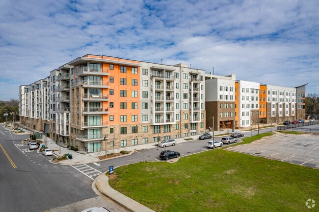
Property Record
510 E Freeman St, Decatur, GA 30030
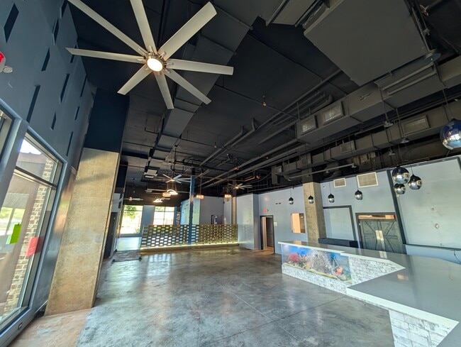
Current Lease Availabilities
NEARBY LISTINGS FOR SALE OR LEASE
-
-
No Photo
-
-
View all Decatur listings for lease on LoopNet.com
Property Detail
510 E Freeman St
15-247-03-020
DeKalb
Apartment
Georgia
X
0.51 AC
13089C0068K
Avondale Park
2025
Atlanta
2025
Atlanta-Sandy Springs-Roswell, GA
022900
DEMOGRAPHICS near 510 E Freeman St
1 Mile
3 Mile
5 Mile
2024 Total Population
14,813
117,236
316,774
2029 Population
14,870
117,933
317,956
Pop Growth 2024-2029
+ 0.38%
+ 0.59%
+ 0.37%
Average Age
41
39
38
2024 Total Households
6,935
49,882
133,678
HH Growth 2024-2029
+ 0.58%
+ 0.77%
+ 0.53%
Median Household Inc
$107,522
$83,140
$78,109
Avg Household Size
2.10
2.20
2.30
2024 Avg HH Vehicles
1.00
2.00
2.00
Median Home Value
$554,857
$448,079
$406,171
Median Year Built
1987
1974
1974
Nearby Places
Map Layers
Map Styles
 Street
 Aerial
- Restaurants
- Banks
- Shops
- Fitness
- Groceries
PUBLIC TRANSPORTATION
TRANSIT/SUBWAY
Avondale (Blue Line - Metropolitan Atlanta Rapid Transit Authority (MARTA))
DRIVE
WALK
Distance
Avondale (Blue Line - Metropolitan Atlanta Rapid Transit Authority (MARTA))
1 min
3 min
0.2 mi
Decatur (Blue Line - Metropolitan Atlanta Rapid Transit Authority (MARTA))
DRIVE
WALK
Distance
Decatur (Blue Line - Metropolitan Atlanta Rapid Transit Authority (MARTA))
2 min
18 min
0.9 mi
COMMUTER RAIL
Atlanta (Crescent - Amtrak)
DRIVE
WALK
Distance
Atlanta (Crescent - Amtrak)
18 min
8.8 mi
AIRPORT
Hartsfield - Jackson Atlanta International
DRIVE
WALK
Distance
Hartsfield - Jackson Atlanta International
27 min
15.6 mi
Freight Ports
Georgia Ports - Savannah
DRIVE
WALK
Distance
Georgia Ports - Savannah
283 min
251.9 mi
Nearby Properties
Address
Land Use
TOTAL SIZE
Lot Size
Zoning
Address
Land Use
TOTAL SIZE
Lot Size
Zoning
2,612 SF
137.60 AC
X
Address
Land Use
TOTAL SIZE
Lot Size
Zoning
123,089 SF
5.07 AC
MU-4
Address
Land Use
TOTAL SIZE
Lot Size
Zoning
78,008 SF
11.16 AC
HR-3
Address
Land Use
TOTAL SIZE
Lot Size
Zoning
123,732 SF
0.51 AC
RM75
Address
Land Use
TOTAL SIZE
Lot Size
Zoning
327,098 SF
4.92 AC
X
Address
Land Use
TOTAL SIZE
Lot Size
Zoning
393,333 SF
5.37 AC
X
Address
Land Use
TOTAL SIZE
Lot Size
Zoning
99,770 SF
2.14 AC
Address
Land Use
TOTAL SIZE
Lot Size
Zoning
158,294 SF
9.41 AC
OI
Address
Land Use
TOTAL SIZE
Lot Size
Zoning
174,052 SF
4.15 AC
MU-5
Address
Land Use
TOTAL SIZE
Lot Size
Zoning
290,130 SF
6.13 AC
R100
Address
Land Use
TOTAL SIZE
Lot Size
Zoning
225,500 SF
9.74 AC
RM75
Address
Land Use
TOTAL SIZE
Lot Size
Zoning
67,882 SF
4.77 AC
X
Address
Land Use
TOTAL SIZE
Lot Size
Zoning
357,531 SF
11.51 AC
RM75
Address
Land Use
TOTAL SIZE
Lot Size
Zoning
202,577 SF
2.97 AC
OI
Address
Land Use
TOTAL SIZE
Lot Size
Zoning
249,774 SF
15.57 AC
RM-HD
Address
Land Use
TOTAL SIZE
Lot Size
Zoning
350,556 SF
46.09 AC
X
Address
Land Use
TOTAL SIZE
Lot Size
Zoning
455,599 SF
43.15 AC
HR-3
Address
Land Use
TOTAL SIZE
Lot Size
Zoning
166,663 SF
8.65 AC
X
Address
Land Use
TOTAL SIZE
Lot Size
Zoning
259,834 SF
3.56 AC
OI
Address
Land Use
TOTAL SIZE
Lot Size
Zoning
296,175 SF
18.95 AC
RM100
Address
Land Use
TOTAL SIZE
Lot Size
Zoning
244,293 SF
2.09 AC
C-2
Address
Land Use
TOTAL SIZE
Lot Size
Zoning
298,763 SF
3.27 AC
M
Address
Land Use
TOTAL SIZE
Lot Size
Zoning
185,074 SF
10.49 AC
RM-HD
Address
Land Use
TOTAL SIZE
Lot Size
Zoning
214,505 SF
11.65 AC
C-1
Address
Land Use
TOTAL SIZE
Lot Size
Zoning
295,718 SF
25.64 AC
RM85
Address
Land Use
TOTAL SIZE
Lot Size
Zoning
104,501 SF
2.56 AC
X
Address
Land Use
TOTAL SIZE
Lot Size
Zoning
174,443 SF
9.46 AC
TND
Address
Land Use
TOTAL SIZE
Lot Size
Zoning
247,880 SF
14.82 AC
RM85
Address
Land Use
TOTAL SIZE
Lot Size
Zoning
76,500 SF
2.84 AC
X
Address
Land Use
TOTAL SIZE
Lot Size
Zoning
166,174 SF
19.70 AC
RM85
The World's #1 Commercial Real Estate Marketplace
Connect with us
© 2025 CoStar Group
The information above has been obtained from sources believed reliable. While we do not doubt its accuracy we have not verified it and make no guarantee, warranty or representation about it. It is your responsibility to independently confirm its accuracy and completeness. Any projections, opinions, assumptions, or estimates used are for example only and do not represent the current or future performance of the property. The value of this transaction to you depends on tax and other factors which should be evaluated by your tax, financial, and legal advisors. You and your advisors should conduct a careful, independent investigation of the property to determine to your satisfaction the suitability of the property for your needs.