Property Record
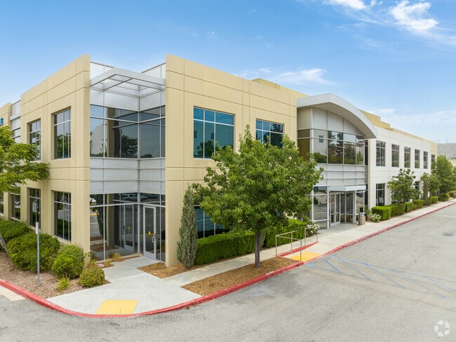
26415 Carl Boyer Dr, Santa Clarita, CA 91350


Current Lease Availabilities
NEARBY LISTINGS FOR SALE OR LEASE
Property Detail
26415 Carl Boyer Dr
Los Angeles-Long Beach-Glendale, CA
42670-07
2836-071-018
TR=42670-07 LOTS 5 AND 6
Officebuilding
Los Angeles
X
California
06037C0817G
5,6
2024
4.19 AC
2025
Santa Clarita Valley
920314
Los Angeles
41,922 SF
DEMOGRAPHICS near 26415 Carl Boyer Dr
1 Mile
3 Mile
5 Mile
2024 Total Population
5,821
108,503
217,190
2029 Population
5,527
104,445
209,350
Pop Growth 2024-2029
(5.05%)
(3.74%)
(3.61%)
Average Age
40
39
39
2024 Total Households
1,916
35,896
72,625
HH Growth 2024-2029
(5.32%)
(3.98%)
(3.84%)
Median Household Inc
$90,347
$98,466
$110,084
Avg Household Size
2.90
2.90
2.90
2024 Avg HH Vehicles
2.00
2.00
2.00
Median Home Value
$498,896
$671,101
$710,415
Median Year Built
1990
1985
1988
Nearby Places
Map Layers
Map Styles
 Street
 Aerial
- Restaurants
- Banks
- Shops
- Fitness
- Groceries
PUBLIC TRANSPORTATION
COMMUTER RAIL
Santa Clarita (Antelope Valley Line - Southern California Regional Rail Authority (Metrolink))
DRIVE
WALK
Distance
Santa Clarita (Antelope Valley Line - Southern California Regional Rail Authority (Metrolink))
5 min
1.9 mi
Via Princessa (Antelope Valley Line - Southern California Regional Rail Authority (Metrolink))
DRIVE
WALK
Distance
Via Princessa (Antelope Valley Line - Southern California Regional Rail Authority (Metrolink))
7 min
3.8 mi
AIRPORT
Bob Hope
DRIVE
WALK
Distance
Bob Hope
27 min
20.1 mi
Los Angeles International
DRIVE
WALK
Distance
Los Angeles International
49 min
37.2 mi
Nearby Properties
Address
Land Use
TOTAL SIZE
Lot Size
Zoning
Address
Land Use
TOTAL SIZE
Lot Size
Zoning
491,654 SF
17.56 AC
SCPI
Address
Land Use
TOTAL SIZE
Lot Size
Zoning
495,604 SF
38.40 AC
SCI
Address
Land Use
TOTAL SIZE
Lot Size
Zoning
255,744 SF
8.33 AC
SCUR3
Address
Land Use
TOTAL SIZE
Lot Size
Zoning
161,103 SF
4.68 AC
SCUR4
Address
Land Use
TOTAL SIZE
Lot Size
Zoning
402,480 SF
13.58 AC
SCCN
Address
Land Use
TOTAL SIZE
Lot Size
Zoning
103,828 SF
6.23 AC
SCUR4
Address
Land Use
TOTAL SIZE
Lot Size
Zoning
2,355 SF
497.82 AC
SCSP
Address
Land Use
TOTAL SIZE
Lot Size
Zoning
196,958 SF
14.03 AC
SCUR5
Address
Land Use
TOTAL SIZE
Lot Size
Zoning
97,780 SF
14.98 AC
SCUR3
Address
Land Use
TOTAL SIZE
Lot Size
Zoning
216,067 SF
25.69 AC
SCBP
Address
Land Use
TOTAL SIZE
Lot Size
Zoning
86,201 SF
3.68 AC
SCUR4
Address
Land Use
TOTAL SIZE
Lot Size
Zoning
245,606 SF
11.67 AC
SCUR4
Address
Land Use
TOTAL SIZE
Lot Size
Zoning
3,840 SF
443.36 AC
SCSP
Address
Land Use
TOTAL SIZE
Lot Size
Zoning
180,492 SF
9.47 AC
SCUR4
Address
Land Use
TOTAL SIZE
Lot Size
Zoning
79,622 SF
1.21 AC
SCPI
Address
Land Use
TOTAL SIZE
Lot Size
Zoning
52,904 SF
3.08 AC
SCPI
Address
Land Use
TOTAL SIZE
Lot Size
Zoning
76,039 SF
11.30 AC
SCCC
Address
Land Use
TOTAL SIZE
Lot Size
Zoning
137,834 SF
8.78 AC
SCSP
Address
Land Use
TOTAL SIZE
Lot Size
Zoning
129,420 SF
23.25 AC
SCBP
Address
Land Use
TOTAL SIZE
Lot Size
Zoning
57,300 SF
6.89 AC
SCCC
Address
Land Use
TOTAL SIZE
Lot Size
Zoning
154,374 SF
15.47 AC
SCBP
Address
Land Use
TOTAL SIZE
Lot Size
Zoning
74,176 SF
6.89 AC
SCUR3
Address
Land Use
TOTAL SIZE
Lot Size
Zoning
347,378 SF
14.11 AC
SCCP
Address
Land Use
TOTAL SIZE
Lot Size
Zoning
141,572 SF
10.67 AC
SCCR
Address
Land Use
TOTAL SIZE
Lot Size
Zoning
134,837 SF
12.52 AC
SCCR
Address
Land Use
TOTAL SIZE
Lot Size
Zoning
59,240 SF
2.78 AC
SCCC
Address
Land Use
TOTAL SIZE
Lot Size
Zoning
211,870 SF
9 AC
SCI
Address
Land Use
TOTAL SIZE
Lot Size
Zoning
70,408 SF
8.69 AC
SCCP
Address
Land Use
TOTAL SIZE
Lot Size
Zoning
273,992 SF
5.19 AC
SCCR
Address
Land Use
TOTAL SIZE
Lot Size
Zoning
151,452 SF
5.63 AC
SCUR5
The World's #1 Commercial Real Estate Marketplace
Connect with us
© 2026 CoStar Group
The information above has been obtained from sources believed reliable. While we do not doubt its accuracy we have not verified it and make no guarantee, warranty or representation about it. It is your responsibility to independently confirm its accuracy and completeness. Any projections, opinions, assumptions, or estimates used are for example only and do not represent the current or future performance of the property. The value of this transaction to you depends on tax and other factors which should be evaluated by your tax, financial, and legal advisors. You and your advisors should conduct a careful, independent investigation of the property to determine to your satisfaction the suitability of the property for your needs.