Property Record
2642 E 3Rd St, Montgomery, AL 36107
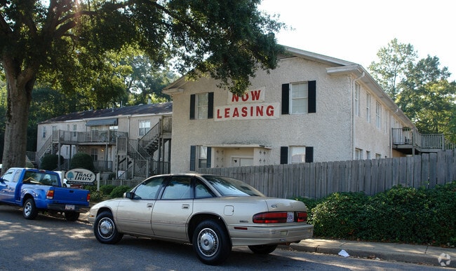

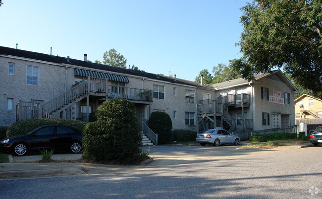
Property Detail
2642 E 3Rd St
10-05-16-3-012-001.001
1005163012001001
Apartment
Montgomery
B-2
Alabama
B and X Area of moderate flood hazard, usually the area between the limits of the 100-year and 500-year floods.
b
2025
0.67 AC
2025
Forest Park
003301
Montgomery
13,956 SF
Montgomery, AL
NEARBY LISTINGS FOR SALE OR LEASE
DEMOGRAPHICS near 2642 E 3Rd St
1 mile
3 mile
5 mile
2025 Total Population
8,208
72,931
147,506
2030 Population
8,114
72,513
146,584
Pop Growth 2025-2030
(1.15%)
(0.57%)
(0.63%)
Average Age
38
39
38
2025 Total Households
3,371
30,090
60,980
HH Growth 2025-2030
(1.16%)
(0.58%)
(0.61%)
Median Household Inc
$68,810
$55,662
$52,743
Avg Household Size
2.30
2.20
2.30
2025 Avg HH Vehicles
2.00
2.00
2.00
Median Home Value
$146,177
$159,524
$142,330
Median Year Built
1964
1966
1973
Nearby Places
Map Layers
Map Styles
 Street
 Aerial
Layers
 Traffic
 Biking
Places
Listings with unknown addresses are not visible on the map
- Restaurants
- Banks
- Shops
- Fitness
- Groceries
PUBLIC TRANSPORTATION
AIRPORT
Montgomery Regional (Dannelly Field)
Drive
Walk
Distance
Montgomery Regional (Dannelly Field)
16 min
11.1 mi
Nearby Properties
Address
Land Use
TOTAL SIZE
Lot Size
Zoning
Address
Land Use
TOTAL SIZE
Lot Size
Zoning
800,140 SF
2.27 AC
T5
Address
Land Use
TOTAL SIZE
Lot Size
Zoning
392,741 SF
2.98 AC
T5
Address
Land Use
TOTAL SIZE
Lot Size
Zoning
150,842 SF
5.40 AC
T5
Address
Land Use
TOTAL SIZE
Lot Size
Zoning
260,402 SF
17 AC
O-2
Address
Land Use
TOTAL SIZE
Lot Size
Zoning
1,343 SF
31.75 AC
R-65-M
Address
Land Use
TOTAL SIZE
Lot Size
Zoning
193,643 SF
1.61 AC
T5
Address
Land Use
TOTAL SIZE
Lot Size
Zoning
36,543 SF
0.62 AC
SD-M
Address
Land Use
TOTAL SIZE
Lot Size
Zoning
4,836 SF
16.25 AC
R-75-M
Address
Land Use
TOTAL SIZE
Lot Size
Zoning
40,829 SF
50.49 AC
SD
Address
Land Use
TOTAL SIZE
Lot Size
Zoning
10,844 SF
1.63 AC
Address
Land Use
TOTAL SIZE
Lot Size
Zoning
285,162 SF
M-1
Address
Land Use
TOTAL SIZE
Lot Size
Zoning
107,355 SF
4.12 AC
T5
Address
Land Use
TOTAL SIZE
Lot Size
Zoning
216,654 SF
26.49 AC
B-2
Address
Land Use
TOTAL SIZE
Lot Size
Zoning
93,981 SF
1.90 AC
T5
Address
Land Use
TOTAL SIZE
Lot Size
Zoning
13,273 SF
2.05 AC
T5
Address
Land Use
TOTAL SIZE
Lot Size
Zoning
164,528 SF
5.28 AC
B-3
Address
Land Use
TOTAL SIZE
Lot Size
Zoning
32,902 SF
14 AC
R-75-M
Address
Land Use
TOTAL SIZE
Lot Size
Zoning
8,519 SF
15.60 AC
B-2
Address
Land Use
TOTAL SIZE
Lot Size
Zoning
58,930 SF
2.24 AC
T5
Address
Land Use
TOTAL SIZE
Lot Size
Zoning
91,378 SF
2.46 AC
SD-M
Address
Land Use
TOTAL SIZE
Lot Size
Zoning
117,175 SF
1.49 AC
T5
Address
Land Use
TOTAL SIZE
Lot Size
Zoning
113,449 SF
0.80 AC
T5
Address
Land Use
TOTAL SIZE
Lot Size
Zoning
77,905 SF
0.83 AC
T5
Address
Land Use
TOTAL SIZE
Lot Size
Zoning
341,170 SF
O-2
Address
Land Use
TOTAL SIZE
Lot Size
Zoning
38,226 SF
5.77 AC
T5
Address
Land Use
TOTAL SIZE
Lot Size
Zoning
120,509 SF
0.29 AC
T5
Address
Land Use
TOTAL SIZE
Lot Size
Zoning
1.72 AC
T5
Address
Land Use
TOTAL SIZE
Lot Size
Zoning
84,764 SF
5.20 AC
B-2
Address
Land Use
TOTAL SIZE
Lot Size
Zoning
105,816 SF
4.34 AC
B-2
Address
Land Use
TOTAL SIZE
Lot Size
Zoning
22,183 SF
8.38 AC
T5
The World's #1 Commercial Real Estate Marketplace
Connect with us
© 2026 CoStar Group
The information above has been obtained from sources believed reliable. While we do not doubt its accuracy we have not verified it and make no guarantee, warranty or representation about it. It is your responsibility to independently confirm its accuracy and completeness. Any projections, opinions, assumptions, or estimates used are for example only and do not represent the current or future performance of the property. The value of this transaction to you depends on tax and other factors which should be evaluated by your tax, financial, and legal advisors. You and your advisors should conduct a careful, independent investigation of the property to determine to your satisfaction the suitability of the property for your needs.