Property Record
2645 E Parleys Way, Salt Lake City, UT 84109


NEARBY LISTINGS FOR SALE OR LEASE
Property Detail
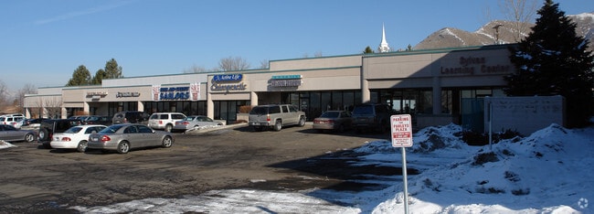
2645 E Parleys Way
Salt Lake City, UT
Laurel Sub
16-22-278-013-0000
BEG S 89^45 E 120.59 FT FR SW COR LOT 17, LAUREL SUB, SD PTALSO LYING N 763.27 FT & W 105.03 FT M OR L FR E 1/4 COR SEC22, T 1S, R 1E, SLM; S 44^07 W 105.02 FT; S 41^02 W 155.58FT; N 51^ W 283.3 FT; N 80^ E 91.01 FT; S 89^45 E 52.9 FT; N 23^26 W 153.
Stripcommercialcenter
Salt Lake
X
Utah
49035C0302H
17
2024
1.33 AC
2025
Foothill Corridor
104300
Salt Lake City
16,482 SF
DEMOGRAPHICS near 2645 E Parleys Way
1 Mile
3 Mile
5 Mile
2024 Total Population
11,580
95,286
241,865
2029 Population
11,815
95,946
244,992
Pop Growth 2024-2029
+ 2.03%
+ 0.69%
+ 1.29%
Average Age
39
39
38
2024 Total Households
4,637
37,657
103,420
HH Growth 2024-2029
+ 2.20%
+ 0.75%
+ 1.49%
Median Household Inc
$105,653
$96,827
$71,379
Avg Household Size
2.40
2.40
2.20
2024 Avg HH Vehicles
2.00
2.00
2.00
Median Home Value
$721,022
$657,515
$590,111
Median Year Built
1960
1958
1967
Nearby Places
Map Layers
Map Styles
 Street
 Aerial
- Restaurants
- Banks
- Shops
- Fitness
- Groceries
PUBLIC TRANSPORTATION
AIRPORT
Salt Lake City International
DRIVE
WALK
Distance
Salt Lake City International
20 min
14.4 mi
Provo Municipal
DRIVE
WALK
Distance
Provo Municipal
57 min
48.3 mi
SALE & LEASE HISTORY
LISTING DATE
SALE/LEASE

Sep 14, 2017
For Lease
Jan 28, 2022
For Lease
Nearby Properties
Address
Land Use
TOTAL SIZE
Lot Size
Zoning
Address
Land Use
TOTAL SIZE
Lot Size
Zoning
591,924 SF
80.77 AC
I
Address
Land Use
TOTAL SIZE
Lot Size
Zoning
530,605 SF
127 AC
RP
Address
Land Use
TOTAL SIZE
Lot Size
Zoning
295,047 SF
113.27 AC
RP
Address
Land Use
TOTAL SIZE
Lot Size
Zoning
298,628 SF
27.30 AC
I
Address
Land Use
TOTAL SIZE
Lot Size
Zoning
254,939 SF
34.68 AC
I
Address
Land Use
TOTAL SIZE
Lot Size
Zoning
440,898 SF
0.01 AC
RP
Address
Land Use
TOTAL SIZE
Lot Size
Zoning
207,140 SF
23.06 AC
P
Address
Land Use
TOTAL SIZE
Lot Size
Zoning
497,018 SF
13.11 AC
I
Address
Land Use
TOTAL SIZE
Lot Size
Zoning
257,003 SF
25.87 AC
1108
Address
Land Use
TOTAL SIZE
Lot Size
Zoning
95,666 SF
52.19 AC
I
Address
Land Use
TOTAL SIZE
Lot Size
Zoning
8,042 SF
64.58 AC
RP
Address
Land Use
TOTAL SIZE
Lot Size
Zoning
183,600 SF
10.70 AC
RMF-35
Address
Land Use
TOTAL SIZE
Lot Size
Zoning
249,796 SF
49.02 AC
I
Address
Land Use
TOTAL SIZE
Lot Size
Zoning
297,476 SF
1.62 AC
CSHBD2
Address
Land Use
TOTAL SIZE
Lot Size
Zoning
728,665 SF
0.01 AC
RP
Address
Land Use
TOTAL SIZE
Lot Size
Zoning
40,825 SF
48.09 AC
OS
Address
Land Use
TOTAL SIZE
Lot Size
Zoning
369,717 SF
2.50 AC
RO
Address
Land Use
TOTAL SIZE
Lot Size
Zoning
412,006 SF
1.70 AC
C3
Address
Land Use
TOTAL SIZE
Lot Size
Zoning
369,377 SF
1.65 AC
Address
Land Use
TOTAL SIZE
Lot Size
Zoning
152,579 SF
25.45 AC
I
Address
Land Use
TOTAL SIZE
Lot Size
Zoning
426,600 SF
1.61 AC
CSHBD1
Address
Land Use
TOTAL SIZE
Lot Size
Zoning
903,167 SF
1.90 AC
CSHBD1
Address
Land Use
TOTAL SIZE
Lot Size
Zoning
107,416 SF
5.46 AC
CSHBD2
Address
Land Use
TOTAL SIZE
Lot Size
Zoning
296,854 SF
10.97 AC
1205
Address
Land Use
TOTAL SIZE
Lot Size
Zoning
303,240 SF
29.21 AC
1205
Address
Land Use
TOTAL SIZE
Lot Size
Zoning
109,159 SF
32.02 AC
OS
Address
Land Use
TOTAL SIZE
Lot Size
Zoning
299,673 SF
2.16 AC
C3
Address
Land Use
TOTAL SIZE
Lot Size
Zoning
192,375 SF
30.87 AC
I
Address
Land Use
TOTAL SIZE
Lot Size
Zoning
266,380 SF
2.09 AC
CSHBD1
Address
Land Use
TOTAL SIZE
Lot Size
Zoning
113,817 SF
12.14 AC
OS
The World's #1 Commercial Real Estate Marketplace
Connect with us
© 2026 CoStar Group
The information above has been obtained from sources believed reliable. While we do not doubt its accuracy we have not verified it and make no guarantee, warranty or representation about it. It is your responsibility to independently confirm its accuracy and completeness. Any projections, opinions, assumptions, or estimates used are for example only and do not represent the current or future performance of the property. The value of this transaction to you depends on tax and other factors which should be evaluated by your tax, financial, and legal advisors. You and your advisors should conduct a careful, independent investigation of the property to determine to your satisfaction the suitability of the property for your needs.