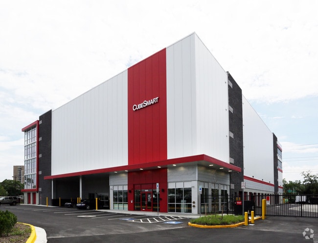
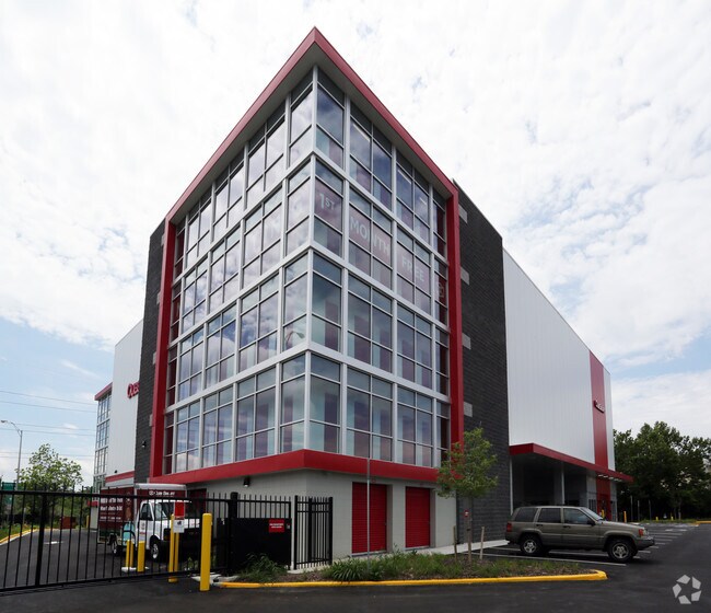
Property Record
2645 S Shirlington Rd, Arlington, VA 22206
NEARBY LISTINGS FOR SALE OR LEASE
Property Detail
2645 S Shirlington Rd
Washington-Arlington-Alexandria, DC-VA-MD-WV
Shirlington
31-034-046
PARCEL A SHIRLINGTON II 85,907 SQ FT
Shipyard
Arlington
X
Virginia
5155190027F
1.97 AC
2025
I-395 Corridor
2025
Washington, DC
103100
DEMOGRAPHICS near 2645 S Shirlington Rd
1 Mile
3 Mile
5 Mile
2024 Total Population
33,468
265,612
599,290
2029 Population
32,610
261,042
584,059
Pop Growth 2024-2029
(2.56%)
(1.72%)
(2.54%)
Average Age
37
38
38
2024 Total Households
15,365
123,640
275,011
HH Growth 2024-2029
(2.58%)
(1.71%)
(2.81%)
Median Household Inc
$113,580
$111,013
$110,727
Avg Household Size
2.10
2.10
2.10
2024 Avg HH Vehicles
1.00
1.00
1.00
Median Home Value
$534,769
$656,322
$684,809
Median Year Built
1964
1976
1975
Nearby Places
Map Layers
Map Styles
 Street
 Aerial
- Restaurants
- Banks
- Shops
- Fitness
- Groceries
PUBLIC TRANSPORTATION
COMMUTER RAIL
Crystal City (Fredericksburg Line - Virginia Railway Express, Manassas Line - Virginia Railway Express)
DRIVE
WALK
Distance
Crystal City (Fredericksburg Line - Virginia Railway Express, Manassas Line - Virginia Railway Express)
7 min
3.4 mi
Alexandria (Fredericksburg Line - Virginia Railway Express, Manassas Line - Virginia Railway Express)
DRIVE
WALK
Distance
Alexandria (Fredericksburg Line - Virginia Railway Express, Manassas Line - Virginia Railway Express)
9 min
3.5 mi
AIRPORT
Ronald Reagan Washington Ntl
DRIVE
WALK
Distance
Ronald Reagan Washington Ntl
8 min
3.6 mi
Washington Dulles International
DRIVE
WALK
Distance
Washington Dulles International
43 min
24.9 mi
Freight Ports
Port of Baltimore
DRIVE
WALK
Distance
Port of Baltimore
67 min
44.9 mi
Nearby Properties
Address
Land Use
TOTAL SIZE
Lot Size
Zoning
Address
Land Use
TOTAL SIZE
Lot Size
Zoning
900,000 SF
11.10 AC
S-3A
Address
Land Use
TOTAL SIZE
Lot Size
Zoning
6,500,000 SF
92.03 AC
S-3A
Address
Land Use
TOTAL SIZE
Lot Size
Zoning
1,732,719 SF
15.91 AC
CDD#4
Address
Land Use
TOTAL SIZE
Lot Size
Zoning
900,000 SF
260 AC
S-3A
Address
Land Use
TOTAL SIZE
Lot Size
Zoning
75.49 AC
RA
Address
Land Use
TOTAL SIZE
Lot Size
Zoning
508,547 SF
4.58 AC
C-O-2.5
Address
Land Use
TOTAL SIZE
Lot Size
Zoning
293,674 SF
13.45 AC
C-O-2.5
Address
Land Use
TOTAL SIZE
Lot Size
Zoning
40,891 SF
2.39 AC
C-O-2.5/C-
Address
Land Use
TOTAL SIZE
Lot Size
Zoning
989,384 SF
5.17 AC
CDD#2
Address
Land Use
TOTAL SIZE
Lot Size
Zoning
62,298 SF
2.58 AC
R-5
Address
Land Use
TOTAL SIZE
Lot Size
Zoning
1,882 SF
0.97 AC
C-O-A
Address
Land Use
TOTAL SIZE
Lot Size
Zoning
633,810 SF
3.45 AC
RA-H-3.2
Address
Land Use
TOTAL SIZE
Lot Size
Zoning
986,000 SF
2.30 AC
C-O-A
Address
Land Use
TOTAL SIZE
Lot Size
Zoning
6,370 SF
3.06 AC
RA6-15
Address
Land Use
TOTAL SIZE
Lot Size
Zoning
1,174,771 SF
20.30 AC
RA
Address
Land Use
TOTAL SIZE
Lot Size
Zoning
35.71 AC
P-S/RA8-18
Address
Land Use
TOTAL SIZE
Lot Size
Zoning
336,904 SF
2.12 AC
CDD#15
Address
Land Use
TOTAL SIZE
Lot Size
Zoning
224,700 SF
1.30 AC
C-O-2.5
Address
Land Use
TOTAL SIZE
Lot Size
Zoning
12,786 SF
2.19 AC
C-2
Address
Land Use
TOTAL SIZE
Lot Size
Zoning
924,015 SF
89.81 AC
S-3A
Address
Land Use
TOTAL SIZE
Lot Size
Zoning
523,155 SF
1.76 AC
RA-H-3.2
Address
Land Use
TOTAL SIZE
Lot Size
Zoning
514,892 SF
4.72 AC
C-O-2.5
Address
Land Use
TOTAL SIZE
Lot Size
Zoning
0.94 AC
C-O-2.5
Address
Land Use
TOTAL SIZE
Lot Size
Zoning
9,800 SF
1.40 AC
C-O-A
Address
Land Use
TOTAL SIZE
Lot Size
Zoning
727,145 SF
19.72 AC
S-3A
Address
Land Use
TOTAL SIZE
Lot Size
Zoning
782,494 SF
27.65 AC
R 12
Address
Land Use
TOTAL SIZE
Lot Size
Zoning
5.85 AC
RA4.8
Address
Land Use
TOTAL SIZE
Lot Size
Zoning
53,549 SF
3.50 AC
C-O
The World's #1 Commercial Real Estate Marketplace
Connect with us
© 2025 CoStar Group
The information above has been obtained from sources believed reliable. While we do not doubt its accuracy we have not verified it and make no guarantee, warranty or representation about it. It is your responsibility to independently confirm its accuracy and completeness. Any projections, opinions, assumptions, or estimates used are for example only and do not represent the current or future performance of the property. The value of this transaction to you depends on tax and other factors which should be evaluated by your tax, financial, and legal advisors. You and your advisors should conduct a careful, independent investigation of the property to determine to your satisfaction the suitability of the property for your needs.