Property Record
265 Charter Oak Rd, Lexington, SC 29072

NEARBY LISTINGS FOR SALE OR LEASE
-
-
View all Lexington listings for sale on LoopNet.com
Property Detail
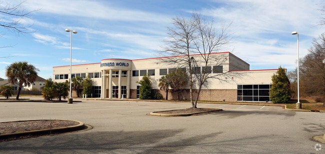
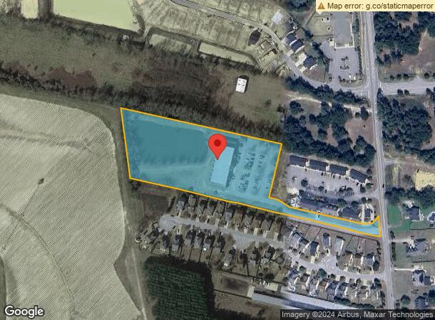
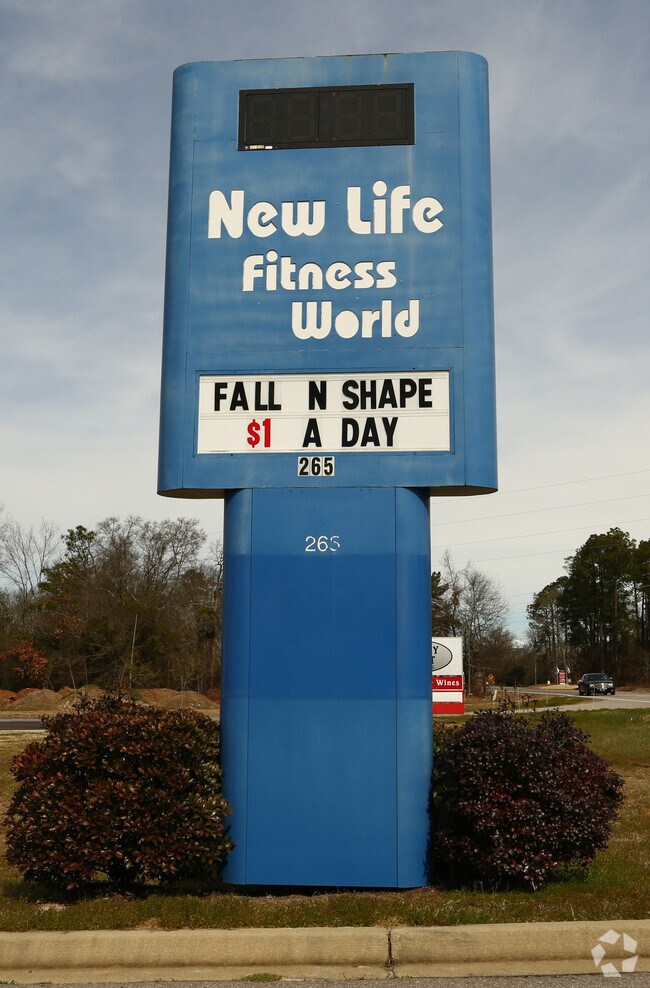
265 Charter Oak Rd
004200-05-003
Prepared For Dorris D King
Gymhealthspa
TRACT 4
X
Lexington
45063C0231J
South Carolina
0
5.42 AC
2024
Lexington
021045
Columbia
34,679 SF
Columbia, SC
DEMOGRAPHICS near 265 Charter Oak Rd
1 Mile
3 Mile
5 Mile
2024 Total Population
3,381
23,823
53,379
2029 Population
3,670
25,966
58,312
Pop Growth 2024-2029
+ 8.55%
+ 9.00%
+ 9.24%
Average Age
35
39
40
2024 Total Households
1,182
8,627
19,870
HH Growth 2024-2029
+ 8.71%
+ 9.17%
+ 9.47%
Median Household Inc
$77,862
$93,845
$87,575
Avg Household Size
2.80
2.70
2.60
2024 Avg HH Vehicles
2.00
2.00
2.00
Median Home Value
$230,679
$256,707
$258,275
Median Year Built
2008
2003
2001
Nearby Places
Map Layers
Map Styles
 Street
 Aerial
- Restaurants
- Banks
- Shops
- Fitness
- Groceries
PUBLIC TRANSPORTATION
AIRPORT
Columbia Metro
DRIVE
WALK
Distance
Columbia Metro
36 min
17.0 mi
SALE & LEASE HISTORY
LISTING DATE
SALE/LEASE

Sep 27, 2021
For Sale
Oct 13, 2021
For Sale
Jun 06, 2023
For Sale
Jun 02, 2023
For Sale
Feb 03, 2022
For Sale
Nearby Properties
Address
Land Use
TOTAL SIZE
Lot Size
Zoning
Address
Land Use
TOTAL SIZE
Lot Size
Zoning
45,171 SF
8.38 AC
ID
Address
Land Use
TOTAL SIZE
Lot Size
Zoning
9,792 SF
7.47 AC
HDR
Address
Land Use
TOTAL SIZE
Lot Size
Zoning
96,585 SF
2.62 AC
ID
Address
Land Use
TOTAL SIZE
Lot Size
Zoning
41,883 SF
21.77 AC
ID
Address
Land Use
TOTAL SIZE
Lot Size
Zoning
49,494 SF
9.98 AC
ID
Address
Land Use
TOTAL SIZE
Lot Size
Zoning
18,300 SF
3.33 AC
RD
Address
Land Use
TOTAL SIZE
Lot Size
Zoning
3,810 SF
1.58 AC
ID
Address
Land Use
TOTAL SIZE
Lot Size
Zoning
1,378 SF
125.89 AC
RD
Address
Land Use
TOTAL SIZE
Lot Size
Zoning
6,760 SF
1.50 AC
ID
Address
Land Use
TOTAL SIZE
Lot Size
Zoning
9,918 SF
2.13 AC
RD
Address
Land Use
TOTAL SIZE
Lot Size
Zoning
4,850 SF
1.88 AC
ID
Address
Land Use
TOTAL SIZE
Lot Size
Zoning
12,600 SF
2.06 AC
ID
Address
Land Use
TOTAL SIZE
Lot Size
Zoning
121.12 AC
RD
Address
Land Use
TOTAL SIZE
Lot Size
Zoning
39,473 SF
5.95 AC
ID
Address
Land Use
TOTAL SIZE
Lot Size
Zoning
5,175 SF
1.61 AC
ID
Address
Land Use
TOTAL SIZE
Lot Size
Zoning
4,098 SF
0.99 AC
ID
Address
Land Use
TOTAL SIZE
Lot Size
Zoning
10,776 SF
2.10 AC
ID
Address
Land Use
TOTAL SIZE
Lot Size
Zoning
14,494 SF
2.17 AC
ID
Address
Land Use
TOTAL SIZE
Lot Size
Zoning
1,800 SF
43.80 AC
ID
Address
Land Use
TOTAL SIZE
Lot Size
Zoning
13,870 SF
3.55 AC
ID
Address
Land Use
TOTAL SIZE
Lot Size
Zoning
1,042 SF
6.25 AC
ID
Address
Land Use
TOTAL SIZE
Lot Size
Zoning
5,029 SF
1.84 AC
ID
Address
Land Use
TOTAL SIZE
Lot Size
Zoning
4,800 SF
4.55 AC
ID
Address
Land Use
TOTAL SIZE
Lot Size
Zoning
13,231 SF
2.40 AC
ID
Address
Land Use
TOTAL SIZE
Lot Size
Zoning
4,400 SF
5.14 AC
ID
Address
Land Use
TOTAL SIZE
Lot Size
Zoning
1,250 SF
7.63 AC
ID
Address
Land Use
TOTAL SIZE
Lot Size
Zoning
4,148 SF
2.92 AC
ID
Address
Land Use
TOTAL SIZE
Lot Size
Zoning
9,600 SF
1.57 AC
GC
Address
Land Use
TOTAL SIZE
Lot Size
Zoning
8,161 SF
2.11 AC
ID
The World's #1 Commercial Real Estate Marketplace
Connect with us
© 2026 CoStar Group
The information above has been obtained from sources believed reliable. While we do not doubt its accuracy we have not verified it and make no guarantee, warranty or representation about it. It is your responsibility to independently confirm its accuracy and completeness. Any projections, opinions, assumptions, or estimates used are for example only and do not represent the current or future performance of the property. The value of this transaction to you depends on tax and other factors which should be evaluated by your tax, financial, and legal advisors. You and your advisors should conduct a careful, independent investigation of the property to determine to your satisfaction the suitability of the property for your needs.