Property Record
2650 Gresham Dr, Vestavia, AL 35243

Save to a Folder
{{folder.Name}}
{{folder.ListingIds.length}} Properties
{{folder.ListingIds.length}} Property
Create a New Folder
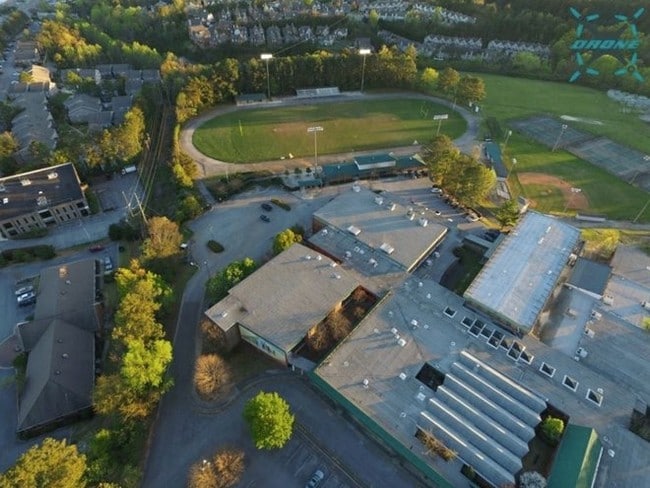
Property Detail
2650 Gresham Dr
28-00-28-3-000-018.000
BEG SW COR NW 1/4 SW 1/4 SEC 28 TP 18 R2W TH N 905 FT TH SE 797.5 FT TH SELY 490 FT TH S 870 FT TH W 1280 FT TO POB
Publicschool
Jefferson
E2IN
Alabama
B and X Area of moderate flood hazard, usually the area between the limits of the 100-year and 500-year floods.
27 AC
0
Hwy 280/Jefferson County
2025
Birmingham
012911
Birmingham, AL
NEARBY LISTINGS FOR SALE OR LEASE
DEMOGRAPHICS near 2650 Gresham Dr
1 mile
3 mile
5 mile
2025 Total Population
4,363
51,329
154,456
2030 Population
4,222
50,372
152,227
Pop Growth 2025-2030
(3.23%)
(1.86%)
(1.44%)
Average Age
41
39
39
2025 Total Households
1,495
21,110
65,659
HH Growth 2025-2030
(3.28%)
(2.16%)
(1.59%)
Median Household Inc
$206,848
$105,683
$95,617
Avg Household Size
2.90
2.30
2.20
2025 Avg HH Vehicles
2.00
2.00
2.00
Median Home Value
$850,746
$524,552
$471,041
Median Year Built
1979
1983
1980
Nearby Places
Map Layers
Map Styles
 Street
 Aerial
Layers
 Traffic
 Biking
Places
Listings with unknown addresses are not visible on the map
- Restaurants
- Banks
- Shops
- Fitness
- Groceries
PUBLIC TRANSPORTATION
COMMUTER RAIL
Birmingham (Crescent - Amtrak)
Drive
Walk
Distance
Birmingham (Crescent - Amtrak)
15 min
8.8 mi
AIRPORT
Birmingham-Shuttlesworth International
Drive
Walk
Distance
Birmingham-Shuttlesworth International
21 min
12.6 mi
Freight Ports
Port of Mobile
Drive
Walk
Distance
Port of Mobile
277 min
250.7 mi
Nearby Properties
Address
Land Use
TOTAL SIZE
Lot Size
Zoning
Address
Land Use
TOTAL SIZE
Lot Size
Zoning
200,418 SF
7 AC
C1
Address
Land Use
TOTAL SIZE
Lot Size
Zoning
978,879 SF
44 AC
I3
Address
Land Use
TOTAL SIZE
Lot Size
Zoning
31,980 SF
100 AC
I3/P
Address
Land Use
TOTAL SIZE
Lot Size
Zoning
261,311 SF
21 AC
C1
Address
Land Use
TOTAL SIZE
Lot Size
Zoning
212,615 SF
20 AC
B-2
Address
Land Use
TOTAL SIZE
Lot Size
Zoning
500,279 SF
53 AC
B2
Address
Land Use
TOTAL SIZE
Lot Size
Zoning
140,853 SF
27 AC
B-2
Address
Land Use
TOTAL SIZE
Lot Size
Zoning
6 AC
C-1
Address
Land Use
TOTAL SIZE
Lot Size
Zoning
169,501 SF
18 AC
E-2
Address
Land Use
TOTAL SIZE
Lot Size
Zoning
153,413 SF
6 AC
C1
Address
Land Use
TOTAL SIZE
Lot Size
Zoning
136,498 SF
11 AC
C1
Address
Land Use
TOTAL SIZE
Lot Size
Zoning
200,927 SF
19 AC
PMUD
Address
Land Use
TOTAL SIZE
Lot Size
Zoning
51,699 SF
1 AC
PCD-
Address
Land Use
TOTAL SIZE
Lot Size
Zoning
235,082 SF
26.10 AC
C1
Address
Land Use
TOTAL SIZE
Lot Size
Zoning
30,967 SF
17.39 AC
Address
Land Use
TOTAL SIZE
Lot Size
Zoning
81,807 SF
6 AC
C1
Address
Land Use
TOTAL SIZE
Lot Size
Zoning
102,373 SF
12.33 AC
R1-E
Address
Land Use
TOTAL SIZE
Lot Size
Zoning
329,345 SF
33 AC
C
Address
Land Use
TOTAL SIZE
Lot Size
Zoning
344,434 SF
16 AC
R4
Address
Land Use
TOTAL SIZE
Lot Size
Zoning
239,213 SF
17 AC
C1
Address
Land Use
TOTAL SIZE
Lot Size
Zoning
329,064 SF
9 AC
I3
Address
Land Use
TOTAL SIZE
Lot Size
Zoning
59,454 SF
4 AC
C1
Address
Land Use
TOTAL SIZE
Lot Size
Zoning
361,937 SF
22 AC
R4
Address
Land Use
TOTAL SIZE
Lot Size
Zoning
331,413 SF
14 AC
R6
Address
Land Use
TOTAL SIZE
Lot Size
Zoning
265,418 SF
27 AC
R2
Address
Land Use
TOTAL SIZE
Lot Size
Zoning
89,134 SF
7 AC
C-1
Address
Land Use
TOTAL SIZE
Lot Size
Zoning
97,764 SF
14 AC
C1
Address
Land Use
TOTAL SIZE
Lot Size
Zoning
62,516 SF
1 AC
I3
Address
Land Use
TOTAL SIZE
Lot Size
Zoning
125,165 SF
8 AC
CP
Address
Land Use
TOTAL SIZE
Lot Size
Zoning
141,583 SF
18 AC
I3
The World's #1 Commercial Real Estate Marketplace
Connect with us
© 2026 CoStar Group
The information above has been obtained from sources believed reliable. While we do not doubt its accuracy we have not verified it and make no guarantee, warranty or representation about it. It is your responsibility to independently confirm its accuracy and completeness. Any projections, opinions, assumptions, or estimates used are for example only and do not represent the current or future performance of the property. The value of this transaction to you depends on tax and other factors which should be evaluated by your tax, financial, and legal advisors. You and your advisors should conduct a careful, independent investigation of the property to determine to your satisfaction the suitability of the property for your needs.