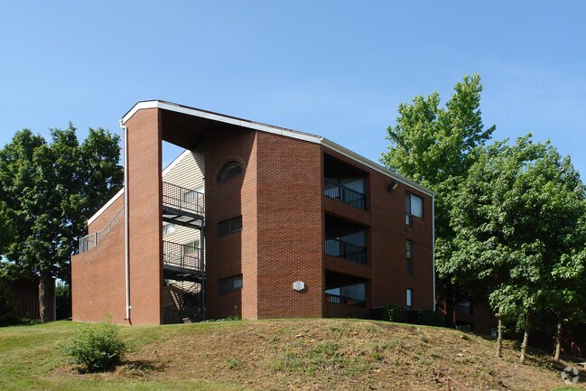
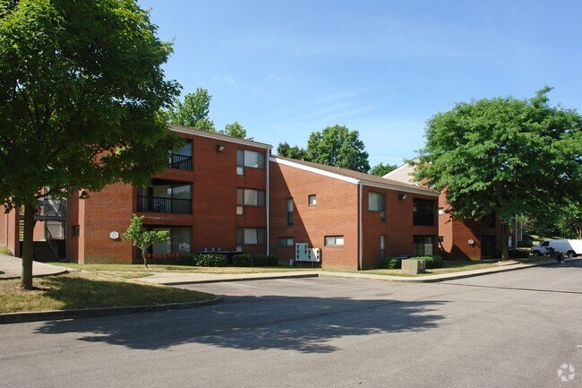
Property Record
2650 Grinstead Dr, Louisville, KY 40206

NEARBY LISTINGS FOR SALE OR LEASE
Property Detail
2650 Grinstead Dr
071K00010000
68.897 AC (PER SURVEY) RESID TR 1 MINOR PLAT DB 9809 X 577
Religious
Jefferson
X
Kentucky
21111C0044F
68.90 AC
0
Westport Rd/Brownsboro Rd
2025
Louisville
007400
Louisville-Jefferson County, KY-IN
DEMOGRAPHICS near 2650 Grinstead Dr
1 Mile
3 Mile
5 Mile
2024 Total Population
10,684
83,065
231,882
2029 Population
10,515
81,909
231,483
Pop Growth 2024-2029
(1.58%)
(1.39%)
(0.17%)
Average Age
42
42
41
2024 Total Households
4,962
40,022
107,631
HH Growth 2024-2029
(1.59%)
(1.37%)
(0.10%)
Median Household Inc
$71,923
$75,823
$59,282
Avg Household Size
2.00
2.00
2.00
2024 Avg HH Vehicles
2.00
2.00
2.00
Median Home Value
$408,102
$337,527
$257,749
Median Year Built
1950
1952
1960
Nearby Places
Map Layers
Map Styles
 Street
 Aerial
- Restaurants
- Banks
- Shops
- Fitness
- Groceries
PUBLIC TRANSPORTATION
AIRPORT
Louisville Muhammad Ali International
DRIVE
WALK
Distance
Louisville Muhammad Ali International
19 min
9.3 mi
Nearby Properties
Address
Land Use
TOTAL SIZE
Lot Size
Zoning
Address
Land Use
TOTAL SIZE
Lot Size
Zoning
Address
Land Use
TOTAL SIZE
Lot Size
Zoning
106,330 SF
9.44 AC
M3-INDUSTR
Address
Land Use
TOTAL SIZE
Lot Size
Zoning
4,337 SF
3.71 AC
(C2)COMMER
Address
Land Use
TOTAL SIZE
Lot Size
Zoning
11,168 SF
13.69 AC
OR3-OFFICE
Address
Land Use
TOTAL SIZE
Lot Size
Zoning
34.06 AC
Address
Land Use
TOTAL SIZE
Lot Size
Zoning
21,767 SF
1.47 AC
EZ1-ENTERP
Address
Land Use
TOTAL SIZE
Lot Size
Zoning
59,648 SF
1.66 AC
OR3-OFFICE
Address
Land Use
TOTAL SIZE
Lot Size
Zoning
10,080 SF
28.04 AC
OR3-OFFICE
Address
Land Use
TOTAL SIZE
Lot Size
Zoning
6,254 SF
1.48 AC
C2-COMMERC
Address
Land Use
TOTAL SIZE
Lot Size
Zoning
400 SF
13.92 AC
R6-RESIDEN
Address
Land Use
TOTAL SIZE
Lot Size
Zoning
15.29 AC
Address
Land Use
TOTAL SIZE
Lot Size
Zoning
2.81 AC
Address
Land Use
TOTAL SIZE
Lot Size
Zoning
176,448 SF
2.45 AC
Address
Land Use
TOTAL SIZE
Lot Size
Zoning
3,008 SF
15.22 AC
R7-RESIDEN
Address
Land Use
TOTAL SIZE
Lot Size
Zoning
92,412 SF
0.87 AC
OR3-OFFICE
Address
Land Use
TOTAL SIZE
Lot Size
Zoning
99,477 SF
11.46 AC
C2-COMMERC
Address
Land Use
TOTAL SIZE
Lot Size
Zoning
85,979 SF
2.68 AC
R6-RESIDEN
Address
Land Use
TOTAL SIZE
Lot Size
Zoning
2,032 SF
6.48 AC
R7-RESIDEN
Address
Land Use
TOTAL SIZE
Lot Size
Zoning
Address
Land Use
TOTAL SIZE
Lot Size
Zoning
143,321 SF
16.67 AC
C2-COMMERC
Address
Land Use
TOTAL SIZE
Lot Size
Zoning
92,295 SF
5.15 AC
OTF-OFFICE
Address
Land Use
TOTAL SIZE
Lot Size
Zoning
24,302 SF
0.27 AC
CM-COMMERC
Address
Land Use
TOTAL SIZE
Lot Size
Zoning
0.13 AC
C2-COMMERC
Address
Land Use
TOTAL SIZE
Lot Size
Zoning
15,168 SF
9.12 AC
C2-COMMERC
Address
Land Use
TOTAL SIZE
Lot Size
Zoning
4,750 SF
9.60 AC
OR2-OFFICE
Address
Land Use
TOTAL SIZE
Lot Size
Zoning
67,068 SF
7.88 AC
OR3-OFFICE
Address
Land Use
TOTAL SIZE
Lot Size
Zoning
7.90 AC
OR3-OFFICE
Address
Land Use
TOTAL SIZE
Lot Size
Zoning
Address
Land Use
TOTAL SIZE
Lot Size
Zoning
75,309 SF
5.18 AC
OTF-OFFICE
Address
Land Use
TOTAL SIZE
Lot Size
Zoning
11.97 AC
The World's #1 Commercial Real Estate Marketplace
Connect with us
© 2025 CoStar Group
The information above has been obtained from sources believed reliable. While we do not doubt its accuracy we have not verified it and make no guarantee, warranty or representation about it. It is your responsibility to independently confirm its accuracy and completeness. Any projections, opinions, assumptions, or estimates used are for example only and do not represent the current or future performance of the property. The value of this transaction to you depends on tax and other factors which should be evaluated by your tax, financial, and legal advisors. You and your advisors should conduct a careful, independent investigation of the property to determine to your satisfaction the suitability of the property for your needs.