Property Record
2650 Holcomb Bridge Rd, Alpharetta, GA 30022

NEARBY LISTINGS FOR SALE OR LEASE
Property Detail
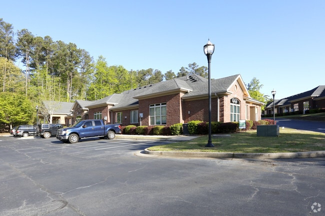
2650 Holcomb Bridge Rd
12-2930-0783-224-5
Horizon Roswell Office Condos
Officecondo
Fulton
X
Georgia
13089C0010K
0.03 AC
2024
N Fulton/Forsyth County
2025
Atlanta
011439
Atlanta-Sandy Springs-Roswell, GA
1,174 SF
DEMOGRAPHICS near 2650 Holcomb Bridge Rd
1 Mile
3 Mile
5 Mile
2024 Total Population
10,467
64,144
201,659
2029 Population
10,625
65,210
205,400
Pop Growth 2024-2029
+ 1.51%
+ 1.66%
+ 1.86%
Average Age
40
41
40
2024 Total Households
4,339
24,697
80,392
HH Growth 2024-2029
+ 1.61%
+ 1.75%
+ 1.97%
Median Household Inc
$92,882
$117,271
$100,512
Avg Household Size
2.40
2.50
2.40
2024 Avg HH Vehicles
2.00
2.00
2.00
Median Home Value
$465,208
$498,342
$486,429
Median Year Built
1986
1986
1987
Nearby Places
Map Layers
Map Styles
 Street
 Aerial
- Restaurants
- Banks
- Shops
- Fitness
- Groceries
PUBLIC TRANSPORTATION
AIRPORT
Hartsfield - Jackson Atlanta International
DRIVE
WALK
Distance
Hartsfield - Jackson Atlanta International
47 min
33.1 mi
SALE & LEASE HISTORY
LISTING DATE
SALE/LEASE

Apr 19, 2018
For Lease
Nearby Properties
Address
Land Use
TOTAL SIZE
Lot Size
Zoning
Address
Land Use
TOTAL SIZE
Lot Size
Zoning
9,544,248 SF
74.91 AC
R4
Address
Land Use
TOTAL SIZE
Lot Size
Zoning
415,701 SF
6.75 AC
OI
Address
Land Use
TOTAL SIZE
Lot Size
Zoning
5,892,558 SF
33.38 AC
R4
Address
Land Use
TOTAL SIZE
Lot Size
Zoning
792,356 SF
20.07 AC
R5
Address
Land Use
TOTAL SIZE
Lot Size
Zoning
1,196,908 SF
30.28 AC
OI
Address
Land Use
TOTAL SIZE
Lot Size
Zoning
1,423,656 SF
15.44 AC
OI
Address
Land Use
TOTAL SIZE
Lot Size
Zoning
2,109,527 SF
70.17 AC
OP
Address
Land Use
TOTAL SIZE
Lot Size
Zoning
4,821,900 SF
20.58 AC
R4C
Address
Land Use
TOTAL SIZE
Lot Size
Zoning
510,068 SF
64.18 AC
OPMS
Address
Land Use
TOTAL SIZE
Lot Size
Zoning
6,769,095 SF
21.82 AC
OI
Address
Land Use
TOTAL SIZE
Lot Size
Zoning
211,069 SF
14.91 AC
OI
Address
Land Use
TOTAL SIZE
Lot Size
Zoning
1,791,710 SF
27 AC
ACOND
Address
Land Use
TOTAL SIZE
Lot Size
Zoning
1,592,455 SF
21.50 AC
R3
Address
Land Use
TOTAL SIZE
Lot Size
Zoning
1,071,370 SF
22.30 AC
R4
Address
Land Use
TOTAL SIZE
Lot Size
Zoning
1,069,100 SF
0.73 AC
A
Address
Land Use
TOTAL SIZE
Lot Size
Zoning
1,747,896 SF
36.51 AC
C1C
Address
Land Use
TOTAL SIZE
Lot Size
Zoning
1,676,766 SF
23 AC
OIC
Address
Land Use
TOTAL SIZE
Lot Size
Zoning
2,849,264 SF
21 AC
OI
Address
Land Use
TOTAL SIZE
Lot Size
Zoning
4,758,628 SF
25.92 AC
R4
Address
Land Use
TOTAL SIZE
Lot Size
Zoning
1,438,388 SF
27.46 AC
OI
Address
Land Use
TOTAL SIZE
Lot Size
Zoning
2,066,346 SF
22.96 AC
R4C
Address
Land Use
TOTAL SIZE
Lot Size
Zoning
192,401 SF
19 AC
RM10
Address
Land Use
TOTAL SIZE
Lot Size
Zoning
1,994,949 SF
14.41 AC
R4C
Address
Land Use
TOTAL SIZE
Lot Size
Zoning
126,630 SF
30 AC
R1
Address
Land Use
TOTAL SIZE
Lot Size
Zoning
115,023 SF
11.77 AC
C3
Address
Land Use
TOTAL SIZE
Lot Size
Zoning
51.89 AC
OI
Address
Land Use
TOTAL SIZE
Lot Size
Zoning
285,089 SF
28 AC
C3
Address
Land Use
TOTAL SIZE
Lot Size
Zoning
51,930 SF
61.63 AC
R1
Address
Land Use
TOTAL SIZE
Lot Size
Zoning
803,680 SF
17.44 AC
A
Address
Land Use
TOTAL SIZE
Lot Size
Zoning
5,720 SF
222.73 AC
RA200
The World's #1 Commercial Real Estate Marketplace
Connect with us
© 2025 CoStar Group
The information above has been obtained from sources believed reliable. While we do not doubt its accuracy we have not verified it and make no guarantee, warranty or representation about it. It is your responsibility to independently confirm its accuracy and completeness. Any projections, opinions, assumptions, or estimates used are for example only and do not represent the current or future performance of the property. The value of this transaction to you depends on tax and other factors which should be evaluated by your tax, financial, and legal advisors. You and your advisors should conduct a careful, independent investigation of the property to determine to your satisfaction the suitability of the property for your needs.