Property Record
2650 N 1850 W, Ogden, UT 84404
NEARBY LISTINGS FOR SALE OR LEASE
Property Detail
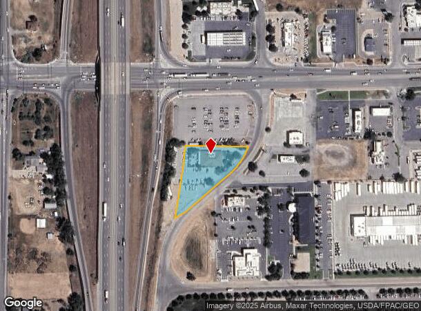
2650 N 1850 W
19-041-0040
ALL OF LOT 7, SECTION 36, TOWNSHIP 7 NORTH, RANGE 2 WEST, SALT LAKE BASE AND MERIDIAN, LOCAL SURVEY. SUBJECTED TO ANY
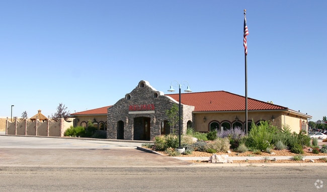
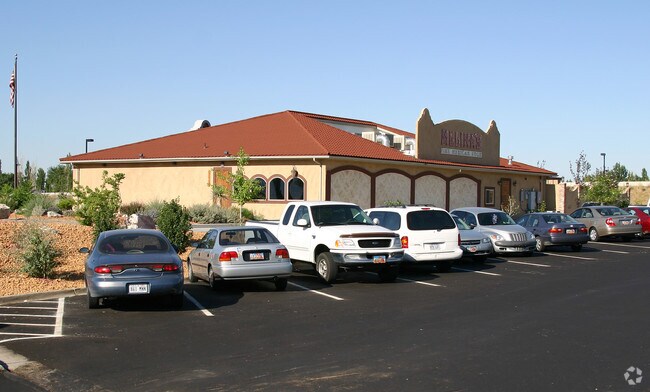
Restaurantbuilding
Weber
X
Utah
49057C0200F
7
2025
1.03 AC
2025
Davis/Weber Counties
210306
Salt Lake City
5,400 SF
Ogden, UT
DEMOGRAPHICS near 2650 N 1850 W
1 Mile
3 Mile
5 Mile
2024 Total Population
2,817
38,289
90,313
2029 Population
3,071
41,426
97,477
Pop Growth 2024-2029
+ 9.02%
+ 8.19%
+ 7.93%
Average Age
33
35
36
2024 Total Households
830
11,911
28,941
HH Growth 2024-2029
+ 9.40%
+ 8.33%
+ 8.11%
Median Household Inc
$98,499
$98,122
$81,457
Avg Household Size
3.40
3.20
3.10
2024 Avg HH Vehicles
2.00
3.00
2.00
Median Home Value
$461,513
$439,976
$382,565
Median Year Built
2006
2002
1995
Nearby Places
Map Layers
Map Styles
 Street
 Aerial
- Restaurants
- Banks
- Shops
- Fitness
- Groceries
PUBLIC TRANSPORTATION
COMMUTER RAIL
Ogden (FrontRunner North - Utah Transit Authority (UTA))
DRIVE
WALK
Distance
Ogden (FrontRunner North - Utah Transit Authority (UTA))
12 min
8.1 mi
Roy (FrontRunner North - Utah Transit Authority (UTA))
DRIVE
WALK
Distance
Roy (FrontRunner North - Utah Transit Authority (UTA))
15 min
9.7 mi
Nearby Properties
Address
Land Use
TOTAL SIZE
Lot Size
Zoning
Address
Land Use
TOTAL SIZE
Lot Size
Zoning
1,154,674 SF
133.48 AC
Address
Land Use
TOTAL SIZE
Lot Size
Zoning
1,001,933 SF
40.73 AC
Address
Land Use
TOTAL SIZE
Lot Size
Zoning
104,868 SF
22.96 AC
Address
Land Use
TOTAL SIZE
Lot Size
Zoning
292,940 SF
17.83 AC
Address
Land Use
TOTAL SIZE
Lot Size
Zoning
108,917 SF
13.90 AC
Address
Land Use
TOTAL SIZE
Lot Size
Zoning
183,172 SF
47.62 AC
Address
Land Use
TOTAL SIZE
Lot Size
Zoning
292,900 SF
14.54 AC
Address
Land Use
TOTAL SIZE
Lot Size
Zoning
264,373 SF
13.52 AC
Address
Land Use
TOTAL SIZE
Lot Size
Zoning
596 SF
8.08 AC
Address
Land Use
TOTAL SIZE
Lot Size
Zoning
1,840 SF
127.86 AC
Address
Land Use
TOTAL SIZE
Lot Size
Zoning
247,962 SF
19.14 AC
Address
Land Use
TOTAL SIZE
Lot Size
Zoning
7,632 SF
6.87 AC
Address
Land Use
TOTAL SIZE
Lot Size
Zoning
228,832 SF
4.61 AC
Address
Land Use
TOTAL SIZE
Lot Size
Zoning
298,546 SF
12.66 AC
Address
Land Use
TOTAL SIZE
Lot Size
Zoning
296,653 SF
11.45 AC
Address
Land Use
TOTAL SIZE
Lot Size
Zoning
26,418 SF
9.81 AC
Address
Land Use
TOTAL SIZE
Lot Size
Zoning
45,534 SF
7.07 AC
Address
Land Use
TOTAL SIZE
Lot Size
Zoning
178,655 SF
11.61 AC
Address
Land Use
TOTAL SIZE
Lot Size
Zoning
21,756 SF
2.32 AC
Address
Land Use
TOTAL SIZE
Lot Size
Zoning
102,522 SF
13.14 AC
Address
Land Use
TOTAL SIZE
Lot Size
Zoning
130,740 SF
21.64 AC
Address
Land Use
TOTAL SIZE
Lot Size
Zoning
164,694 SF
10 AC
Address
Land Use
TOTAL SIZE
Lot Size
Zoning
36,456 SF
4.49 AC
Address
Land Use
TOTAL SIZE
Lot Size
Zoning
43,946 SF
5.83 AC
Address
Land Use
TOTAL SIZE
Lot Size
Zoning
5,368 SF
53.37 AC
Address
Land Use
TOTAL SIZE
Lot Size
Zoning
37,492 SF
5.84 AC
The World's #1 Commercial Real Estate Marketplace
Connect with us
© 2026 CoStar Group
The information above has been obtained from sources believed reliable. While we do not doubt its accuracy we have not verified it and make no guarantee, warranty or representation about it. It is your responsibility to independently confirm its accuracy and completeness. Any projections, opinions, assumptions, or estimates used are for example only and do not represent the current or future performance of the property. The value of this transaction to you depends on tax and other factors which should be evaluated by your tax, financial, and legal advisors. You and your advisors should conduct a careful, independent investigation of the property to determine to your satisfaction the suitability of the property for your needs.