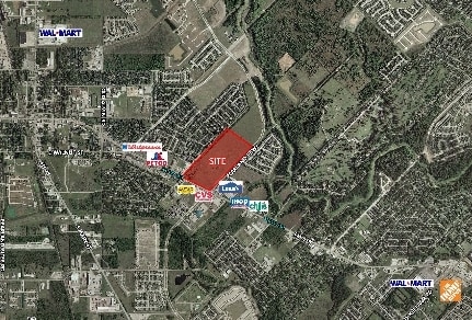
Property Record
2650 Pearland Pkwy, Pearland, TX 77581

NEARBY LISTINGS FOR SALE OR LEASE
Property Detail
2650 Pearland Pkwy
Houston-The Woodlands-Sugar Land, TX
Development Plat Of The Center At Pearla
3413-0001-002
DEVELOPMENT PLAT OF THE CENTER AT PEARLAND PARKWAY (A0198) LOT RESERVE A (AMEND) ACRES 3.9776
Commercialnec
Brazoria
X
Texas
48039C0042K
a
2024
14.83 AC
2025
Southeast Outlier
660400
Houston
128,754 SF
DEMOGRAPHICS near 2650 Pearland Pkwy
1 Mile
3 Mile
5 Mile
2024 Total Population
10,508
74,122
183,894
2029 Population
11,556
79,091
193,557
Pop Growth 2024-2029
+ 9.97%
+ 6.70%
+ 5.25%
Average Age
37
38
37
2024 Total Households
3,832
24,809
61,067
HH Growth 2024-2029
+ 10.10%
+ 6.91%
+ 5.35%
Median Household Inc
$101,381
$103,547
$84,718
Avg Household Size
2.70
2.90
2.90
2024 Avg HH Vehicles
2.00
2.00
2.00
Median Home Value
$328,222
$270,678
$246,414
Median Year Built
1995
1996
1993
Nearby Places
- Restaurants
- Banks
- Shops
- Fitness
- Groceries
PUBLIC TRANSPORTATION
AIRPORT
William P Hobby
DRIVE
WALK
Distance
William P Hobby
17 min
7.6 mi
George Bush Intcntl/Houston
DRIVE
WALK
Distance
George Bush Intcntl/Houston
52 min
38.4 mi
Freight Ports
Port of Houston
DRIVE
WALK
Distance
Port of Houston
28 min
15.8 mi
Nearby Properties
Address
Land Use
TOTAL SIZE
Lot Size
Zoning
Address
Land Use
TOTAL SIZE
Lot Size
Zoning
83.37 AC
0004
Address
Land Use
TOTAL SIZE
Lot Size
Zoning
359,985 SF
12.56 AC
Address
Land Use
TOTAL SIZE
Lot Size
Zoning
64.56 AC
0016
Address
Land Use
TOTAL SIZE
Lot Size
Zoning
236,642 SF
11.48 AC
Address
Land Use
TOTAL SIZE
Lot Size
Zoning
309,102 SF
16.81 AC
Address
Land Use
TOTAL SIZE
Lot Size
Zoning
7.42 AC
Address
Land Use
TOTAL SIZE
Lot Size
Zoning
97,736 SF
16.49 AC
Address
Land Use
TOTAL SIZE
Lot Size
Zoning
72,543 SF
22.64 AC
Address
Land Use
TOTAL SIZE
Lot Size
Zoning
14.93 AC
Address
Land Use
TOTAL SIZE
Lot Size
Zoning
144,879 SF
8.91 AC
Address
Land Use
TOTAL SIZE
Lot Size
Zoning
285,328 SF
40.75 AC
Address
Land Use
TOTAL SIZE
Lot Size
Zoning
110,990 SF
18.25 AC
Address
Land Use
TOTAL SIZE
Lot Size
Zoning
89.23 AC
Address
Land Use
TOTAL SIZE
Lot Size
Zoning
155,524 SF
7.86 AC
Address
Land Use
TOTAL SIZE
Lot Size
Zoning
113,376 SF
9.80 AC
Address
Land Use
TOTAL SIZE
Lot Size
Zoning
148,902 SF
11.40 AC
Address
Land Use
TOTAL SIZE
Lot Size
Zoning
157,128 SF
10 AC
0041
Address
Land Use
TOTAL SIZE
Lot Size
Zoning
114,828 SF
7.94 AC
Address
Land Use
TOTAL SIZE
Lot Size
Zoning
134,596 SF
7.21 AC
Address
Land Use
TOTAL SIZE
Lot Size
Zoning
67,218 SF
30.11 AC
Address
Land Use
TOTAL SIZE
Lot Size
Zoning
221,377 SF
26.83 AC
Address
Land Use
TOTAL SIZE
Lot Size
Zoning
229,097 SF
22.66 AC
Address
Land Use
TOTAL SIZE
Lot Size
Zoning
44,546 SF
7.54 AC
Address
Land Use
TOTAL SIZE
Lot Size
Zoning
67,595 SF
4.97 AC
Address
Land Use
TOTAL SIZE
Lot Size
Zoning
112,800 SF
3.20 AC
Address
Land Use
TOTAL SIZE
Lot Size
Zoning
124,152 SF
9.57 AC
0051
Address
Land Use
TOTAL SIZE
Lot Size
Zoning
54,802 SF
12.63 AC
0014
Address
Land Use
TOTAL SIZE
Lot Size
Zoning
49.29 AC
0007
Address
Land Use
TOTAL SIZE
Lot Size
Zoning
80,715 SF
8.73 AC
The World's #1 Commercial Real Estate Marketplace
Connect with us
© 2025 CoStar Group
The information above has been obtained from sources believed reliable. While we do not doubt its accuracy we have not verified it and make no guarantee, warranty or representation about it. It is your responsibility to independently confirm its accuracy and completeness. Any projections, opinions, assumptions, or estimates used are for example only and do not represent the current or future performance of the property. The value of this transaction to you depends on tax and other factors which should be evaluated by your tax, financial, and legal advisors. You and your advisors should conduct a careful, independent investigation of the property to determine to your satisfaction the suitability of the property for your needs.