Property Record
2650 Riverside Dr, Macon, GA 31204
NEARBY LISTINGS FOR SALE OR LEASE
Property Detail
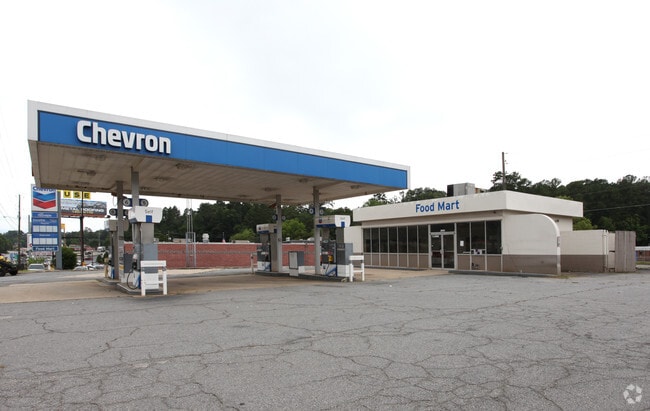
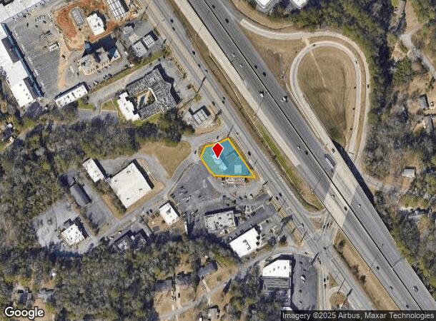
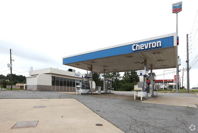
2650 Riverside Dr
Macon-Bibb County, GA
Blanton Winship
O054-0085
BLANTON WINSHIP
Conveniencestore
Bibb
X
Georgia
13021C0131G
363
2025
0.62 AC
2025
Suburban Macon
012000
Atlanta
2,269 SF
DEMOGRAPHICS near 2650 Riverside Dr
1 Mile
3 Mile
5 Mile
2024 Total Population
3,402
38,836
87,761
2029 Population
3,289
38,500
87,283
Pop Growth 2024-2029
(3.32%)
(0.87%)
(0.54%)
Average Age
40
39
39
2024 Total Households
1,430
17,206
36,791
HH Growth 2024-2029
(3.36%)
(0.91%)
(0.47%)
Median Household Inc
$73,216
$47,681
$43,235
Avg Household Size
2.30
2.20
2.30
2024 Avg HH Vehicles
2.00
1.00
1.00
Median Home Value
$155,827
$153,206
$148,278
Median Year Built
1962
1966
1970
Nearby Places
Map Layers
Map Styles
 Street
 Aerial
- Restaurants
- Banks
- Shops
- Fitness
- Groceries
SALE & LEASE HISTORY
LISTING DATE
SALE/LEASE

Sep 23, 2016
For Sale
Nearby Properties
Address
Land Use
TOTAL SIZE
Lot Size
Zoning
Address
Land Use
TOTAL SIZE
Lot Size
Zoning
196,702 SF
37.72 AC
PDE
Address
Land Use
TOTAL SIZE
Lot Size
Zoning
154,196 SF
44.86 AC
R-1A
Address
Land Use
TOTAL SIZE
Lot Size
Zoning
194,734 SF
6.37 AC
C-2
Address
Land Use
TOTAL SIZE
Lot Size
Zoning
127,536 SF
3.56 AC
PDE
Address
Land Use
TOTAL SIZE
Lot Size
Zoning
71,021 SF
8.94 AC
PDC
Address
Land Use
TOTAL SIZE
Lot Size
Zoning
231,774 SF
21.27 AC
R-1AAA
Address
Land Use
TOTAL SIZE
Lot Size
Zoning
199,096 SF
22.03 AC
R-2
Address
Land Use
TOTAL SIZE
Lot Size
Zoning
1,039 SF
14.79 AC
PDR
Address
Land Use
TOTAL SIZE
Lot Size
Zoning
1,452 SF
12.16 AC
R-3
Address
Land Use
TOTAL SIZE
Lot Size
Zoning
145,967 SF
2.53 AC
C-4
Address
Land Use
TOTAL SIZE
Lot Size
Zoning
6,720 SF
16.69 AC
PDR
Address
Land Use
TOTAL SIZE
Lot Size
Zoning
4,000 SF
2,887.63 AC
001
Address
Land Use
TOTAL SIZE
Lot Size
Zoning
141,816 SF
16.44 AC
C-2
Address
Land Use
TOTAL SIZE
Lot Size
Zoning
2,366 SF
14.46 AC
PDE
Address
Land Use
TOTAL SIZE
Lot Size
Zoning
46,174 SF
9.67 AC
R-2
Address
Land Use
TOTAL SIZE
Lot Size
Zoning
110,745 SF
4.99 AC
PDE
Address
Land Use
TOTAL SIZE
Lot Size
Zoning
143,280 SF
5.06 AC
HR-3
Address
Land Use
TOTAL SIZE
Lot Size
Zoning
63,654 SF
14.67 AC
C-2
Address
Land Use
TOTAL SIZE
Lot Size
Zoning
23,520 SF
12.78 AC
R-3
Address
Land Use
TOTAL SIZE
Lot Size
Zoning
145 SF
15.97 AC
R-3
Address
Land Use
TOTAL SIZE
Lot Size
Zoning
2,816 SF
12.46 AC
R-2
Address
Land Use
TOTAL SIZE
Lot Size
Zoning
48,524 SF
1.80 AC
C-2
Address
Land Use
TOTAL SIZE
Lot Size
Zoning
50,918 SF
2 AC
C-2
Address
Land Use
TOTAL SIZE
Lot Size
Zoning
117,083 SF
8.32 AC
PDR
Address
Land Use
TOTAL SIZE
Lot Size
Zoning
26,865 SF
6.60 AC
R-3
Address
Land Use
TOTAL SIZE
Lot Size
Zoning
20,572 SF
16.08 AC
R-3
Address
Land Use
TOTAL SIZE
Lot Size
Zoning
48,312 SF
2.39 AC
HPD
Address
Land Use
TOTAL SIZE
Lot Size
Zoning
16,180 SF
9.52 AC
C-1
Address
Land Use
TOTAL SIZE
Lot Size
Zoning
76,578 SF
13.60 AC
R-1AAA
Address
Land Use
TOTAL SIZE
Lot Size
Zoning
47,952 SF
2.14 AC
C-2
The World's #1 Commercial Real Estate Marketplace
Connect with us
© 2025 CoStar Group
The information above has been obtained from sources believed reliable. While we do not doubt its accuracy we have not verified it and make no guarantee, warranty or representation about it. It is your responsibility to independently confirm its accuracy and completeness. Any projections, opinions, assumptions, or estimates used are for example only and do not represent the current or future performance of the property. The value of this transaction to you depends on tax and other factors which should be evaluated by your tax, financial, and legal advisors. You and your advisors should conduct a careful, independent investigation of the property to determine to your satisfaction the suitability of the property for your needs.