Property Record
2650 Walnut Pl, Saint Louis, MO 63103


Property Detail
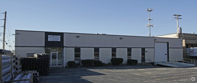
2650 Walnut Pl
1720-00-0200-0
C.B. 1720 WALNUT PL 0.649 ACRES MILL CREEK VALLEY SUBDN BND S-208.223 FT N OF CLARK AVE
Commercialnec
ST. LOUIS CITY
J
Missouri
B and X Area of moderate flood hazard, usually the area between the limits of the 100-year and 500-year floods.
0.65 AC
2024
St Louis City North
2025
St. Louis
127500
St. Louis, MO-IL
13,685 SF
NEARBY LISTINGS FOR SALE OR LEASE
DEMOGRAPHICS near 2650 Walnut Pl
1 mile
3 mile
5 mile
2025 Total Population
12,744
114,485
258,062
2030 Population
12,150
110,522
249,709
Pop Growth 2025-2030
(4.66%)
(3.46%)
(3.24%)
Average Age
38
38
39
2025 Total Households
6,706
55,995
120,700
HH Growth 2025-2030
(4.95%)
(4.11%)
(3.97%)
Median Household Inc
$42,699
$60,596
$55,439
Avg Household Size
1.60
1.90
2.00
2025 Avg HH Vehicles
1.00
1.00
1.00
Median Home Value
$239,339
$265,982
$191,689
Median Year Built
1962
1947
1947
Nearby Places
Map Layers
Map Styles
 Street
 Aerial
Layers
 Traffic
 Biking
Places
Listings with unknown addresses are not visible on the map
- Restaurants
- Banks
- Shops
- Fitness
- Groceries
PUBLIC TRANSPORTATION
COMMUTER RAIL
Union Station (Lambert Airport Shiloh-Scott - St. Louis MetroLink (MetroLink), Shrewsbury-Lansdowne I-44 Emerson Park - St. Louis MetroLink (MetroLink))
Drive
Walk
Distance
Union Station (Lambert Airport Shiloh-Scott - St. Louis MetroLink (MetroLink), Shrewsbury-Lansdowne I-44 Emerson Park - St. Louis MetroLink (MetroLink))
2 min
17 min
0.9 mi
Civic Center (Lambert Airport Shiloh-Scott - St. Louis MetroLink (MetroLink), Shrewsbury-Lansdowne I-44 Emerson Park - St. Louis MetroLink (MetroLink))
Drive
Walk
Distance
Civic Center (Lambert Airport Shiloh-Scott - St. Louis MetroLink (MetroLink), Shrewsbury-Lansdowne I-44 Emerson Park - St. Louis MetroLink (MetroLink))
2 min
20 min
1.1 mi
AIRPORT
St Louis Lambert International
Drive
Walk
Distance
St Louis Lambert International
22 min
13.2 mi
Scott AFB/Midamerica St Louis
Drive
Walk
Distance
Scott AFB/Midamerica St Louis
41 min
27.0 mi
Freight Ports
Port Milwaukee
Drive
Walk
Distance
Port Milwaukee
420 min
371.3 mi
SALE & LEASE HISTORY
LISTING DATE
SALE/LEASE

Jan 12, 2017
For Lease
Nearby Properties
Address
Land Use
TOTAL SIZE
Lot Size
Zoning
Address
Land Use
TOTAL SIZE
Lot Size
Zoning
467,000 SF
11.19 AC
I
Address
Land Use
TOTAL SIZE
Lot Size
Zoning
1,037,632 SF
3.34 AC
I
Address
Land Use
TOTAL SIZE
Lot Size
Zoning
661,472 SF
7.29 AC
L
Address
Land Use
TOTAL SIZE
Lot Size
Zoning
1.72 AC
I
Address
Land Use
TOTAL SIZE
Lot Size
Zoning
1,361,485 SF
5.45 AC
E
Address
Land Use
TOTAL SIZE
Lot Size
Zoning
1.71 AC
I
Address
Land Use
TOTAL SIZE
Lot Size
Zoning
355,000 SF
0.75 AC
I
Address
Land Use
TOTAL SIZE
Lot Size
Zoning
229.57 AC
B
Address
Land Use
TOTAL SIZE
Lot Size
Zoning
472,328 SF
19.85 AC
I
Address
Land Use
TOTAL SIZE
Lot Size
Zoning
10.97 AC
I
Address
Land Use
TOTAL SIZE
Lot Size
Zoning
1,165,128 SF
1.70 AC
L
Address
Land Use
TOTAL SIZE
Lot Size
Zoning
624,049 SF
20.78 AC
K
Address
Land Use
TOTAL SIZE
Lot Size
Zoning
1,189,932 SF
1.45 AC
I
Address
Land Use
TOTAL SIZE
Lot Size
Zoning
7.38 AC
I
Address
Land Use
TOTAL SIZE
Lot Size
Zoning
1,089,750 SF
8.43 AC
I
Address
Land Use
TOTAL SIZE
Lot Size
Zoning
593,701 SF
2.08 AC
I
Address
Land Use
TOTAL SIZE
Lot Size
Zoning
246,345 SF
4.17 AC
J
Address
Land Use
TOTAL SIZE
Lot Size
Zoning
1.98 AC
H
Address
Land Use
TOTAL SIZE
Lot Size
Zoning
Address
Land Use
TOTAL SIZE
Lot Size
Zoning
423,303 SF
9.97 AC
H
Address
Land Use
TOTAL SIZE
Lot Size
Zoning
702,704 SF
2.10 AC
I
Address
Land Use
TOTAL SIZE
Lot Size
Zoning
225,920 SF
2.02 AC
H
Address
Land Use
TOTAL SIZE
Lot Size
Zoning
360,580 SF
26.13 AC
KJ
Address
Land Use
TOTAL SIZE
Lot Size
Zoning
570,135 SF
0.52 AC
I
Address
Land Use
TOTAL SIZE
Lot Size
Zoning
359,040 SF
1.33 AC
L
Address
Land Use
TOTAL SIZE
Lot Size
Zoning
248,809 SF
3.23 AC
H
Address
Land Use
TOTAL SIZE
Lot Size
Zoning
439,346 SF
1.45 AC
I
Address
Land Use
TOTAL SIZE
Lot Size
Zoning
303,680 SF
2.09 AC
I
Address
Land Use
TOTAL SIZE
Lot Size
Zoning
190,000 SF
2.71 AC
I
Address
Land Use
TOTAL SIZE
Lot Size
Zoning
189,841 SF
4.18 AC
K
The World's #1 Commercial Real Estate Marketplace
Connect with us
© 2026 CoStar Group
The information above has been obtained from sources believed reliable. While we do not doubt its accuracy we have not verified it and make no guarantee, warranty or representation about it. It is your responsibility to independently confirm its accuracy and completeness. Any projections, opinions, assumptions, or estimates used are for example only and do not represent the current or future performance of the property. The value of this transaction to you depends on tax and other factors which should be evaluated by your tax, financial, and legal advisors. You and your advisors should conduct a careful, independent investigation of the property to determine to your satisfaction the suitability of the property for your needs.