Property Record
2651 S Stonebridge Dr, Mckinney, TX 75072
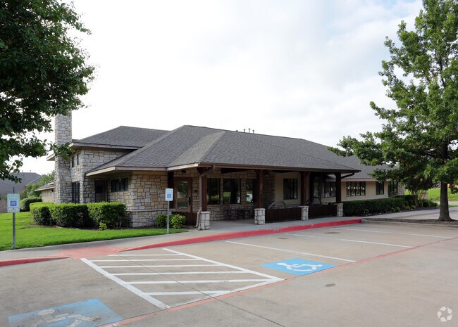

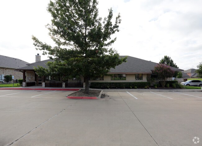
Property Detail
2651 S Stonebridge Dr
R-4411-00A-0060-1
STONEBRIDGE PARCEL 903, BLK A, LOT 6
Officebuilding
COLLIN
COMM/OFFIC
Texas
B and X Area of moderate flood hazard, usually the area between the limits of the 100-year and 500-year floods.
6
2025
0.99 AC
2025
McKinney
030531
Dallas/Ft Worth
5,758 SF
Dallas-Fort Worth-Arlington, TX
NEARBY LISTINGS FOR SALE OR LEASE
DEMOGRAPHICS near 2651 S Stonebridge Dr
1 mile
3 mile
5 mile
2025 Total Population
13,584
155,074
315,401
2030 Population
15,422
176,852
360,810
Pop Growth 2025-2030
+ 13.53%
+ 14.04%
+ 14.40%
Average Age
39
37
37
2025 Total Households
4,585
52,796
106,075
HH Growth 2025-2030
+ 13.72%
+ 14.29%
+ 14.60%
Median Household Inc
$164,033
$146,081
$148,117
Avg Household Size
2.90
2.90
2.90
2025 Avg HH Vehicles
2.00
2.00
2.00
Median Home Value
$631,391
$595,082
$616,801
Median Year Built
2006
2010
2010
Nearby Places
Map Layers
Map Styles
 Street
 Aerial
Transit
 Traffic
 Biking
Places
Listings with unknown addresses are not visible on the map
- Restaurants
- Banks
- Shops
- Fitness
- Groceries
PUBLIC TRANSPORTATION
AIRPORT
Dallas Love Field
Drive
Walk
Distance
Dallas Love Field
42 min
30.6 mi
Dallas-Fort Worth International
Drive
Walk
Distance
Dallas-Fort Worth International
39 min
31.4 mi
Nearby Properties
Address
Land Use
TOTAL SIZE
Lot Size
Zoning
Address
Land Use
TOTAL SIZE
Lot Size
Zoning
766,124 SF
62.04 AC
Address
Land Use
TOTAL SIZE
Lot Size
Zoning
691,265 SF
53.52 AC
Address
Land Use
TOTAL SIZE
Lot Size
Zoning
256,445 SF
10.42 AC
Address
Land Use
TOTAL SIZE
Lot Size
Zoning
494,378 SF
57.29 AC
Address
Land Use
TOTAL SIZE
Lot Size
Zoning
387,377 SF
64.34 AC
Address
Land Use
TOTAL SIZE
Lot Size
Zoning
585,170 SF
18.69 AC
MF RG-18
Address
Land Use
TOTAL SIZE
Lot Size
Zoning
557,288 SF
9.18 AC
Address
Land Use
TOTAL SIZE
Lot Size
Zoning
518,353 SF
28.51 AC
MF-M
Address
Land Use
TOTAL SIZE
Lot Size
Zoning
466,467 SF
46.81 AC
Address
Land Use
TOTAL SIZE
Lot Size
Zoning
493,621 SF
17 AC
APTS
Address
Land Use
TOTAL SIZE
Lot Size
Zoning
435,382 SF
6.95 AC
MF-E
Address
Land Use
TOTAL SIZE
Lot Size
Zoning
398,732 SF
25.88 AC
MF-M
Address
Land Use
TOTAL SIZE
Lot Size
Zoning
556,741 SF
8.70 AC
MF-R
Address
Land Use
TOTAL SIZE
Lot Size
Zoning
483,386 SF
4.62 AC
MF-R
Address
Land Use
TOTAL SIZE
Lot Size
Zoning
464,454 SF
11.04 AC
PD
Address
Land Use
TOTAL SIZE
Lot Size
Zoning
505,541 SF
19.78 AC
SFR
Address
Land Use
TOTAL SIZE
Lot Size
Zoning
397,395 SF
12.25 AC
Address
Land Use
TOTAL SIZE
Lot Size
Zoning
357,097 SF
19.68 AC
MF-M
Address
Land Use
TOTAL SIZE
Lot Size
Zoning
274,184 SF
20.34 AC
COMM
Address
Land Use
TOTAL SIZE
Lot Size
Zoning
379,701 SF
17.58 AC
MULTI-FAMI
Address
Land Use
TOTAL SIZE
Lot Size
Zoning
345,998 SF
17.81 AC
MF-M
Address
Land Use
TOTAL SIZE
Lot Size
Zoning
344,076 SF
15.49 AC
MULTI-FAMI
Address
Land Use
TOTAL SIZE
Lot Size
Zoning
337,425 SF
7.44 AC
MF-E
Address
Land Use
TOTAL SIZE
Lot Size
Zoning
442,463 SF
17.34 AC
Address
Land Use
TOTAL SIZE
Lot Size
Zoning
407,094 SF
15.04 AC
MF RG-18
Address
Land Use
TOTAL SIZE
Lot Size
Zoning
345,481 SF
5.01 AC
Address
Land Use
TOTAL SIZE
Lot Size
Zoning
386,153 SF
13.83 AC
Address
Land Use
TOTAL SIZE
Lot Size
Zoning
381,990 SF
13.80 AC
MF-H
Address
Land Use
TOTAL SIZE
Lot Size
Zoning
357,411 SF
13.59 AC
MF-M
Address
Land Use
TOTAL SIZE
Lot Size
Zoning
291,032 SF
5.73 AC
MF-E
The World's #1 Commercial Real Estate Marketplace
Connect with us
© 2026 CoStar Group
The information above has been obtained from sources believed reliable. While we do not doubt its accuracy we have not verified it and make no guarantee, warranty or representation about it. It is your responsibility to independently confirm its accuracy and completeness. Any projections, opinions, assumptions, or estimates used are for example only and do not represent the current or future performance of the property. The value of this transaction to you depends on tax and other factors which should be evaluated by your tax, financial, and legal advisors. You and your advisors should conduct a careful, independent investigation of the property to determine to your satisfaction the suitability of the property for your needs.