Property Record
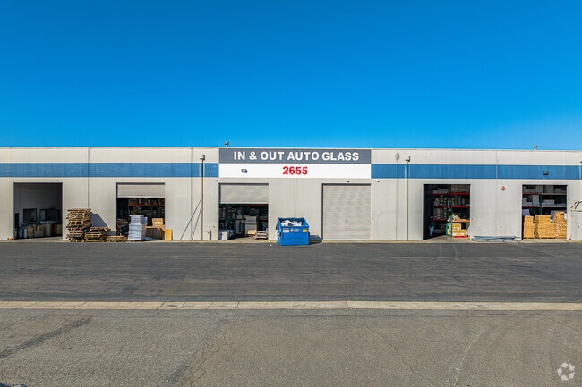
2655 Land Ave, Sacramento, CA 95815


Current Lease Availabilities
NEARBY LISTINGS FOR SALE OR LEASE
Property Detail
2655 Land Ave
Sacramento-Roseville-Folsom, CA
Parcel Map
265-0280-053
PARCEL MAP, LOT A
Heavyindustrial
Sacramento
X
California
06067C0181H
a
2024
1.34 AC
2025
NE Sacramento
006300
Sacramento
32,000 SF
DEMOGRAPHICS near 2655 Land Ave
1 Mile
3 Mile
5 Mile
2024 Total Population
19,001
143,659
375,521
2029 Population
19,161
144,715
379,302
Pop Growth 2024-2029
+ 0.84%
+ 0.74%
+ 1.01%
Average Age
36
37
38
2024 Total Households
6,364
50,857
147,522
HH Growth 2024-2029
+ 0.82%
+ 0.73%
+ 1.14%
Median Household Inc
$41,394
$54,076
$67,606
Avg Household Size
2.80
2.70
2.40
2024 Avg HH Vehicles
2.00
2.00
2.00
Median Home Value
$267,901
$376,930
$469,101
Median Year Built
1957
1969
1971
Nearby Places
Map Layers
Map Styles
 Street
 Aerial
- Restaurants
- Banks
- Shops
- Fitness
- Groceries
PUBLIC TRANSPORTATION
COMMUTER RAIL
DRIVE
WALK
Distance
11 min
5.1 mi
AIRPORT
Sacramento International
DRIVE
WALK
Distance
Sacramento International
22 min
13.5 mi
Freight Ports
Port of Stockton
DRIVE
WALK
Distance
Port of Stockton
64 min
51.9 mi
Nearby Properties
Address
Land Use
TOTAL SIZE
Lot Size
Zoning
Address
Land Use
TOTAL SIZE
Lot Size
Zoning
201,132 SF
28.11 AC
C-2
Address
Land Use
TOTAL SIZE
Lot Size
Zoning
490,607 SF
32.63 AC
RD-30
Address
Land Use
TOTAL SIZE
Lot Size
Zoning
2.87 AC
C-2
Address
Land Use
TOTAL SIZE
Lot Size
Zoning
10.49 AC
C-2
Address
Land Use
TOTAL SIZE
Lot Size
Zoning
224,595 SF
42.03 AC
SPA
Address
Land Use
TOTAL SIZE
Lot Size
Zoning
319,856 SF
12.27 AC
R-3-R-PUD
Address
Land Use
TOTAL SIZE
Lot Size
Zoning
43,200 SF
38.55 AC
SPA
Address
Land Use
TOTAL SIZE
Lot Size
Zoning
226,731 SF
15.73 AC
OB-PUD
Address
Land Use
TOTAL SIZE
Lot Size
Zoning
390,860 SF
20.17 AC
R-3-R-PUD
Address
Land Use
TOTAL SIZE
Lot Size
Zoning
383,000 SF
25.52 AC
M-1
Address
Land Use
TOTAL SIZE
Lot Size
Zoning
335,346 SF
16.65 AC
SC-R-PUD
Address
Land Use
TOTAL SIZE
Lot Size
Zoning
420,421 SF
25.39 AC
BP
Address
Land Use
TOTAL SIZE
Lot Size
Zoning
190,723 SF
9.10 AC
RD-30
Address
Land Use
TOTAL SIZE
Lot Size
Zoning
156,649 SF
6.14 AC
LC
Address
Land Use
TOTAL SIZE
Lot Size
Zoning
1,281 SF
0.42 AC
RD-20
Address
Land Use
TOTAL SIZE
Lot Size
Zoning
74,008 SF
6.78 AC
H-PC
Address
Land Use
TOTAL SIZE
Lot Size
Zoning
136,152 SF
13.40 AC
AC LC
Address
Land Use
TOTAL SIZE
Lot Size
Zoning
168,560 SF
8.95 AC
RD-30
Address
Land Use
TOTAL SIZE
Lot Size
Zoning
207,273 SF
11.44 AC
R-2B-R-PUD
Address
Land Use
TOTAL SIZE
Lot Size
Zoning
152,000 SF
12.88 AC
SPA
Address
Land Use
TOTAL SIZE
Lot Size
Zoning
81,504 SF
7.06 AC
LC (PC) RD
Address
Land Use
TOTAL SIZE
Lot Size
Zoning
417,214 SF
23.66 AC
SPA
Address
Land Use
TOTAL SIZE
Lot Size
Zoning
4.49 AC
C-4-R
Address
Land Use
TOTAL SIZE
Lot Size
Zoning
15.83 AC
MRD-SPD
Address
Land Use
TOTAL SIZE
Lot Size
Zoning
99,491 SF
3.65 AC
C-2
Address
Land Use
TOTAL SIZE
Lot Size
Zoning
4.35 AC
C-2
Address
Land Use
TOTAL SIZE
Lot Size
Zoning
1,221,441 SF
36.86 AC
SPA
Address
Land Use
TOTAL SIZE
Lot Size
Zoning
106,700 SF
5.38 AC
RD-30
Address
Land Use
TOTAL SIZE
Lot Size
Zoning
74,123 SF
3.55 AC
LC
Address
Land Use
TOTAL SIZE
Lot Size
Zoning
116,440 SF
8.59 AC
RD-30
The World's #1 Commercial Real Estate Marketplace
Connect with us
© 2026 CoStar Group
The information above has been obtained from sources believed reliable. While we do not doubt its accuracy we have not verified it and make no guarantee, warranty or representation about it. It is your responsibility to independently confirm its accuracy and completeness. Any projections, opinions, assumptions, or estimates used are for example only and do not represent the current or future performance of the property. The value of this transaction to you depends on tax and other factors which should be evaluated by your tax, financial, and legal advisors. You and your advisors should conduct a careful, independent investigation of the property to determine to your satisfaction the suitability of the property for your needs.