Property Record
2657 Eureka Ter, Manhattan, KS 66503

NEARBY LISTINGS FOR SALE OR LEASE
-
-
View all Manhattan listings for sale on LoopNet.com
Property Detail
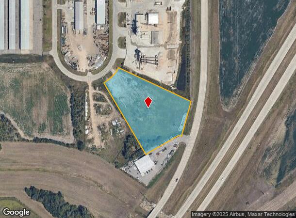
2657 Eureka Ter
Manhattan, KS
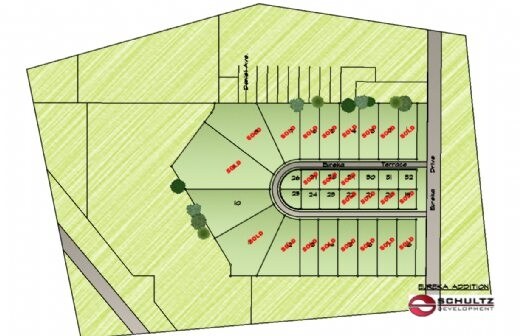
Penny's Addn #2
218-28-0-00-06-023.00-0
PENNY'S ADDN #2, LOT 3, ACRES 3.44
Commercialnec
Riley
X
Kansas
20161C0344G
3
2024
3.44 AC
2025
Kansas Area
000900
Other Market Areas
DEMOGRAPHICS near 2657 Eureka Ter
1 Mile
3 Mile
5 Mile
2024 Total Population
82
8,229
40,520
2029 Population
79
8,226
40,512
Pop Growth 2024-2029
(3.66%)
(0.04%)
(0.02%)
Average Age
36
36
33
2024 Total Households
31
3,228
16,200
HH Growth 2024-2029
(3.23%)
(0.31%)
(0.09%)
Median Household Inc
$76,786
$108,728
$68,207
Avg Household Size
2.40
2.40
2.20
2024 Avg HH Vehicles
2.00
2.00
2.00
Median Home Value
$153,571
$292,781
$255,813
Median Year Built
1992
2002
1984
Nearby Places
Map Layers
Map Styles
 Street
 Aerial
- Restaurants
- Banks
- Shops
- Fitness
- Groceries
PUBLIC TRANSPORTATION
AIRPORT
Manhattan Regional
DRIVE
WALK
Distance
Manhattan Regional
9 min
3.5 mi
Nearby Properties
Address
Land Use
TOTAL SIZE
Lot Size
Zoning
Address
Land Use
TOTAL SIZE
Lot Size
Zoning
32,402 SF
5.76 AC
R
Address
Land Use
TOTAL SIZE
Lot Size
Zoning
56,522 SF
17.60 AC
ROW
Address
Land Use
TOTAL SIZE
Lot Size
Zoning
23,900 SF
4.51 AC
I3
Address
Land Use
TOTAL SIZE
Lot Size
Zoning
42,878 SF
8.75 AC
I5
Address
Land Use
TOTAL SIZE
Lot Size
Zoning
25,764 SF
7.63 AC
R
Address
Land Use
TOTAL SIZE
Lot Size
Zoning
123,150 SF
12.55 AC
PUD
Address
Land Use
TOTAL SIZE
Lot Size
Zoning
200,158 SF
20.07 AC
I3
Address
Land Use
TOTAL SIZE
Lot Size
Zoning
24,519 SF
4.82 AC
N1
Address
Land Use
TOTAL SIZE
Lot Size
Zoning
71,669 SF
5.14 AC
PUD
Address
Land Use
TOTAL SIZE
Lot Size
Zoning
82,503 SF
12.40 AC
PUD
Address
Land Use
TOTAL SIZE
Lot Size
Zoning
2,511 SF
180.75 AC
AG
Address
Land Use
TOTAL SIZE
Lot Size
Zoning
6,579 SF
88.68 AC
C1
Address
Land Use
TOTAL SIZE
Lot Size
Zoning
1,152 SF
98.80 AC
AG
Address
Land Use
TOTAL SIZE
Lot Size
Zoning
14,645 SF
8.74 AC
SF1
Address
Land Use
TOTAL SIZE
Lot Size
Zoning
7,178 SF
0.33 AC
Address
Land Use
TOTAL SIZE
Lot Size
Zoning
22,729 SF
3.11 AC
PUD
Address
Land Use
TOTAL SIZE
Lot Size
Zoning
0.71 AC
R
Address
Land Use
TOTAL SIZE
Lot Size
Zoning
53,602 SF
5.85 AC
I3
Address
Land Use
TOTAL SIZE
Lot Size
Zoning
22,087 SF
4.45 AC
C2
Address
Land Use
TOTAL SIZE
Lot Size
Zoning
123.52 AC
AG
Address
Land Use
TOTAL SIZE
Lot Size
Zoning
646.23 AC
FORT
Address
Land Use
TOTAL SIZE
Lot Size
Zoning
645.63 AC
FORT
Address
Land Use
TOTAL SIZE
Lot Size
Zoning
3,492 SF
2.85 AC
R
Address
Land Use
TOTAL SIZE
Lot Size
Zoning
6,796 SF
5 AC
R3
Address
Land Use
TOTAL SIZE
Lot Size
Zoning
67,328 SF
9.13 AC
I5
Address
Land Use
TOTAL SIZE
Lot Size
Zoning
541.33 AC
FORT
Address
Land Use
TOTAL SIZE
Lot Size
Zoning
8,026 SF
5 AC
AG
Address
Land Use
TOTAL SIZE
Lot Size
Zoning
31,640 SF
8.99 AC
C4
Address
Land Use
TOTAL SIZE
Lot Size
Zoning
40,000 SF
8.56 AC
I3
Address
Land Use
TOTAL SIZE
Lot Size
Zoning
13,500 SF
4.28 AC
C6
The World's #1 Commercial Real Estate Marketplace
Connect with us
© 2026 CoStar Group
The information above has been obtained from sources believed reliable. While we do not doubt its accuracy we have not verified it and make no guarantee, warranty or representation about it. It is your responsibility to independently confirm its accuracy and completeness. Any projections, opinions, assumptions, or estimates used are for example only and do not represent the current or future performance of the property. The value of this transaction to you depends on tax and other factors which should be evaluated by your tax, financial, and legal advisors. You and your advisors should conduct a careful, independent investigation of the property to determine to your satisfaction the suitability of the property for your needs.