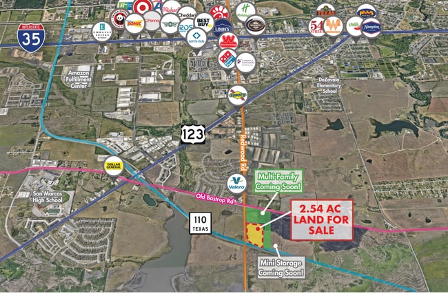
Property Record
266 Cr-266, San Marcos, TX 78666


Property Detail
266 Cr-266
Austin-Round Rock-San Marcos, TX
A0488 WILLIAM WEST & A0481 JESSE W WILSON SURVEYS, ACRES 3.25
R130384
HAYS
Farms
Texas
B and X Area of moderate flood hazard, usually the area between the limits of the 100-year and 500-year floods.
3.25 AC
2024
Hays County
2025
Austin
010100
NEARBY LISTINGS FOR SALE OR LEASE
DEMOGRAPHICS near 266 Cr-266
1 mile
3 mile
5 mile
2025 Total Population
2,886
23,362
78,265
2030 Population
3,349
27,084
89,474
Pop Growth 2025-2030
+ 16.04%
+ 15.93%
+ 14.32%
Average Age
36
35
33
2025 Total Households
977
8,796
30,891
HH Growth 2025-2030
+ 17.30%
+ 17.30%
+ 15.70%
Median Household Inc
$91,224
$60,589
$54,429
Avg Household Size
2.80
2.50
2.30
2025 Avg HH Vehicles
2.00
2.00
2.00
Median Home Value
$258,333
$202,253
$303,411
Median Year Built
2010
2003
1998
Nearby Places
Map Layers
Map Styles
 Street
 Aerial
Layers
 Traffic
 Biking
Places
Listings with unknown addresses are not visible on the map
- Restaurants
- Banks
- Shops
- Fitness
- Groceries
PUBLIC TRANSPORTATION
COMMUTER RAIL
San Marcos Amtrak (Texas Eagle - Amtrak)
Drive
Walk
Distance
San Marcos Amtrak (Texas Eagle - Amtrak)
9 min
3.9 mi
AIRPORT
Austin-Bergstrom International
Drive
Walk
Distance
Austin-Bergstrom International
51 min
39.5 mi
Freight Ports
Calhoun Port
Drive
Walk
Distance
Calhoun Port
164 min
135.1 mi
SALE & LEASE HISTORY
LISTING DATE
SALE/LEASE

Jun 04, 2024
For Sale
Nearby Properties
Address
Land Use
TOTAL SIZE
Lot Size
Zoning
Address
Land Use
TOTAL SIZE
Lot Size
Zoning
855,000 SF
95.65 AC
Address
Land Use
TOTAL SIZE
Lot Size
Zoning
419,973 SF
23.69 AC
Address
Land Use
TOTAL SIZE
Lot Size
Zoning
466,968 SF
15.19 AC
Address
Land Use
TOTAL SIZE
Lot Size
Zoning
352,285 SF
12.75 AC
Address
Land Use
TOTAL SIZE
Lot Size
Zoning
283,033 SF
19.46 AC
Address
Land Use
TOTAL SIZE
Lot Size
Zoning
223,401 SF
9.75 AC
Address
Land Use
TOTAL SIZE
Lot Size
Zoning
184,438 SF
12.57 AC
Address
Land Use
TOTAL SIZE
Lot Size
Zoning
343,560 SF
10.40 AC
Address
Land Use
TOTAL SIZE
Lot Size
Zoning
255,621 SF
8.83 AC
Address
Land Use
TOTAL SIZE
Lot Size
Zoning
277,659 SF
10.77 AC
Address
Land Use
TOTAL SIZE
Lot Size
Zoning
307,962 SF
14.23 AC
Address
Land Use
TOTAL SIZE
Lot Size
Zoning
24.14 AC
Address
Land Use
TOTAL SIZE
Lot Size
Zoning
341,111 SF
20.94 AC
Address
Land Use
TOTAL SIZE
Lot Size
Zoning
195,018 SF
7.37 AC
Address
Land Use
TOTAL SIZE
Lot Size
Zoning
305,644 SF
27.93 AC
Address
Land Use
TOTAL SIZE
Lot Size
Zoning
160,056 SF
10.05 AC
Address
Land Use
TOTAL SIZE
Lot Size
Zoning
535,134 SF
29.28 AC
Address
Land Use
TOTAL SIZE
Lot Size
Zoning
127,306 SF
20.85 AC
Address
Land Use
TOTAL SIZE
Lot Size
Zoning
141,735 SF
6.62 AC
Address
Land Use
TOTAL SIZE
Lot Size
Zoning
296,034 SF
7.78 AC
Address
Land Use
TOTAL SIZE
Lot Size
Zoning
247,668 SF
9.08 AC
Address
Land Use
TOTAL SIZE
Lot Size
Zoning
230,979 SF
7.54 AC
Address
Land Use
TOTAL SIZE
Lot Size
Zoning
152,046 SF
8 AC
Address
Land Use
TOTAL SIZE
Lot Size
Zoning
73,658 SF
13.95 AC
Address
Land Use
TOTAL SIZE
Lot Size
Zoning
Address
Land Use
TOTAL SIZE
Lot Size
Zoning
75,703 SF
8 AC
Address
Land Use
TOTAL SIZE
Lot Size
Zoning
165,000 SF
9.78 AC
Address
Land Use
TOTAL SIZE
Lot Size
Zoning
217,458 SF
49.57 AC
Address
Land Use
TOTAL SIZE
Lot Size
Zoning
Address
Land Use
TOTAL SIZE
Lot Size
Zoning
262,032 SF
20.02 AC
The World's #1 Commercial Real Estate Marketplace
Connect with us
© 2026 CoStar Group
The information above has been obtained from sources believed reliable. While we do not doubt its accuracy we have not verified it and make no guarantee, warranty or representation about it. It is your responsibility to independently confirm its accuracy and completeness. Any projections, opinions, assumptions, or estimates used are for example only and do not represent the current or future performance of the property. The value of this transaction to you depends on tax and other factors which should be evaluated by your tax, financial, and legal advisors. You and your advisors should conduct a careful, independent investigation of the property to determine to your satisfaction the suitability of the property for your needs.