Property Record
266 E Paletown Rd, Quakertown, PA 18951
Property Detail
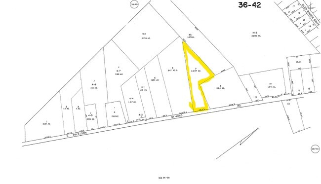
266 E Paletown Rd
36-042-007
4.759AC 590W OF PALETWN NO FRONTAGE 2887S SR313
Commercialnec
Bucks
SRL
Pennsylvania
B and X Area of moderate flood hazard, usually the area between the limits of the 100-year and 500-year floods.
5.55 AC
2024
Upper Bucks County
2025
Philadelphia
106401
Philadelphia-Camden-Wilmington, PA-NJ-DE-MD
6,834 SF
NEARBY LISTINGS FOR SALE OR LEASE
DEMOGRAPHICS near 266 E Paletown Rd
1 mile
3 mile
5 mile
2025 Total Population
2,582
25,540
54,449
2030 Population
2,662
25,867
54,863
Pop Growth 2025-2030
+ 3.10%
+ 1.28%
+ 0.76%
Average Age
43
42
43
2025 Total Households
969
9,665
20,994
HH Growth 2025-2030
+ 2.99%
+ 1.20%
+ 0.68%
Median Household Inc
$87,733
$91,325
$97,583
Avg Household Size
2.60
2.60
2.50
2025 Avg HH Vehicles
2.00
2.00
2.00
Median Home Value
$384,463
$377,216
$386,237
Median Year Built
1999
1978
1977
Nearby Places
Map Layers
Map Styles
 Street
 Aerial
Layers
 Traffic
 Biking
Places
Listings with unknown addresses are not visible on the map
- Restaurants
- Banks
- Shops
- Fitness
- Groceries
PUBLIC TRANSPORTATION
AIRPORT
Lehigh Valley International
Drive
Walk
Distance
Lehigh Valley International
38 min
20.7 mi
Trenton Mercer
Drive
Walk
Distance
Trenton Mercer
58 min
35.0 mi
Freight Ports
Port of Philadelphia
Drive
Walk
Distance
Port of Philadelphia
64 min
37.8 mi
Nearby Properties
Address
Land Use
TOTAL SIZE
Lot Size
Zoning
Address
Land Use
TOTAL SIZE
Lot Size
Zoning
276,132 SF
61.72 AC
PC
Address
Land Use
TOTAL SIZE
Lot Size
Zoning
51,884 SF
40.42 AC
EXT
Address
Land Use
TOTAL SIZE
Lot Size
Zoning
203,923 SF
34.17 AC
HC
Address
Land Use
TOTAL SIZE
Lot Size
Zoning
157,360 SF
17.34 AC
SRC
Address
Land Use
TOTAL SIZE
Lot Size
Zoning
14,450 SF
7.16 AC
R4
Address
Land Use
TOTAL SIZE
Lot Size
Zoning
362,576 SF
25.24 AC
PI
Address
Land Use
TOTAL SIZE
Lot Size
Zoning
1 SF
15.66 AC
PC
Address
Land Use
TOTAL SIZE
Lot Size
Zoning
208,937 SF
20.07 AC
PC
Address
Land Use
TOTAL SIZE
Lot Size
Zoning
67,443 SF
1.97 AC
NC
Address
Land Use
TOTAL SIZE
Lot Size
Zoning
58,391 SF
9.45 AC
PC
Address
Land Use
TOTAL SIZE
Lot Size
Zoning
7.98 AC
PI
Address
Land Use
TOTAL SIZE
Lot Size
Zoning
1,200 SF
17.50 AC
PI
Address
Land Use
TOTAL SIZE
Lot Size
Zoning
71,000 SF
5.90 AC
EXT
Address
Land Use
TOTAL SIZE
Lot Size
Zoning
36,450 SF
3.09 AC
HC
Address
Land Use
TOTAL SIZE
Lot Size
Zoning
12,734 SF
4.68 AC
HC
Address
Land Use
TOTAL SIZE
Lot Size
Zoning
48,457 SF
2.73 AC
PC
Address
Land Use
TOTAL SIZE
Lot Size
Zoning
22,950 SF
1.97 AC
HR
Address
Land Use
TOTAL SIZE
Lot Size
Zoning
170,655 SF
25.75 AC
PI
Address
Land Use
TOTAL SIZE
Lot Size
Zoning
4.22 AC
R4
Address
Land Use
TOTAL SIZE
Lot Size
Zoning
46,579 SF
5.13 AC
HR
Address
Land Use
TOTAL SIZE
Lot Size
Zoning
86,854 SF
9.64 AC
HC
Address
Land Use
TOTAL SIZE
Lot Size
Zoning
22,150 SF
2.54 AC
R2
Address
Land Use
TOTAL SIZE
Lot Size
Zoning
144,197 SF
5.38 AC
H
Address
Land Use
TOTAL SIZE
Lot Size
Zoning
107,925 SF
17.05 AC
RA
Address
Land Use
TOTAL SIZE
Lot Size
Zoning
32,270 SF
17.95 AC
PC
Address
Land Use
TOTAL SIZE
Lot Size
Zoning
58,942 SF
5.97 AC
PC
Address
Land Use
TOTAL SIZE
Lot Size
Zoning
50,055 SF
7.75 AC
EXT
Address
Land Use
TOTAL SIZE
Lot Size
Zoning
82,753 SF
7.85 AC
PC
Address
Land Use
TOTAL SIZE
Lot Size
Zoning
171,127 SF
12.27 AC
LI
Address
Land Use
TOTAL SIZE
Lot Size
Zoning
125,116 SF
9.55 AC
PI
The World's #1 Commercial Real Estate Marketplace
Connect with us
© 2026 CoStar Group
The information above has been obtained from sources believed reliable. While we do not doubt its accuracy we have not verified it and make no guarantee, warranty or representation about it. It is your responsibility to independently confirm its accuracy and completeness. Any projections, opinions, assumptions, or estimates used are for example only and do not represent the current or future performance of the property. The value of this transaction to you depends on tax and other factors which should be evaluated by your tax, financial, and legal advisors. You and your advisors should conduct a careful, independent investigation of the property to determine to your satisfaction the suitability of the property for your needs.