Property Record
266 Olmsted Blvd, Pinehurst, NC 28374
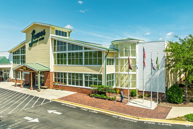

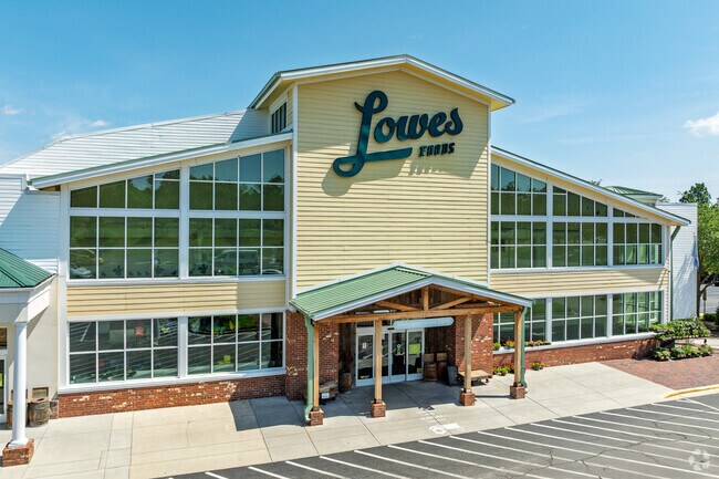
Property Detail
266 Olmsted Blvd
Pinehurst-Southern Pines, NC
SILVERADO ASSOCIATES LAND TAYLORTOWN MUNI OLMSTED
8552-00-69-3963
MOORE
Communitycenter
North Carolina
B and X Area of moderate flood hazard, usually the area between the limits of the 100-year and 500-year floods.
7.43 AC
2025
North Carolina Southeast Area
2025
Other Market Areas
950601
NEARBY LISTINGS FOR SALE OR LEASE
DEMOGRAPHICS near 266 Olmsted Blvd
1 mile
3 mile
5 mile
2025 Total Population
2,525
20,941
35,945
2030 Population
2,697
22,313
38,368
Pop Growth 2025-2030
+ 6.81%
+ 6.55%
+ 6.74%
Average Age
48
50
47
2025 Total Households
1,123
9,411
16,019
HH Growth 2025-2030
+ 7.12%
+ 6.80%
+ 6.97%
Median Household Inc
$82,114
$98,311
$89,490
Avg Household Size
2.20
2.20
2.20
2025 Avg HH Vehicles
2.00
2.00
2.00
Median Home Value
$510,736
$492,626
$466,249
Median Year Built
1993
1994
1995
Nearby Places
Map Layers
Map Styles
 Street
 Aerial
Layers
 Traffic
 Biking
Places
Listings with unknown addresses are not visible on the map
- Restaurants
- Banks
- Shops
- Fitness
- Groceries
PUBLIC TRANSPORTATION
AIRPORT
Fayetteville Regional/Grannis Field
Drive
Walk
Distance
Fayetteville Regional/Grannis Field
71 min
48.4 mi
Nearby Properties
Address
Land Use
TOTAL SIZE
Lot Size
Zoning
Address
Land Use
TOTAL SIZE
Lot Size
Zoning
3,953 SF
86.18 AC
MULTI
Address
Land Use
TOTAL SIZE
Lot Size
Zoning
29,476 SF
22.76 AC
H
Address
Land Use
TOTAL SIZE
Lot Size
Zoning
20,091 SF
12 AC
PPC
Address
Land Use
TOTAL SIZE
Lot Size
Zoning
16.26 AC
PD
Address
Land Use
TOTAL SIZE
Lot Size
Zoning
7,161 SF
0.87 AC
RD
Address
Land Use
TOTAL SIZE
Lot Size
Zoning
132,600 SF
86.18 AC
Address
Land Use
TOTAL SIZE
Lot Size
Zoning
17,091 SF
12.65 AC
R10
Address
Land Use
TOTAL SIZE
Lot Size
Zoning
11.80 AC
Address
Land Use
TOTAL SIZE
Lot Size
Zoning
190.53 AC
Address
Land Use
TOTAL SIZE
Lot Size
Zoning
155.66 AC
RD
Address
Land Use
TOTAL SIZE
Lot Size
Zoning
7.45 AC
Address
Land Use
TOTAL SIZE
Lot Size
Zoning
26,856 SF
1.52 AC
R10
Address
Land Use
TOTAL SIZE
Lot Size
Zoning
9,417 SF
4.19 AC
OP
Address
Land Use
TOTAL SIZE
Lot Size
Zoning
15,422 SF
35.21 AC
R20
Address
Land Use
TOTAL SIZE
Lot Size
Zoning
4,000 SF
238.22 AC
PDD
Address
Land Use
TOTAL SIZE
Lot Size
Zoning
33,960 SF
18 AC
NC
Address
Land Use
TOTAL SIZE
Lot Size
Zoning
0.87 AC
Address
Land Use
TOTAL SIZE
Lot Size
Zoning
25,651 SF
4.34 AC
CM
Address
Land Use
TOTAL SIZE
Lot Size
Zoning
15,100 SF
11.47 AC
NC
Address
Land Use
TOTAL SIZE
Lot Size
Zoning
20,709 SF
3.60 AC
H
Address
Land Use
TOTAL SIZE
Lot Size
Zoning
33,886 SF
9.68 AC
R10
Address
Land Use
TOTAL SIZE
Lot Size
Zoning
47,273 SF
11.25 AC
NC
Address
Land Use
TOTAL SIZE
Lot Size
Zoning
10,435 SF
11.26 AC
R20
Address
Land Use
TOTAL SIZE
Lot Size
Zoning
5,090 SF
99.55 AC
RD
Address
Land Use
TOTAL SIZE
Lot Size
Zoning
36 SF
181.27 AC
RD
Address
Land Use
TOTAL SIZE
Lot Size
Zoning
5,700 SF
205.35 AC
RS2CD
Address
Land Use
TOTAL SIZE
Lot Size
Zoning
480 SF
73.70 AC
PC
Address
Land Use
TOTAL SIZE
Lot Size
Zoning
18,895 SF
86.18 AC
Address
Land Use
TOTAL SIZE
Lot Size
Zoning
10.94 AC
The World's #1 Commercial Real Estate Marketplace
Connect with us
© 2026 CoStar Group
The information above has been obtained from sources believed reliable. While we do not doubt its accuracy we have not verified it and make no guarantee, warranty or representation about it. It is your responsibility to independently confirm its accuracy and completeness. Any projections, opinions, assumptions, or estimates used are for example only and do not represent the current or future performance of the property. The value of this transaction to you depends on tax and other factors which should be evaluated by your tax, financial, and legal advisors. You and your advisors should conduct a careful, independent investigation of the property to determine to your satisfaction the suitability of the property for your needs.