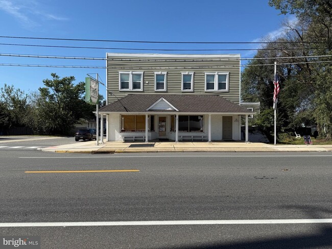
Property Record
266 Shell Rd, Penns Grove, NJ 08069
NEARBY LISTINGS FOR SALE OR LEASE
Property Detail
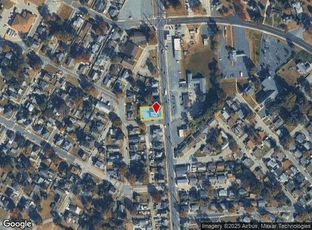
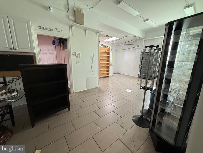
266 Shell Rd
02-00113-0000-00008
ADDITIONAL LOTS: FLOWER SHOP
Commercialnec
Salem
X
New Jersey
34033C0053C
8
2024
0.23 AC
2025
Salem County
020600
Philadelphia
3,405 SF
Philadelphia-Camden-Wilmington, PA-NJ-DE-MD
DEMOGRAPHICS near 266 Shell Rd
1 Mile
3 Mile
5 Mile
2024 Total Population
6,921
14,870
80,260
2029 Population
7,104
15,281
82,898
Pop Growth 2024-2029
+ 2.64%
+ 2.76%
+ 3.29%
Average Age
39
40
40
2024 Total Households
2,625
5,627
32,207
HH Growth 2024-2029
+ 2.63%
+ 2.74%
+ 3.43%
Median Household Inc
$72,912
$71,321
$63,787
Avg Household Size
2.60
2.60
2.40
2024 Avg HH Vehicles
1.00
2.00
1.00
Median Home Value
$210,948
$214,402
$217,439
Median Year Built
1958
1958
1955
Nearby Places
Map Layers
Map Styles
 Street
 Aerial
- Restaurants
- Banks
- Shops
- Fitness
- Groceries
PUBLIC TRANSPORTATION
COMMUTER RAIL
Wilmington (R2 - Southeastern Pennsylvania Transportation Authority Regional Rail (SEPTA Regional Rail))
DRIVE
WALK
Distance
Wilmington (R2 - Southeastern Pennsylvania Transportation Authority Regional Rail (SEPTA Regional Rail))
18 min
9.1 mi
AIRPORT
Philadelphia International
DRIVE
WALK
Distance
Philadelphia International
35 min
22.0 mi
Freight Ports
Port of Wilmington, RI
DRIVE
WALK
Distance
Port of Wilmington, RI
17 min
9.0 mi
SALE & LEASE HISTORY
LISTING DATE
SALE/LEASE

Nov 07, 2025
For Lease
Nearby Properties
Address
Land Use
TOTAL SIZE
Lot Size
Zoning
Address
Land Use
TOTAL SIZE
Lot Size
Zoning
118.77 AC
GC
Address
Land Use
TOTAL SIZE
Lot Size
Zoning
412.70 AC
06
Address
Land Use
TOTAL SIZE
Lot Size
Zoning
150.60 AC
AG
Address
Land Use
TOTAL SIZE
Lot Size
Zoning
47.91 AC
IC
Address
Land Use
TOTAL SIZE
Lot Size
Zoning
4,895 SF
76.28 AC
26M-2
Address
Land Use
TOTAL SIZE
Lot Size
Zoning
Address
Land Use
TOTAL SIZE
Lot Size
Zoning
10.75 AC
LC
Address
Land Use
TOTAL SIZE
Lot Size
Zoning
118.77 AC
GC
Address
Land Use
TOTAL SIZE
Lot Size
Zoning
29.05 AC
GC
Address
Land Use
TOTAL SIZE
Lot Size
Zoning
23,402 SF
44.89 AC
LR
Address
Land Use
TOTAL SIZE
Lot Size
Zoning
105.88 AC
26M-2
Address
Land Use
TOTAL SIZE
Lot Size
Zoning
26.64 AC
GI
Address
Land Use
TOTAL SIZE
Lot Size
Zoning
150.60 AC
AG
Address
Land Use
TOTAL SIZE
Lot Size
Zoning
47.91 AC
IC
Address
Land Use
TOTAL SIZE
Lot Size
Zoning
20 AC
GI
Address
Land Use
TOTAL SIZE
Lot Size
Zoning
10.28 AC
IC
Address
Land Use
TOTAL SIZE
Lot Size
Zoning
848 SF
10.69 AC
LR
Address
Land Use
TOTAL SIZE
Lot Size
Zoning
29.05 AC
GC
Address
Land Use
TOTAL SIZE
Lot Size
Zoning
1,133.55 AC
GI
Address
Land Use
TOTAL SIZE
Lot Size
Zoning
19.67 AC
LR
Address
Land Use
TOTAL SIZE
Lot Size
Zoning
11.76 AC
GC
Address
Land Use
TOTAL SIZE
Lot Size
Zoning
204.56 AC
GI
Address
Land Use
TOTAL SIZE
Lot Size
Zoning
Address
Land Use
TOTAL SIZE
Lot Size
Zoning
31.77 AC
GC
Address
Land Use
TOTAL SIZE
Lot Size
Zoning
19,576 SF
5.70 AC
Address
Land Use
TOTAL SIZE
Lot Size
Zoning
Address
Land Use
TOTAL SIZE
Lot Size
Zoning
105,735 SF
113.29 AC
HI
Address
Land Use
TOTAL SIZE
Lot Size
Zoning
25,268 SF
5 AC
LR
Address
Land Use
TOTAL SIZE
Lot Size
Zoning
9,636 SF
10.97 AC
GC
Address
Land Use
TOTAL SIZE
Lot Size
Zoning
The World's #1 Commercial Real Estate Marketplace
Connect with us
© 2025 CoStar Group
The information above has been obtained from sources believed reliable. While we do not doubt its accuracy we have not verified it and make no guarantee, warranty or representation about it. It is your responsibility to independently confirm its accuracy and completeness. Any projections, opinions, assumptions, or estimates used are for example only and do not represent the current or future performance of the property. The value of this transaction to you depends on tax and other factors which should be evaluated by your tax, financial, and legal advisors. You and your advisors should conduct a careful, independent investigation of the property to determine to your satisfaction the suitability of the property for your needs.