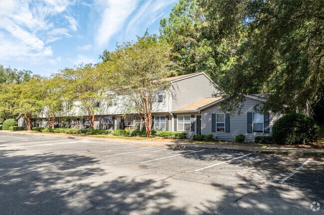
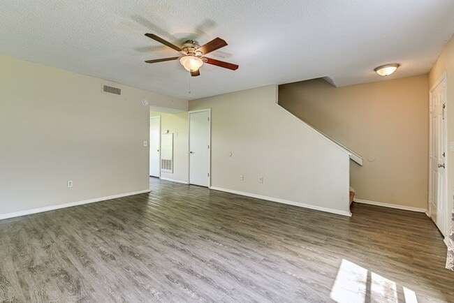
Property Record
2660 Old Bainbridge Rd, Tallahassee, FL 32303

NEARBY LISTINGS FOR SALE OR LEASE
Property Detail
2660 Old Bainbridge Rd
21-15-20-610-000.0
Unplatted Land
Multifamilydwelling
15 1N 1W IN S 1/2 OF SEC OR 5129/94 OPR 147/2195 2227 1266/295 OR 1416/1659 1690/980 983
X
Leon
12073C0277F
Florida
2025
16.46 AC
2025
Northwest Tallahassee
002205
Tallahassee
137,442 SF
Tallahassee, FL
DEMOGRAPHICS near 2660 Old Bainbridge Rd
1 Mile
3 Mile
5 Mile
2024 Total Population
9,957
77,020
138,022
2029 Population
10,557
80,338
144,541
Pop Growth 2024-2029
+ 6.03%
+ 4.31%
+ 4.72%
Average Age
34
32
34
2024 Total Households
4,282
32,211
58,667
HH Growth 2024-2029
+ 6.24%
+ 4.40%
+ 4.89%
Median Household Inc
$52,668
$41,077
$44,055
Avg Household Size
2.20
2.20
2.10
2024 Avg HH Vehicles
2.00
2.00
2.00
Median Home Value
$155,360
$182,322
$210,491
Median Year Built
1981
1985
1983
Nearby Places
Map Layers
Map Styles
 Street
 Aerial
- Restaurants
- Banks
- Shops
- Fitness
- Groceries
PUBLIC TRANSPORTATION
AIRPORT
Tallahassee International
DRIVE
WALK
Distance
Tallahassee International
17 min
8.1 mi
Freight Ports
Port of Panama City
DRIVE
WALK
Distance
Port of Panama City
140 min
104.0 mi
Nearby Properties
Address
Land Use
TOTAL SIZE
Lot Size
Zoning
Address
Land Use
TOTAL SIZE
Lot Size
Zoning
6,686,582 SF
86.50 AC
UT
Address
Land Use
TOTAL SIZE
Lot Size
Zoning
4,577,528 SF
108.47 AC
UT
Address
Land Use
TOTAL SIZE
Lot Size
Zoning
3,647,358 SF
49.17 AC
UT
Address
Land Use
TOTAL SIZE
Lot Size
Zoning
1,604,893 SF
175.71 AC
MR1
Address
Land Use
TOTAL SIZE
Lot Size
Zoning
859,455 SF
3.79 AC
CU45
Address
Land Use
TOTAL SIZE
Lot Size
Zoning
704,857 SF
4.95 AC
UT
Address
Land Use
TOTAL SIZE
Lot Size
Zoning
664,514 SF
2.49 AC
UT
Address
Land Use
TOTAL SIZE
Lot Size
Zoning
369,383 SF
4.51 AC
UT
Address
Land Use
TOTAL SIZE
Lot Size
Zoning
758,762 SF
20.82 AC
UT
Address
Land Use
TOTAL SIZE
Lot Size
Zoning
719,149 SF
40.73 AC
MR1
Address
Land Use
TOTAL SIZE
Lot Size
Zoning
721,205 SF
6.19 AC
UT
Address
Land Use
TOTAL SIZE
Lot Size
Zoning
414,216 SF
2.23 AC
CU45
Address
Land Use
TOTAL SIZE
Lot Size
Zoning
556,751 SF
20.60 AC
CP
Address
Land Use
TOTAL SIZE
Lot Size
Zoning
859,666 SF
20.17 AC
MR1
Address
Land Use
TOTAL SIZE
Lot Size
Zoning
538,290 SF
11.05 AC
Address
Land Use
TOTAL SIZE
Lot Size
Zoning
392,437 SF
10 AC
UT
Address
Land Use
TOTAL SIZE
Lot Size
Zoning
421,095 SF
28.06 AC
MR1
Address
Land Use
TOTAL SIZE
Lot Size
Zoning
225,370 SF
3.76 AC
CU45
Address
Land Use
TOTAL SIZE
Lot Size
Zoning
459,568 SF
10.10 AC
CU45
Address
Land Use
TOTAL SIZE
Lot Size
Zoning
883,293 SF
35.97 AC
R4
Address
Land Use
TOTAL SIZE
Lot Size
Zoning
607,000 SF
37.55 AC
PUD
Address
Land Use
TOTAL SIZE
Lot Size
Zoning
1,241,812 SF
44.71 AC
MR1
Address
Land Use
TOTAL SIZE
Lot Size
Zoning
423,131 SF
8.36 AC
CU45
Address
Land Use
TOTAL SIZE
Lot Size
Zoning
739,671 SF
20.04 AC
MR1
Address
Land Use
TOTAL SIZE
Lot Size
Zoning
1,048,414 SF
5.88 AC
UT
Address
Land Use
TOTAL SIZE
Lot Size
Zoning
660,721 SF
30.95 AC
Address
Land Use
TOTAL SIZE
Lot Size
Zoning
489,720 SF
2.07 AC
UPUD
Address
Land Use
TOTAL SIZE
Lot Size
Zoning
325,725 SF
2.44 AC
UPUD
Address
Land Use
TOTAL SIZE
Lot Size
Zoning
498,076 SF
22.49 AC
MR1
Address
Land Use
TOTAL SIZE
Lot Size
Zoning
96,444 SF
16.70 AC
UT
The World's #1 Commercial Real Estate Marketplace
Connect with us
© 2026 CoStar Group
The information above has been obtained from sources believed reliable. While we do not doubt its accuracy we have not verified it and make no guarantee, warranty or representation about it. It is your responsibility to independently confirm its accuracy and completeness. Any projections, opinions, assumptions, or estimates used are for example only and do not represent the current or future performance of the property. The value of this transaction to you depends on tax and other factors which should be evaluated by your tax, financial, and legal advisors. You and your advisors should conduct a careful, independent investigation of the property to determine to your satisfaction the suitability of the property for your needs.