Property Record
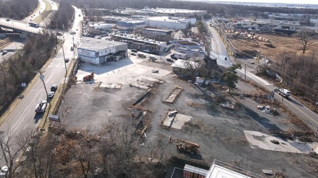
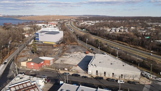
2664 Arthur Kill Rd, Staten Island, NY 10309
NEARBY LISTINGS FOR SALE OR LEASE
Property Detail
2664 Arthur Kill Rd
07089-0003
LAND EASEMENT HELD BY CITY OF NEW YORK
Warehouse
Staten Island
X
New York
34023C0086F
1
2024
0.85 AC
2025
Staten Island
020805
Long Island (New York)
896 SF
New York-Jersey City-White Plains, NY-NJ
DEMOGRAPHICS near 2664 Arthur Kill Rd
1 mile
3 mile
5 mile
2024 Total Population
14,305
123,874
330,890
2029 Population
13,943
121,587
325,014
Pop Growth 2024-2029
(2.53%)
(1.85%)
(1.78%)
Average Age
41
41
41
2024 Total Households
5,187
43,121
116,254
HH Growth 2024-2029
(2.58%)
(1.96%)
(1.79%)
Median Household Inc
$104,892
$96,087
$90,383
Avg Household Size
2.70
2.80
2.80
2024 Avg HH Vehicles
2.00
2.00
2.00
Median Home Value
$614,031
$596,156
$526,717
Median Year Built
1989
1982
1975
Nearby Places
Map Layers
Map Styles
 Street
 Aerial
Transit
 Traffic
 Biking
Places
Listings with unknown addresses are not visible on the map
- Restaurants
- Banks
- Shops
- Fitness
- Groceries
PUBLIC TRANSPORTATION
COMMUTER RAIL
Pleasant Plains (Staten Island Railway - New York MTA Subway (The Subway))
Drive
Walk
Distance
Pleasant Plains (Staten Island Railway - New York MTA Subway (The Subway))
5 min
2.1 mi
Huguenot (Staten Island Railway - New York MTA Subway (The Subway))
Drive
Walk
Distance
Huguenot (Staten Island Railway - New York MTA Subway (The Subway))
7 min
2.7 mi
AIRPORT
Newark Liberty International
Drive
Walk
Distance
Newark Liberty International
27 min
16.8 mi
LaGuardia
Drive
Walk
Distance
LaGuardia
51 min
30.3 mi
John F Kennedy International
Drive
Walk
Distance
John F Kennedy International
50 min
33.0 mi
Freight Ports
New York Container Terminal
Drive
Walk
Distance
New York Container Terminal
12 min
7.4 mi
SALE & LEASE HISTORY
LISTING DATE
SALE/LEASE

Jan 24, 2024
For Sale
Aug 15, 2022
For Sale
Nearby Properties
Address
Land Use
TOTAL SIZE
Lot Size
Zoning
Address
Land Use
TOTAL SIZE
Lot Size
Zoning
196.03 AC
HIA
Address
Land Use
TOTAL SIZE
Lot Size
Zoning
794,430 SF
36.09 AC
R50
Address
Land Use
TOTAL SIZE
Lot Size
Zoning
329,350 SF
15.99 AC
Address
Land Use
TOTAL SIZE
Lot Size
Zoning
Address
Land Use
TOTAL SIZE
Lot Size
Zoning
237 AC
M1-1
Address
Land Use
TOTAL SIZE
Lot Size
Zoning
118 AC
M3-1
Address
Land Use
TOTAL SIZE
Lot Size
Zoning
404,985 SF
15.32 AC
R25
Address
Land Use
TOTAL SIZE
Lot Size
Zoning
196,382 SF
25.95 AC
Address
Land Use
TOTAL SIZE
Lot Size
Zoning
360,082 SF
22.45 AC
R50
Address
Land Use
TOTAL SIZE
Lot Size
Zoning
365,784 SF
12.73 AC
HIA
Address
Land Use
TOTAL SIZE
Lot Size
Zoning
37.32 AC
S-3B
Address
Land Use
TOTAL SIZE
Lot Size
Zoning
146 AC
PARK
Address
Land Use
TOTAL SIZE
Lot Size
Zoning
298,080 SF
13.79 AC
LI
Address
Land Use
TOTAL SIZE
Lot Size
Zoning
286,290 SF
21.24 AC
R50
Address
Land Use
TOTAL SIZE
Lot Size
Zoning
10,240 SF
22.96 AC
LI
Address
Land Use
TOTAL SIZE
Lot Size
Zoning
Address
Land Use
TOTAL SIZE
Lot Size
Zoning
1.64 AC
R-25
Address
Land Use
TOTAL SIZE
Lot Size
Zoning
245,272 SF
18.54 AC
R50
Address
Land Use
TOTAL SIZE
Lot Size
Zoning
263,925 SF
11.98 AC
R50
Address
Land Use
TOTAL SIZE
Lot Size
Zoning
7.24 AC
Address
Land Use
TOTAL SIZE
Lot Size
Zoning
411,000 SF
18.54 AC
R3X
Address
Land Use
TOTAL SIZE
Lot Size
Zoning
55.47 AC
Address
Land Use
TOTAL SIZE
Lot Size
Zoning
21,120 SF
14.45 AC
R50
Address
Land Use
TOTAL SIZE
Lot Size
Zoning
5,214 SF
93 AC
M3-1
Address
Land Use
TOTAL SIZE
Lot Size
Zoning
214,392 SF
11.79 AC
R50
Address
Land Use
TOTAL SIZE
Lot Size
Zoning
71.66 AC
M-3
Address
Land Use
TOTAL SIZE
Lot Size
Zoning
131,140 SF
10 AC
LI
Address
Land Use
TOTAL SIZE
Lot Size
Zoning
Address
Land Use
TOTAL SIZE
Lot Size
Zoning
Address
Land Use
TOTAL SIZE
Lot Size
Zoning
262,455 SF
7.01 AC
R50
The World's #1 Commercial Real Estate Marketplace
Connect with us
© 2026 CoStar Group
The information above has been obtained from sources believed reliable. While we do not doubt its accuracy we have not verified it and make no guarantee, warranty or representation about it. It is your responsibility to independently confirm its accuracy and completeness. Any projections, opinions, assumptions, or estimates used are for example only and do not represent the current or future performance of the property. The value of this transaction to you depends on tax and other factors which should be evaluated by your tax, financial, and legal advisors. You and your advisors should conduct a careful, independent investigation of the property to determine to your satisfaction the suitability of the property for your needs.