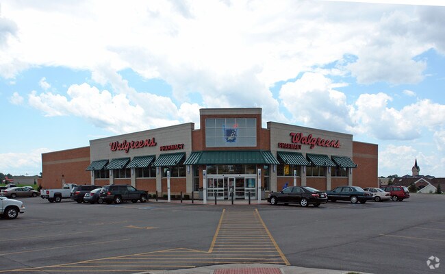
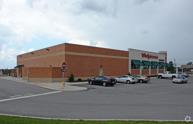
Property Record
2665 E Henrietta Rd, Henrietta, NY 14467

Property Detail
2665 E Henrietta Rd
263200-176-060-0001-069-100
Monroe
Storebuilding
New York
05 - COMME
69.100
B and X Area of moderate flood hazard, usually the area between the limits of the 100-year and 500-year floods.
2.48 AC
2025
South Central
2025
Rochester
013208
Rochester, NY
14,500 SF
NEARBY LISTINGS FOR SALE OR LEASE
DEMOGRAPHICS near 2665 E Henrietta Rd
1 mile
3 mile
5 mile
2025 Total Population
7,568
37,504
110,848
2030 Population
7,561
37,421
110,463
Pop Growth 2025-2030
(0.09%)
(0.22%)
(0.35%)
Average Age
43
42
40
2025 Total Households
3,273
15,816
43,560
HH Growth 2025-2030
(0.09%)
(0.24%)
(0.46%)
Median Household Inc
$74,096
$73,522
$79,318
Avg Household Size
2.30
2.20
2.20
2025 Avg HH Vehicles
2.00
2.00
2.00
Median Home Value
$185,220
$212,814
$258,614
Median Year Built
1964
1969
1966
Nearby Places
Map Layers
Map Styles
 Street
 Aerial
Layers
 Traffic
 Biking
Places
Listings with unknown addresses are not visible on the map
- Restaurants
- Banks
- Shops
- Fitness
- Groceries
PUBLIC TRANSPORTATION
AIRPORT
Frederick Douglass/Greater Rochester International
Drive
Walk
Distance
Frederick Douglass/Greater Rochester International
12 min
6.5 mi
Nearby Properties
Address
Land Use
TOTAL SIZE
Lot Size
Zoning
Address
Land Use
TOTAL SIZE
Lot Size
Zoning
446,748 SF
14.10 AC
06 - INDUS
Address
Land Use
TOTAL SIZE
Lot Size
Zoning
57,638 SF
227.96 AC
02 - SINGL
Address
Land Use
TOTAL SIZE
Lot Size
Zoning
323,859 SF
19.12 AC
05 - COMME
Address
Land Use
TOTAL SIZE
Lot Size
Zoning
400,000 SF
43.50 AC
06 - INDUS
Address
Land Use
TOTAL SIZE
Lot Size
Zoning
37,632 SF
29.06 AC
06 - INDUS
Address
Land Use
TOTAL SIZE
Lot Size
Zoning
364,000 SF
66.25 AC
06 - INDUS
Address
Land Use
TOTAL SIZE
Lot Size
Zoning
80,747 SF
9.37 AC
02 - SINGL
Address
Land Use
TOTAL SIZE
Lot Size
Zoning
94,000 SF
15.49 AC
02 - SINGL
Address
Land Use
TOTAL SIZE
Lot Size
Zoning
50,913 SF
24.54 AC
B
Address
Land Use
TOTAL SIZE
Lot Size
Zoning
3,960 SF
98.15 AC
02 - SINGL
Address
Land Use
TOTAL SIZE
Lot Size
Zoning
14,760 SF
64 AC
06 - INDUS
Address
Land Use
TOTAL SIZE
Lot Size
Zoning
4,442 SF
31 AC
02 - SINGL
Address
Land Use
TOTAL SIZE
Lot Size
Zoning
6,751 SF
18.52 AC
02 - SINGL
Address
Land Use
TOTAL SIZE
Lot Size
Zoning
237,866 SF
34.97 AC
05 - COMME
Address
Land Use
TOTAL SIZE
Lot Size
Zoning
111,762 SF
10.80 AC
06 - INDUS
Address
Land Use
TOTAL SIZE
Lot Size
Zoning
42,948 SF
16.24 AC
02 - SINGL
Address
Land Use
TOTAL SIZE
Lot Size
Zoning
270,000 SF
54.90 AC
02 - SINGL
Address
Land Use
TOTAL SIZE
Lot Size
Zoning
510,332 SF
48 AC
05 - COMME
Address
Land Use
TOTAL SIZE
Lot Size
Zoning
144,652 SF
12.64 AC
05 - COMME
Address
Land Use
TOTAL SIZE
Lot Size
Zoning
439,675 SF
36.80 AC
06 - INDUS
Address
Land Use
TOTAL SIZE
Lot Size
Zoning
85,355 SF
12.04 AC
06 - INDUS
Address
Land Use
TOTAL SIZE
Lot Size
Zoning
42,881 SF
17.46 AC
02 - SINGL
Address
Land Use
TOTAL SIZE
Lot Size
Zoning
181,876 SF
11.64 AC
07 - MIXED
Address
Land Use
TOTAL SIZE
Lot Size
Zoning
183,054 SF
7.61 AC
06 - INDUS
Address
Land Use
TOTAL SIZE
Lot Size
Zoning
170,256 SF
14.82 AC
06 - INDUS
Address
Land Use
TOTAL SIZE
Lot Size
Zoning
106,364 SF
9.70 AC
02 - SINGL
Address
Land Use
TOTAL SIZE
Lot Size
Zoning
600 SF
446.14 AC
07 - MIXED
Address
Land Use
TOTAL SIZE
Lot Size
Zoning
53,750 SF
16.61 AC
06 - INDUS
Address
Land Use
TOTAL SIZE
Lot Size
Zoning
105,755 SF
8.43 AC
05 - COMME
Address
Land Use
TOTAL SIZE
Lot Size
Zoning
206,667 SF
36.77 AC
06 - INDUS
The World's #1 Commercial Real Estate Marketplace
Connect with us
© 2026 CoStar Group
The information above has been obtained from sources believed reliable. While we do not doubt its accuracy we have not verified it and make no guarantee, warranty or representation about it. It is your responsibility to independently confirm its accuracy and completeness. Any projections, opinions, assumptions, or estimates used are for example only and do not represent the current or future performance of the property. The value of this transaction to you depends on tax and other factors which should be evaluated by your tax, financial, and legal advisors. You and your advisors should conduct a careful, independent investigation of the property to determine to your satisfaction the suitability of the property for your needs.