Property Record
2665 Highway 29 S, Anderson, SC 29626

NEARBY LISTINGS FOR SALE OR LEASE
-
-
View all Anderson listings for sale on LoopNet.com
Property Detail
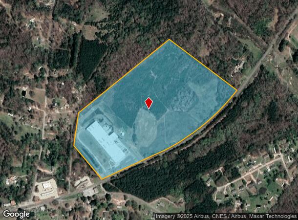
2665 Highway 29 S
099-00-02-006
CP S 872/9A F000 D000 PP 023/268 HWY 29 S 48.20 AC
Miscellaneous
Anderson
X
South Carolina
45007C0380E
48.20 AC
0
Anderson County
2024
Greenville/Spartanburg
012200
Greenville-Anderson-Mauldin, SC
DEMOGRAPHICS near 2665 Highway 29 S
1 Mile
3 Mile
5 Mile
2024 Total Population
661
8,443
34,753
2029 Population
715
9,111
37,553
Pop Growth 2024-2029
+ 8.17%
+ 7.91%
+ 8.06%
Average Age
40
40
40
2024 Total Households
280
3,322
14,053
HH Growth 2024-2029
+ 8.21%
+ 8.01%
+ 8.16%
Median Household Inc
$27,428
$42,552
$38,418
Avg Household Size
2.40
2.50
2.40
2024 Avg HH Vehicles
2.00
2.00
2.00
Median Home Value
$69,999
$84,114
$107,065
Median Year Built
1995
1984
1980
Nearby Places
Map Layers
Map Styles
 Street
 Aerial
- Restaurants
- Banks
- Shops
- Fitness
- Groceries
PUBLIC TRANSPORTATION
AIRPORT
Greenville Spartanburg International
DRIVE
WALK
Distance
Greenville Spartanburg International
63 min
48.5 mi
SALE & LEASE HISTORY
LISTING DATE
SALE/LEASE

Oct 16, 2017
For Sale
Nearby Properties
Address
Land Use
TOTAL SIZE
Lot Size
Zoning
Address
Land Use
TOTAL SIZE
Lot Size
Zoning
167,320 SF
14.75 AC
Address
Land Use
TOTAL SIZE
Lot Size
Zoning
75.85 AC
Address
Land Use
TOTAL SIZE
Lot Size
Zoning
9,550 SF
3 AC
Address
Land Use
TOTAL SIZE
Lot Size
Zoning
150,719 SF
31.62 AC
Address
Land Use
TOTAL SIZE
Lot Size
Zoning
89.99 AC
Address
Land Use
TOTAL SIZE
Lot Size
Zoning
163,600 SF
18.28 AC
Address
Land Use
TOTAL SIZE
Lot Size
Zoning
3,496 SF
8 AC
Address
Land Use
TOTAL SIZE
Lot Size
Zoning
2,834 SF
36.93 AC
Address
Land Use
TOTAL SIZE
Lot Size
Zoning
19.73 AC
Address
Land Use
TOTAL SIZE
Lot Size
Zoning
7,014 SF
3.03 AC
Address
Land Use
TOTAL SIZE
Lot Size
Zoning
9,360 SF
1.50 AC
Address
Land Use
TOTAL SIZE
Lot Size
Zoning
38.28 AC
Address
Land Use
TOTAL SIZE
Lot Size
Zoning
200 SF
0.50 AC
Address
Land Use
TOTAL SIZE
Lot Size
Zoning
Address
Land Use
TOTAL SIZE
Lot Size
Zoning
6,000 SF
2.49 AC
Address
Land Use
TOTAL SIZE
Lot Size
Zoning
Address
Land Use
TOTAL SIZE
Lot Size
Zoning
3,188 SF
1.39 AC
Address
Land Use
TOTAL SIZE
Lot Size
Zoning
3.33 AC
Address
Land Use
TOTAL SIZE
Lot Size
Zoning
2,477 SF
1 AC
Address
Land Use
TOTAL SIZE
Lot Size
Zoning
17.16 AC
Address
Land Use
TOTAL SIZE
Lot Size
Zoning
2.01 AC
Address
Land Use
TOTAL SIZE
Lot Size
Zoning
12,693 SF
10.30 AC
Address
Land Use
TOTAL SIZE
Lot Size
Zoning
7,530 SF
44.84 AC
Address
Land Use
TOTAL SIZE
Lot Size
Zoning
10,566 SF
30.33 AC
Address
Land Use
TOTAL SIZE
Lot Size
Zoning
34.85 AC
Address
Land Use
TOTAL SIZE
Lot Size
Zoning
2,500 SF
10.36 AC
Address
Land Use
TOTAL SIZE
Lot Size
Zoning
2,400 SF
5.97 AC
The World's #1 Commercial Real Estate Marketplace
Connect with us
© 2026 CoStar Group
The information above has been obtained from sources believed reliable. While we do not doubt its accuracy we have not verified it and make no guarantee, warranty or representation about it. It is your responsibility to independently confirm its accuracy and completeness. Any projections, opinions, assumptions, or estimates used are for example only and do not represent the current or future performance of the property. The value of this transaction to you depends on tax and other factors which should be evaluated by your tax, financial, and legal advisors. You and your advisors should conduct a careful, independent investigation of the property to determine to your satisfaction the suitability of the property for your needs.