Property Record
2666 Huntington Dr, Duarte, CA 91010


NEARBY LISTINGS FOR SALE OR LEASE
Property Detail
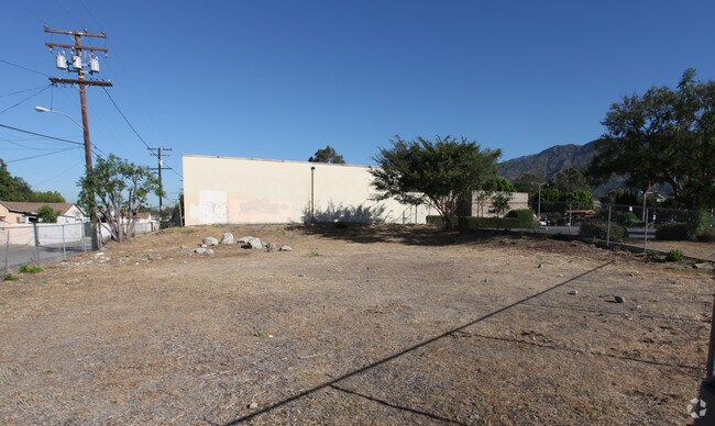
2666 Huntington Dr
8604-011-110
TR=13436 LOTS 48, 49, 50 AND 51
Lightindustrial
Los Angeles
X
California
06037C1415F
48-51
2024
1.02 AC
2025
Eastern SGV
430005
Los Angeles
9,280 SF
Los Angeles-Long Beach-Glendale, CA
DEMOGRAPHICS near 2666 Huntington Dr
1 Mile
3 Mile
5 Mile
2024 Total Population
9,810
86,999
305,177
2029 Population
9,455
84,179
294,724
Pop Growth 2024-2029
(3.62%)
(3.24%)
(3.43%)
Average Age
44
40
40
2024 Total Households
3,345
26,479
92,839
HH Growth 2024-2029
(3.89%)
(3.39%)
(3.62%)
Median Household Inc
$107,928
$81,144
$84,687
Avg Household Size
2.90
3.10
3.20
2024 Avg HH Vehicles
2.00
2.00
2.00
Median Home Value
$727,172
$659,472
$706,590
Median Year Built
1968
1963
1960
Nearby Places
Map Layers
Map Styles
 Street
 Aerial
- Restaurants
- Banks
- Shops
- Fitness
- Groceries
PUBLIC TRANSPORTATION
COMMUTER RAIL
Baldwin Park (San Bernardino Line - Southern California Regional Rail Authority (Metrolink))
DRIVE
WALK
Distance
Baldwin Park (San Bernardino Line - Southern California Regional Rail Authority (Metrolink))
12 min
5.6 mi
Covina (San Bernardino Line - Southern California Regional Rail Authority (Metrolink))
DRIVE
WALK
Distance
Covina (San Bernardino Line - Southern California Regional Rail Authority (Metrolink))
11 min
6.0 mi
AIRPORT
Ontario International
DRIVE
WALK
Distance
Ontario International
34 min
25.1 mi
Bob Hope
DRIVE
WALK
Distance
Bob Hope
36 min
28.6 mi
Long Beach (Daugherty Field)
DRIVE
WALK
Distance
Long Beach (Daugherty Field)
39 min
29.9 mi
Nearby Properties
Address
Land Use
TOTAL SIZE
Lot Size
Zoning
Address
Land Use
TOTAL SIZE
Lot Size
Zoning
453,050 SF
17.48 AC
DUH*
Address
Land Use
TOTAL SIZE
Lot Size
Zoning
836,910 SF
75.03 AC
IRM25*
Address
Land Use
TOTAL SIZE
Lot Size
Zoning
636,006 SF
27.79 AC
IRM2*
Address
Land Use
TOTAL SIZE
Lot Size
Zoning
1,104,998 SF
28 AC
IRM2*
Address
Land Use
TOTAL SIZE
Lot Size
Zoning
221,911 SF
2.24 AC
AZCBD*
Address
Land Use
TOTAL SIZE
Lot Size
Zoning
184,820 SF
IRM1*
Address
Land Use
TOTAL SIZE
Lot Size
Zoning
3.29 AC
DUSP
Address
Land Use
TOTAL SIZE
Lot Size
Zoning
357,639 SF
4.34 AC
DUSP
Address
Land Use
TOTAL SIZE
Lot Size
Zoning
627,908 SF
23.08 AC
IRM1*
Address
Land Use
TOTAL SIZE
Lot Size
Zoning
270,111 SF
12.79 AC
IRM2*
Address
Land Use
TOTAL SIZE
Lot Size
Zoning
200,000 SF
11.41 AC
AZM2*
Address
Land Use
TOTAL SIZE
Lot Size
Zoning
473,624 SF
4.53 AC
DUH*
Address
Land Use
TOTAL SIZE
Lot Size
Zoning
160,000 SF
6.74 AC
AZM2*
Address
Land Use
TOTAL SIZE
Lot Size
Zoning
100,253 SF
0.96 AC
DUH*
Address
Land Use
TOTAL SIZE
Lot Size
Zoning
717,472 SF
16.11 AC
AZC3*
Address
Land Use
TOTAL SIZE
Lot Size
Zoning
17.27 AC
IRM2S*
Address
Land Use
TOTAL SIZE
Lot Size
Zoning
155,884 SF
7.50 AC
AZA171/2
Address
Land Use
TOTAL SIZE
Lot Size
Zoning
213,749 SF
4.99 AC
IRM2
Address
Land Use
TOTAL SIZE
Lot Size
Zoning
329,324 SF
21.84 AC
AZM2
Address
Land Use
TOTAL SIZE
Lot Size
Zoning
108,340 SF
2.53 AC
DUH*
Address
Land Use
TOTAL SIZE
Lot Size
Zoning
147,852 SF
5.29 AC
AZM2YY
Address
Land Use
TOTAL SIZE
Lot Size
Zoning
98,113 SF
6.07 AC
MOCG*
Address
Land Use
TOTAL SIZE
Lot Size
Zoning
465,988 SF
8.03 AC
MOM*
Address
Land Use
TOTAL SIZE
Lot Size
Zoning
150,032 SF
3.14 AC
AZCB
Address
Land Use
TOTAL SIZE
Lot Size
Zoning
229,179 SF
13.50 AC
IRM1
Address
Land Use
TOTAL SIZE
Lot Size
Zoning
216,889 SF
27.71 AC
AZM2*
Address
Land Use
TOTAL SIZE
Lot Size
Zoning
134,018 SF
5.97 AC
MORH*
The World's #1 Commercial Real Estate Marketplace
Connect with us
© 2025 CoStar Group
The information above has been obtained from sources believed reliable. While we do not doubt its accuracy we have not verified it and make no guarantee, warranty or representation about it. It is your responsibility to independently confirm its accuracy and completeness. Any projections, opinions, assumptions, or estimates used are for example only and do not represent the current or future performance of the property. The value of this transaction to you depends on tax and other factors which should be evaluated by your tax, financial, and legal advisors. You and your advisors should conduct a careful, independent investigation of the property to determine to your satisfaction the suitability of the property for your needs.