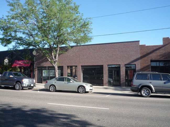
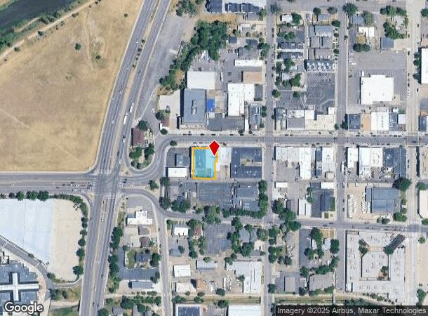
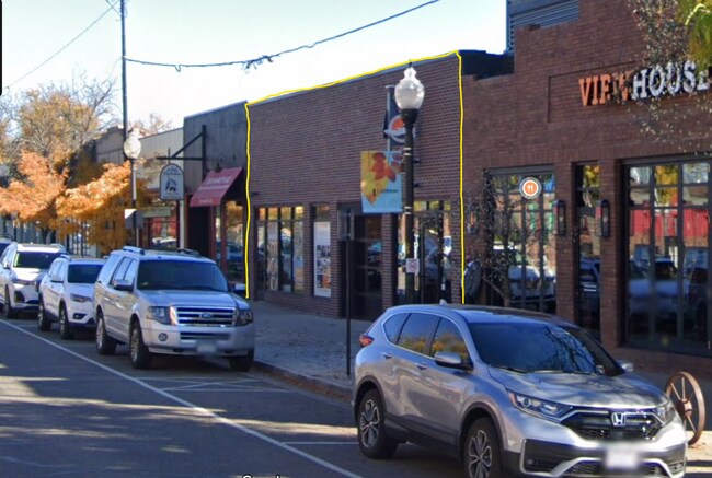
Property Record
2670 W Main St, Littleton, CO 80120
NEARBY LISTINGS FOR SALE OR LEASE
Property Detail
2670 W Main St
Denver-Aurora-Lakewood, CO
Hills Resub
2077-17-4-08-012
SUBDIVISIONCD 033450 SUBDIVISIONNAME HILLS RESUB BLOCK 002 LOT 013 LOTS 13-16 EX THE S 72.5 FT OF THE E 7.2 FT OF SD LOT 13 HILLS RESUBDIVISION OF BLK 2 LITTLETON
Restaurantbuilding
Arapahoe
X
Colorado
08005C0432N
13
2023
0.30 AC
2024
South
006501
Denver
11,188 SF
DEMOGRAPHICS near 2670 W Main St
1 Mile
3 Mile
5 Mile
2024 Total Population
14,084
93,721
276,360
2029 Population
14,153
93,957
279,492
Pop Growth 2024-2029
+ 0.49%
+ 0.25%
+ 1.13%
Average Age
42
42
41
2024 Total Households
6,847
39,057
113,866
HH Growth 2024-2029
+ 0.47%
+ 0.28%
+ 1.28%
Median Household Inc
$69,883
$91,542
$93,436
Avg Household Size
2.00
2.30
2.30
2024 Avg HH Vehicles
2.00
2.00
2.00
Median Home Value
$472,777
$576,856
$556,924
Median Year Built
1977
1974
1977
Nearby Places
Map Layers
Map Styles
 Street
 Aerial
- Restaurants
- Banks
- Shops
- Fitness
- Groceries
PUBLIC TRANSPORTATION
TRANSIT/SUBWAY
Littletown-Downtown (C Line - Denver Regional Transportation District Light Rail (TheRide), D Line - Denver Regional Transportation District Light Rail (TheRide))
DRIVE
WALK
Distance
Littletown-Downtown (C Line - Denver Regional Transportation District Light Rail (TheRide), D Line - Denver Regional Transportation District Light Rail (TheRide))
2 min
7 min
0.3 mi
AIRPORT
Denver International
DRIVE
WALK
Distance
Denver International
46 min
33.2 mi
Nearby Properties
Address
Land Use
TOTAL SIZE
Lot Size
Zoning
Address
Land Use
TOTAL SIZE
Lot Size
Zoning
665,722 SF
615.85 AC
OS-B
Address
Land Use
TOTAL SIZE
Lot Size
Zoning
248,291 SF
128.77 AC
CMP-H2
Address
Land Use
TOTAL SIZE
Lot Size
Zoning
330,776 SF
48.11 AC
CMP-H2
Address
Land Use
TOTAL SIZE
Lot Size
Zoning
251,583 SF
38.03 AC
Address
Land Use
TOTAL SIZE
Lot Size
Zoning
208,529 SF
34.81 AC
R-5
Address
Land Use
TOTAL SIZE
Lot Size
Zoning
133,908 SF
9.39 AC
LPD-C
Address
Land Use
TOTAL SIZE
Lot Size
Zoning
572,657 SF
0.21 AC
LPD-C
Address
Land Use
TOTAL SIZE
Lot Size
Zoning
221,025 SF
8.45 AC
PUD
Address
Land Use
TOTAL SIZE
Lot Size
Zoning
107,159 SF
26.40 AC
Address
Land Use
TOTAL SIZE
Lot Size
Zoning
47.24 AC
Address
Land Use
TOTAL SIZE
Lot Size
Zoning
7,035 SF
12.90 AC
LPD-R
Address
Land Use
TOTAL SIZE
Lot Size
Zoning
10,260 SF
49.33 AC
CMP-H2
Address
Land Use
TOTAL SIZE
Lot Size
Zoning
250,402 SF
21 AC
Address
Land Use
TOTAL SIZE
Lot Size
Zoning
206,632 SF
33.68 AC
Address
Land Use
TOTAL SIZE
Lot Size
Zoning
61,607 SF
11.60 AC
LPD-C
Address
Land Use
TOTAL SIZE
Lot Size
Zoning
94,367 SF
10.02 AC
R-2
Address
Land Use
TOTAL SIZE
Lot Size
Zoning
39.44 AC
Address
Land Use
TOTAL SIZE
Lot Size
Zoning
133,594 SF
25.03 AC
Address
Land Use
TOTAL SIZE
Lot Size
Zoning
351,792 SF
16.99 AC
LPD-C
Address
Land Use
TOTAL SIZE
Lot Size
Zoning
248,058 SF
12.24 AC
Address
Land Use
TOTAL SIZE
Lot Size
Zoning
146,877 SF
11.52 AC
Address
Land Use
TOTAL SIZE
Lot Size
Zoning
279,023 SF
13.15 AC
LPD-R
Address
Land Use
TOTAL SIZE
Lot Size
Zoning
308,134 SF
14.56 AC
LPD-C
Address
Land Use
TOTAL SIZE
Lot Size
Zoning
195,179 SF
5.54 AC
EI1
Address
Land Use
TOTAL SIZE
Lot Size
Zoning
221,819 SF
33.64 AC
A1
Address
Land Use
TOTAL SIZE
Lot Size
Zoning
80,576 SF
11.44 AC
Address
Land Use
TOTAL SIZE
Lot Size
Zoning
68,943 SF
21.70 AC
Address
Land Use
TOTAL SIZE
Lot Size
Zoning
81,037 SF
15.31 AC
LPD-C
Address
Land Use
TOTAL SIZE
Lot Size
Zoning
91,278 SF
8.13 AC
LPD-C
Address
Land Use
TOTAL SIZE
Lot Size
Zoning
30.05 AC
SD
The World's #1 Commercial Real Estate Marketplace
Connect with us
© 2025 CoStar Group
The information above has been obtained from sources believed reliable. While we do not doubt its accuracy we have not verified it and make no guarantee, warranty or representation about it. It is your responsibility to independently confirm its accuracy and completeness. Any projections, opinions, assumptions, or estimates used are for example only and do not represent the current or future performance of the property. The value of this transaction to you depends on tax and other factors which should be evaluated by your tax, financial, and legal advisors. You and your advisors should conduct a careful, independent investigation of the property to determine to your satisfaction the suitability of the property for your needs.