Property Record
26701 E Colbern Rd, Lees Summit, MO 64064

Property Detail
26701 E Colbern Rd
Kansas City, MO-KS
COLBERN ROAD DOALLAR GENERAL--- LOT 1
54-430-01-22-01-4-00-000
JACKSON
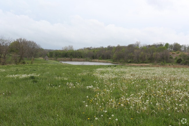
Agriculturalland
Missouri
B and X Area of moderate flood hazard, usually the area between the limits of the 100-year and 500-year floods.
1
2024
4.37 AC
2025
Southeast Jackson County
013918
Kansas City
11,200 SF
NEARBY LISTINGS FOR SALE OR LEASE
-
-
SE Colbern Dr @ Chapman Ridge Dr
Lee's Summit, MO 64086
$439,085 - $1,210,533
1.44 - 2.53 AC Lot
Land
-
View all Lees Summit listings for sale on LoopNet.com
DEMOGRAPHICS near 26701 E Colbern Rd
1 mile
3 mile
5 mile
2025 Total Population
3,533
15,986
64,278
2030 Population
3,695
16,489
64,960
Pop Growth 2025-2030
+ 4.59%
+ 3.15%
+ 1.06%
Average Age
42
40
39
2025 Total Households
1,318
5,721
23,153
HH Growth 2025-2030
+ 4.70%
+ 3.25%
+ 1.08%
Median Household Inc
$138,970
$123,772
$104,087
Avg Household Size
2.70
2.80
2.70
2025 Avg HH Vehicles
2.00
2.00
2.00
Median Home Value
$472,437
$418,964
$297,180
Median Year Built
2001
1998
1989
Nearby Places
Map Layers
Map Styles
 Street
 Aerial
Layers
 Traffic
 Biking
Places
Listings with unknown addresses are not visible on the map
- Restaurants
- Banks
- Shops
- Fitness
- Groceries
PUBLIC TRANSPORTATION
COMMUTER RAIL
Lee's Summit Amtrak (Lincoln Service Missouri River Runner - Amtrak, Missouri River Runner - Amtrak)
Drive
Walk
Distance
Lee's Summit Amtrak (Lincoln Service Missouri River Runner - Amtrak, Missouri River Runner - Amtrak)
16 min
8.1 mi
Freight Ports
Tulsa Port Of Catoosa
Drive
Walk
Distance
Tulsa Port Of Catoosa
273 min
246.8 mi
SALE & LEASE HISTORY
LISTING DATE
SALE/LEASE

Apr 17, 2017
For Sale
Nearby Properties
Address
Land Use
TOTAL SIZE
Lot Size
Zoning
Address
Land Use
TOTAL SIZE
Lot Size
Zoning
67,891 SF
464.50 AC
Address
Land Use
TOTAL SIZE
Lot Size
Zoning
143,264 SF
24.84 AC
Address
Land Use
TOTAL SIZE
Lot Size
Zoning
112,409 SF
4.90 AC
Address
Land Use
TOTAL SIZE
Lot Size
Zoning
28,274 SF
27.48 AC
Address
Land Use
TOTAL SIZE
Lot Size
Zoning
90,675 SF
19.93 AC
Address
Land Use
TOTAL SIZE
Lot Size
Zoning
65,539 SF
19.24 AC
Address
Land Use
TOTAL SIZE
Lot Size
Zoning
53,505 SF
8.51 AC
Address
Land Use
TOTAL SIZE
Lot Size
Zoning
15,043 SF
4.80 AC
Address
Land Use
TOTAL SIZE
Lot Size
Zoning
35,048 SF
9.54 AC
Address
Land Use
TOTAL SIZE
Lot Size
Zoning
Address
Land Use
TOTAL SIZE
Lot Size
Zoning
15,307 SF
5.58 AC
Address
Land Use
TOTAL SIZE
Lot Size
Zoning
Address
Land Use
TOTAL SIZE
Lot Size
Zoning
8,607 SF
4 AC
Address
Land Use
TOTAL SIZE
Lot Size
Zoning
9,080 SF
60 AC
Address
Land Use
TOTAL SIZE
Lot Size
Zoning
12,688 SF
15 AC
Address
Land Use
TOTAL SIZE
Lot Size
Zoning
13,750 SF
2.21 AC
Address
Land Use
TOTAL SIZE
Lot Size
Zoning
18,545 SF
3.91 AC
Address
Land Use
TOTAL SIZE
Lot Size
Zoning
1,404 SF
119.01 AC
Address
Land Use
TOTAL SIZE
Lot Size
Zoning
25,652 SF
26.15 AC
Address
Land Use
TOTAL SIZE
Lot Size
Zoning
79,761 SF
16 AC
Address
Land Use
TOTAL SIZE
Lot Size
Zoning
Address
Land Use
TOTAL SIZE
Lot Size
Zoning
Address
Land Use
TOTAL SIZE
Lot Size
Zoning
9,548 SF
10 AC
Address
Land Use
TOTAL SIZE
Lot Size
Zoning
8,204 SF
1.93 AC
Address
Land Use
TOTAL SIZE
Lot Size
Zoning
Address
Land Use
TOTAL SIZE
Lot Size
Zoning
15,995 SF
2 AC
Address
Land Use
TOTAL SIZE
Lot Size
Zoning
15,806 SF
76.40 AC
Address
Land Use
TOTAL SIZE
Lot Size
Zoning
Address
Land Use
TOTAL SIZE
Lot Size
Zoning
The World's #1 Commercial Real Estate Marketplace
Connect with us
© 2026 CoStar Group
The information above has been obtained from sources believed reliable. While we do not doubt its accuracy we have not verified it and make no guarantee, warranty or representation about it. It is your responsibility to independently confirm its accuracy and completeness. Any projections, opinions, assumptions, or estimates used are for example only and do not represent the current or future performance of the property. The value of this transaction to you depends on tax and other factors which should be evaluated by your tax, financial, and legal advisors. You and your advisors should conduct a careful, independent investigation of the property to determine to your satisfaction the suitability of the property for your needs.