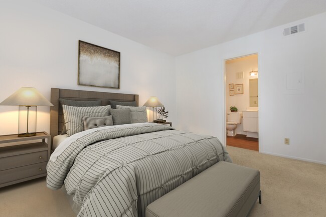
Property Record
26702 Isabella Pkwy, Canyon Country, CA 91351

NEARBY LISTINGS FOR SALE OR LEASE
-
-
View all Canyon Country listings for sale on LoopNet.com
Property Detail
26702 Isabella Pkwy
Los Angeles-Long Beach-Glendale, CA
43116
2836-041-002
TR=43116 LOT 3
Multifamilydwelling
Los Angeles
X
California
06037C0840G
3
2024
6.50 AC
2025
Canyon Country
920048
Los Angeles
129,816 SF
DEMOGRAPHICS near 26702 Isabella Pkwy
1 Mile
3 Mile
5 Mile
2024 Total Population
10,964
100,221
208,016
2029 Population
10,393
96,723
200,526
Pop Growth 2024-2029
(5.21%)
(3.49%)
(3.60%)
Average Age
40
39
39
2024 Total Households
3,599
33,062
69,414
HH Growth 2024-2029
(5.39%)
(3.70%)
(3.83%)
Median Household Inc
$94,944
$100,112
$108,267
Avg Household Size
3.00
2.90
2.90
2024 Avg HH Vehicles
2.00
2.00
2.00
Median Home Value
$614,187
$668,014
$703,130
Median Year Built
1986
1986
1987
Nearby Places
Map Layers
Map Styles
 Street
 Aerial
- Restaurants
- Banks
- Shops
- Fitness
- Groceries
PUBLIC TRANSPORTATION
COMMUTER RAIL
Via Princessa (Antelope Valley Line - Southern California Regional Rail Authority (Metrolink))
DRIVE
WALK
Distance
Via Princessa (Antelope Valley Line - Southern California Regional Rail Authority (Metrolink))
4 min
2.0 mi
Santa Clarita (Antelope Valley Line - Southern California Regional Rail Authority (Metrolink))
DRIVE
WALK
Distance
Santa Clarita (Antelope Valley Line - Southern California Regional Rail Authority (Metrolink))
4 min
2.1 mi
AIRPORT
Bob Hope
DRIVE
WALK
Distance
Bob Hope
30 min
21.1 mi
Freight Ports
The Port of Hueneme
DRIVE
WALK
Distance
The Port of Hueneme
79 min
55.3 mi
Nearby Properties
Address
Land Use
TOTAL SIZE
Lot Size
Zoning
Address
Land Use
TOTAL SIZE
Lot Size
Zoning
495,604 SF
38.40 AC
SCI
Address
Land Use
TOTAL SIZE
Lot Size
Zoning
255,744 SF
8.33 AC
SCUR3
Address
Land Use
TOTAL SIZE
Lot Size
Zoning
161,103 SF
4.68 AC
SCUR4
Address
Land Use
TOTAL SIZE
Lot Size
Zoning
103,828 SF
6.23 AC
SCUR4
Address
Land Use
TOTAL SIZE
Lot Size
Zoning
2,355 SF
497.82 AC
SCSP
Address
Land Use
TOTAL SIZE
Lot Size
Zoning
196,958 SF
14.03 AC
SCUR5
Address
Land Use
TOTAL SIZE
Lot Size
Zoning
97,780 SF
14.98 AC
SCUR3
Address
Land Use
TOTAL SIZE
Lot Size
Zoning
216,067 SF
25.69 AC
SCBP
Address
Land Use
TOTAL SIZE
Lot Size
Zoning
3,840 SF
443.36 AC
SCSP
Address
Land Use
TOTAL SIZE
Lot Size
Zoning
76,039 SF
11.30 AC
SCCC
Address
Land Use
TOTAL SIZE
Lot Size
Zoning
241,112 SF
10.98 AC
SCUR5
Address
Land Use
TOTAL SIZE
Lot Size
Zoning
137,834 SF
8.78 AC
SCSP
Address
Land Use
TOTAL SIZE
Lot Size
Zoning
129,420 SF
23.25 AC
SCBP
Address
Land Use
TOTAL SIZE
Lot Size
Zoning
154,374 SF
15.47 AC
SCBP
Address
Land Use
TOTAL SIZE
Lot Size
Zoning
74,176 SF
6.89 AC
SCUR3
Address
Land Use
TOTAL SIZE
Lot Size
Zoning
347,378 SF
14.11 AC
SCCP
Address
Land Use
TOTAL SIZE
Lot Size
Zoning
141,572 SF
10.67 AC
SCCR
Address
Land Use
TOTAL SIZE
Lot Size
Zoning
134,837 SF
12.52 AC
SCCR
Address
Land Use
TOTAL SIZE
Lot Size
Zoning
59,240 SF
2.78 AC
SCCC
Address
Land Use
TOTAL SIZE
Lot Size
Zoning
211,870 SF
9 AC
SCI
Address
Land Use
TOTAL SIZE
Lot Size
Zoning
235,426 SF
5.50 AC
SCSP
Address
Land Use
TOTAL SIZE
Lot Size
Zoning
169,848 SF
9 AC
SCSP
Address
Land Use
TOTAL SIZE
Lot Size
Zoning
70,408 SF
8.69 AC
SCCP
Address
Land Use
TOTAL SIZE
Lot Size
Zoning
151,452 SF
5.63 AC
SCUR5
Address
Land Use
TOTAL SIZE
Lot Size
Zoning
144,240 SF
5.51 AC
SCUR5
Address
Land Use
TOTAL SIZE
Lot Size
Zoning
49,750 SF
1.97 AC
SCCC
Address
Land Use
TOTAL SIZE
Lot Size
Zoning
50,908 SF
1.42 AC
SCSP
Address
Land Use
TOTAL SIZE
Lot Size
Zoning
137,018 SF
5.52 AC
SCUR5
Address
Land Use
TOTAL SIZE
Lot Size
Zoning
265,972 SF
7.81 AC
SCCC
The World's #1 Commercial Real Estate Marketplace
Connect with us
© 2026 CoStar Group
The information above has been obtained from sources believed reliable. While we do not doubt its accuracy we have not verified it and make no guarantee, warranty or representation about it. It is your responsibility to independently confirm its accuracy and completeness. Any projections, opinions, assumptions, or estimates used are for example only and do not represent the current or future performance of the property. The value of this transaction to you depends on tax and other factors which should be evaluated by your tax, financial, and legal advisors. You and your advisors should conduct a careful, independent investigation of the property to determine to your satisfaction the suitability of the property for your needs.