Property Record
26705 Maple Valley Black Diamond Rd Se, Maple Valley, WA 98038


NEARBY LISTINGS FOR SALE OR LEASE
-
-
View all Maple Valley listings for sale on LoopNet.com
Property Detail
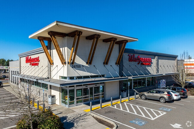
26705 Maple Valley Black Diamond Rd Se
Seattle-Tacoma-Bellevue, WA
Boundary Line Adjustment Cd08
272206-9086
PARCEL B CITY OF MAPLE VALLEY BOUNDARY LINE ADJUSTMENT NO CD1312-001 RECORDING NO 20140730900003 (BEING A PORTION OF SE QTR STR 27-22-06)
Storebuilding
King
X
Washington
53033C1285G
2
2025
1.56 AC
2024
E King County
032011
Seattle/Puget Sound
14,820 SF
DEMOGRAPHICS near 26705 Maple Valley Black Diamond Rd Se
1 Mile
3 Mile
5 Mile
2024 Total Population
10,244
42,377
71,964
2029 Population
10,284
42,668
72,272
Pop Growth 2024-2029
+ 0.39%
+ 0.69%
+ 0.43%
Average Age
35
38
39
2024 Total Households
3,124
14,022
24,352
HH Growth 2024-2029
+ 0.19%
+ 0.44%
+ 0.21%
Median Household Inc
$140,725
$130,938
$123,792
Avg Household Size
3.20
3.00
2.90
2024 Avg HH Vehicles
2.00
2.00
2.00
Median Home Value
$659,741
$657,488
$664,106
Median Year Built
2000
1995
1992
Nearby Places
Map Layers
Map Styles
 Street
 Aerial
- Restaurants
- Banks
- Shops
- Fitness
- Groceries
PUBLIC TRANSPORTATION
AIRPORT
Seattle-Tacoma International
DRIVE
WALK
Distance
Seattle-Tacoma International
37 min
21.2 mi
Freight Ports
Port of Tacoma
DRIVE
WALK
Distance
Port of Tacoma
37 min
24.6 mi
Nearby Properties
Address
Land Use
TOTAL SIZE
Lot Size
Zoning
Address
Land Use
TOTAL SIZE
Lot Size
Zoning
316,190 SF
35 AC
PUB
Address
Land Use
TOTAL SIZE
Lot Size
Zoning
188,400 SF
8.35 AC
TC
Address
Land Use
TOTAL SIZE
Lot Size
Zoning
157,420 SF
9.46 AC
R-18
Address
Land Use
TOTAL SIZE
Lot Size
Zoning
121,338 SF
5.13 AC
CB
Address
Land Use
TOTAL SIZE
Lot Size
Zoning
5.13 AC
R-24
Address
Land Use
TOTAL SIZE
Lot Size
Zoning
247,582 SF
39.90 AC
R1
Address
Land Use
TOTAL SIZE
Lot Size
Zoning
4,720 SF
122.76 AC
RLTC
Address
Land Use
TOTAL SIZE
Lot Size
Zoning
112,138 SF
20.71 AC
REC
Address
Land Use
TOTAL SIZE
Lot Size
Zoning
93,019 SF
14.62 AC
PUB
Address
Land Use
TOTAL SIZE
Lot Size
Zoning
55,760 SF
8.56 AC
TC
Address
Land Use
TOTAL SIZE
Lot Size
Zoning
162,547 SF
14.18 AC
TC
Address
Land Use
TOTAL SIZE
Lot Size
Zoning
18,722 SF
9.57 AC
TC
Address
Land Use
TOTAL SIZE
Lot Size
Zoning
123,911 SF
24.63 AC
R6
Address
Land Use
TOTAL SIZE
Lot Size
Zoning
51,480 SF
2.37 AC
CB
Address
Land Use
TOTAL SIZE
Lot Size
Zoning
126,994 SF
79.85 AC
RA5
Address
Land Use
TOTAL SIZE
Lot Size
Zoning
17,653 SF
5.16 AC
CC
Address
Land Use
TOTAL SIZE
Lot Size
Zoning
314.60 AC
CHECK WITH
Address
Land Use
TOTAL SIZE
Lot Size
Zoning
20,379 SF
80.20 AC
PRO
Address
Land Use
TOTAL SIZE
Lot Size
Zoning
62,725 SF
14.83 AC
PUB
Address
Land Use
TOTAL SIZE
Lot Size
Zoning
63,969 SF
20.36 AC
PUB
Address
Land Use
TOTAL SIZE
Lot Size
Zoning
5,628 SF
3.93 AC
NB
Address
Land Use
TOTAL SIZE
Lot Size
Zoning
76.81 AC
R6
Address
Land Use
TOTAL SIZE
Lot Size
Zoning
64,485 SF
21.51 AC
R1
Address
Land Use
TOTAL SIZE
Lot Size
Zoning
122.41 AC
PUB
Address
Land Use
TOTAL SIZE
Lot Size
Zoning
1,741 SF
4.55 AC
CB
Address
Land Use
TOTAL SIZE
Lot Size
Zoning
13,400 SF
3.18 AC
CB
Address
Land Use
TOTAL SIZE
Lot Size
Zoning
36,960 SF
2.42 AC
R-12
Address
Land Use
TOTAL SIZE
Lot Size
Zoning
12,900 SF
3.13 AC
CB
Address
Land Use
TOTAL SIZE
Lot Size
Zoning
8,460 SF
3.05 AC
TC
Address
Land Use
TOTAL SIZE
Lot Size
Zoning
35,035 SF
3.67 AC
R-12
The World's #1 Commercial Real Estate Marketplace
Connect with us
© 2026 CoStar Group
The information above has been obtained from sources believed reliable. While we do not doubt its accuracy we have not verified it and make no guarantee, warranty or representation about it. It is your responsibility to independently confirm its accuracy and completeness. Any projections, opinions, assumptions, or estimates used are for example only and do not represent the current or future performance of the property. The value of this transaction to you depends on tax and other factors which should be evaluated by your tax, financial, and legal advisors. You and your advisors should conduct a careful, independent investigation of the property to determine to your satisfaction the suitability of the property for your needs.