Property Record
26730 State Highway 74, Perris, CA 92570


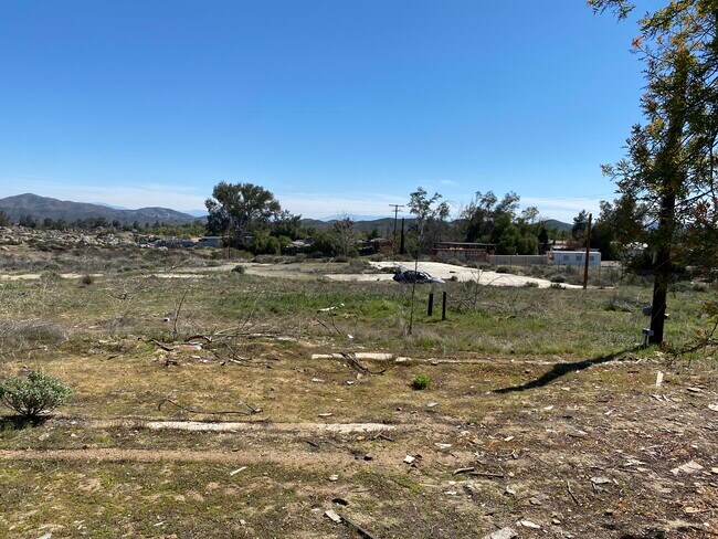

Property Detail
26730 State Highway 74
345-220-088
6.40 ACRES M/L IN POR SW 1/4 OF SEC 15 T5S R4W FOR TOTAL DESCRIPTION SEE ASSESSORS MAPS
Commercialnec
Riverside
RR
California
B and X Area of moderate flood hazard, usually the area between the limits of the 100-year and 500-year floods.
6.40 AC
2024
South Riverside
2025
Inland Empire (California)
042907
Riverside-San Bernardino-Ontario, CA
5,694 SF
NEARBY LISTINGS FOR SALE OR LEASE
-
-
View all Perris listings for sale on LoopNet.com
DEMOGRAPHICS near 26730 State Highway 74
1 mile
3 mile
5 mile
2025 Total Population
1,891
16,438
86,746
2030 Population
1,922
16,963
89,371
Pop Growth 2025-2030
+ 1.64%
+ 3.19%
+ 3.03%
Average Age
38
35
37
2025 Total Households
557
4,332
25,165
HH Growth 2025-2030
+ 1.08%
+ 2.86%
+ 2.71%
Median Household Inc
$67,250
$87,713
$90,340
Avg Household Size
3.30
3.70
3.30
2025 Avg HH Vehicles
3.00
3.00
2.00
Median Home Value
$461,841
$570,341
$583,392
Median Year Built
1986
1996
1991
Nearby Places
Map Layers
Map Styles
 Street
 Aerial
Layers
 Traffic
 Biking
Places
Listings with unknown addresses are not visible on the map
- Restaurants
- Banks
- Shops
- Fitness
- Groceries
PUBLIC TRANSPORTATION
COMMUTER RAIL
Perris Downtown (Metrolink 91-Perris Valley Line - Metrolink Trains)
Drive
Walk
Distance
Perris Downtown (Metrolink 91-Perris Valley Line - Metrolink Trains)
7 min
5.4 mi
South Perris (Metrolink 91-Perris Valley Line - Metrolink Trains)
Drive
Walk
Distance
South Perris (Metrolink 91-Perris Valley Line - Metrolink Trains)
10 min
7.3 mi
AIRPORT
Ontario International
Drive
Walk
Distance
Ontario International
48 min
39.0 mi
Freight Ports
Port of Long Beach
Drive
Walk
Distance
Port of Long Beach
84 min
66.7 mi
SALE & LEASE HISTORY
LISTING DATE
SALE/LEASE

Mar 31, 2017
For Sale
Feb 28, 2022
For Sale
Nearby Properties
Address
Land Use
TOTAL SIZE
Lot Size
Zoning
Address
Land Use
TOTAL SIZE
Lot Size
Zoning
74,712 SF
5.73 AC
MSC
Address
Land Use
TOTAL SIZE
Lot Size
Zoning
198.39 AC
RR
Address
Land Use
TOTAL SIZE
Lot Size
Zoning
24,000 SF
9.49 AC
M-SC
Address
Land Use
TOTAL SIZE
Lot Size
Zoning
7,549 SF
1.97 AC
RR
Address
Land Use
TOTAL SIZE
Lot Size
Zoning
13,000 SF
3.13 AC
RR
Address
Land Use
TOTAL SIZE
Lot Size
Zoning
3,000 SF
3.07 AC
MSC
Address
Land Use
TOTAL SIZE
Lot Size
Zoning
1,200 SF
C1CP
Address
Land Use
TOTAL SIZE
Lot Size
Zoning
1,296 SF
6.73 AC
MSC
Address
Land Use
TOTAL SIZE
Lot Size
Zoning
4,288 SF
1.34 AC
MSC
Address
Land Use
TOTAL SIZE
Lot Size
Zoning
2,132 SF
0.69 AC
MSC
Address
Land Use
TOTAL SIZE
Lot Size
Zoning
1,548 SF
13.34 AC
RA10
Address
Land Use
TOTAL SIZE
Lot Size
Zoning
720 SF
6.11 AC
RR
Address
Land Use
TOTAL SIZE
Lot Size
Zoning
30,000 SF
1.85 AC
RR
Address
Land Use
TOTAL SIZE
Lot Size
Zoning
4.26 AC
RR
Address
Land Use
TOTAL SIZE
Lot Size
Zoning
3.14 AC
MSC
Address
Land Use
TOTAL SIZE
Lot Size
Zoning
4,586 SF
9.93 AC
RR
Address
Land Use
TOTAL SIZE
Lot Size
Zoning
1,272 SF
14.65 AC
RR
Address
Land Use
TOTAL SIZE
Lot Size
Zoning
1,288 SF
6.72 AC
MSC
The World's #1 Commercial Real Estate Marketplace
Connect with us
© 2026 CoStar Group
The information above has been obtained from sources believed reliable. While we do not doubt its accuracy we have not verified it and make no guarantee, warranty or representation about it. It is your responsibility to independently confirm its accuracy and completeness. Any projections, opinions, assumptions, or estimates used are for example only and do not represent the current or future performance of the property. The value of this transaction to you depends on tax and other factors which should be evaluated by your tax, financial, and legal advisors. You and your advisors should conduct a careful, independent investigation of the property to determine to your satisfaction the suitability of the property for your needs.