Property Record
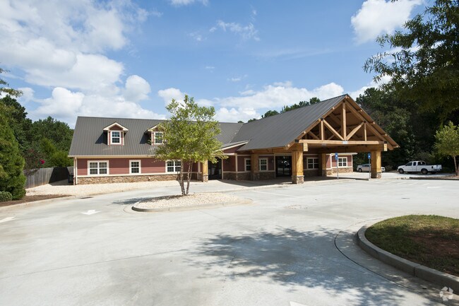
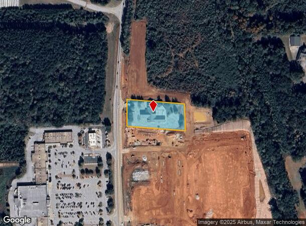
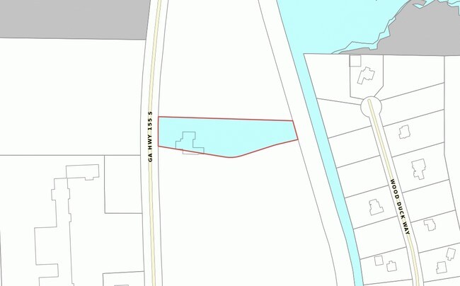
2675 Highway 155, Locust Grove, GA 30248
NEARBY LISTINGS FOR SALE OR LEASE
Property Detail
2675 Highway 155
Atlanta-Sandy Springs-Roswell, GA
Latagar Inc Surv
0097-01-001-002
LD: 7LL: 210+
Animalhospitalvet
Henry
X
Georgia
13255C0085E
210
2025
2.76 AC
2025
W Henry/Spalding
070506
Atlanta
16,134 SF
DEMOGRAPHICS near 2675 Highway 155
1 Mile
3 Mile
5 Mile
2024 Total Population
1,075
17,918
49,759
2029 Population
1,194
19,750
54,719
Pop Growth 2024-2029
+ 11.07%
+ 10.22%
+ 9.97%
Average Age
37
37
37
2024 Total Households
372
5,911
17,545
HH Growth 2024-2029
+ 11.29%
+ 10.35%
+ 10.08%
Median Household Inc
$82,056
$86,368
$72,051
Avg Household Size
2.90
3.00
2.80
2024 Avg HH Vehicles
2.00
2.00
2.00
Median Home Value
$275,903
$259,857
$225,030
Median Year Built
2007
2005
2005
Nearby Places
Map Layers
Map Styles
 Street
 Aerial
- Restaurants
- Banks
- Shops
- Fitness
- Groceries
PUBLIC TRANSPORTATION
AIRPORT
Hartsfield - Jackson Atlanta International
DRIVE
WALK
Distance
Hartsfield - Jackson Atlanta International
37 min
28.2 mi
Freight Ports
Georgia Ports - Savannah
DRIVE
WALK
Distance
Georgia Ports - Savannah
243 min
217.1 mi
Nearby Properties
Address
Land Use
TOTAL SIZE
Lot Size
Zoning
Address
Land Use
TOTAL SIZE
Lot Size
Zoning
5,174,944 SF
107.34 AC
M1
Address
Land Use
TOTAL SIZE
Lot Size
Zoning
2,016,606 SF
61.08 AC
M
Address
Land Use
TOTAL SIZE
Lot Size
Zoning
1,079,756 SF
92.38 AC
M1
Address
Land Use
TOTAL SIZE
Lot Size
Zoning
1,010,600 SF
78.40 AC
M1
Address
Land Use
TOTAL SIZE
Lot Size
Zoning
1,126,973 SF
88.82 AC
M1
Address
Land Use
TOTAL SIZE
Lot Size
Zoning
1,038,514 SF
141.54 AC
M1
Address
Land Use
TOTAL SIZE
Lot Size
Zoning
247,544 SF
43.30 AC
Address
Land Use
TOTAL SIZE
Lot Size
Zoning
4,307,236 SF
66.85 AC
M1
Address
Land Use
TOTAL SIZE
Lot Size
Zoning
7,005,327 SF
56.89 AC
M1
Address
Land Use
TOTAL SIZE
Lot Size
Zoning
18,084 SF
59.72 AC
M1
Address
Land Use
TOTAL SIZE
Lot Size
Zoning
22,633 SF
31 AC
RM
Address
Land Use
TOTAL SIZE
Lot Size
Zoning
4,982 SF
34.62 AC
RM
Address
Land Use
TOTAL SIZE
Lot Size
Zoning
21,308 SF
14.22 AC
M1
Address
Land Use
TOTAL SIZE
Lot Size
Zoning
676,000 SF
40.84 AC
M
Address
Land Use
TOTAL SIZE
Lot Size
Zoning
5,681,569 SF
37.80 AC
M1
Address
Land Use
TOTAL SIZE
Lot Size
Zoning
6,101,324 SF
42.27 AC
M1
Address
Land Use
TOTAL SIZE
Lot Size
Zoning
1,122,282 SF
39.20 AC
M2
Address
Land Use
TOTAL SIZE
Lot Size
Zoning
427,200 SF
67.92 AC
PD
Address
Land Use
TOTAL SIZE
Lot Size
Zoning
756,765 SF
50.68 AC
M1
Address
Land Use
TOTAL SIZE
Lot Size
Zoning
3,783,900 SF
43.09 AC
M1
Address
Land Use
TOTAL SIZE
Lot Size
Zoning
3,137,442 SF
53.75 AC
M1
Address
Land Use
TOTAL SIZE
Lot Size
Zoning
3,060,922 SF
27.99 AC
M1
Address
Land Use
TOTAL SIZE
Lot Size
Zoning
814,754 SF
21.65 AC
M1
Address
Land Use
TOTAL SIZE
Lot Size
Zoning
977,344 SF
32.79 AC
M1
Address
Land Use
TOTAL SIZE
Lot Size
Zoning
2,307,900 SF
27.52 AC
M1
Address
Land Use
TOTAL SIZE
Lot Size
Zoning
926,735 SF
25.94 AC
Address
Land Use
TOTAL SIZE
Lot Size
Zoning
297,051 SF
33.41 AC
M1
Address
Land Use
TOTAL SIZE
Lot Size
Zoning
1,650,464 SF
33.98 AC
Address
Land Use
TOTAL SIZE
Lot Size
Zoning
2,189,729 SF
23.17 AC
M1
Address
Land Use
TOTAL SIZE
Lot Size
Zoning
852,348 SF
27.17 AC
M1
The World's #1 Commercial Real Estate Marketplace
Connect with us
© 2025 CoStar Group
The information above has been obtained from sources believed reliable. While we do not doubt its accuracy we have not verified it and make no guarantee, warranty or representation about it. It is your responsibility to independently confirm its accuracy and completeness. Any projections, opinions, assumptions, or estimates used are for example only and do not represent the current or future performance of the property. The value of this transaction to you depends on tax and other factors which should be evaluated by your tax, financial, and legal advisors. You and your advisors should conduct a careful, independent investigation of the property to determine to your satisfaction the suitability of the property for your needs.