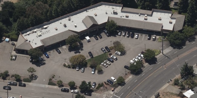
Property Record
26775 Hayward Blvd, Hayward, CA 94542


NEARBY LISTINGS FOR SALE OR LEASE
Property Detail
26775 Hayward Blvd
Oakland-Hayward-Berkeley, CA
Hayward Heath
445-0290-005-07
PORTION LOTS D-H,O,S&T
Regionalshoppingcenterormallwithanchorstore
Alameda
X
California
06001C0293G
d-h&o
2024
2.15 AC
2025
Hayward/Castro Valley
435102
East Bay/Oakland
18,400 SF
DEMOGRAPHICS near 26775 Hayward Blvd
1 Mile
3 Mile
5 Mile
2024 Total Population
9,609
149,101
327,513
2029 Population
9,330
144,728
316,579
Pop Growth 2024-2029
(2.90%)
(2.93%)
(3.34%)
Average Age
39
39
40
2024 Total Households
3,058
47,136
103,352
HH Growth 2024-2029
(2.94%)
(3.08%)
(3.53%)
Median Household Inc
$122,825
$102,490
$104,003
Avg Household Size
2.60
3.00
3.00
2024 Avg HH Vehicles
2.00
2.00
2.00
Median Home Value
$923,386
$764,079
$799,578
Median Year Built
1976
1972
1971
Nearby Places
Map Layers
Map Styles
 Street
 Aerial
- Restaurants
- Banks
- Shops
- Fitness
- Groceries
PUBLIC TRANSPORTATION
COMMUTER RAIL
DRIVE
WALK
Distance
9 min
3.6 mi
DRIVE
WALK
Distance
9 min
3.6 mi
AIRPORT
Metro Oakland International
DRIVE
WALK
Distance
Metro Oakland International
21 min
13.1 mi
San Francisco International
DRIVE
WALK
Distance
San Francisco International
34 min
24.5 mi
Norman Y Mineta San Jose International
DRIVE
WALK
Distance
Norman Y Mineta San Jose International
39 min
29.1 mi
Freight Ports
Port of Oakland
DRIVE
WALK
Distance
Port of Oakland
26 min
17.6 mi
SALE & LEASE HISTORY
LISTING DATE
SALE/LEASE

Sep 24, 2016
For Lease
Nearby Properties
Address
Land Use
TOTAL SIZE
Lot Size
Zoning
Address
Land Use
TOTAL SIZE
Lot Size
Zoning
710,091 SF
50.34 AC
Address
Land Use
TOTAL SIZE
Lot Size
Zoning
4.90 AC
Address
Land Use
TOTAL SIZE
Lot Size
Zoning
2.48 AC
Address
Land Use
TOTAL SIZE
Lot Size
Zoning
173,948 SF
6.10 AC
Address
Land Use
TOTAL SIZE
Lot Size
Zoning
175,325 SF
2.91 AC
Address
Land Use
TOTAL SIZE
Lot Size
Zoning
470,929 SF
31.62 AC
Address
Land Use
TOTAL SIZE
Lot Size
Zoning
1.50 AC
Address
Land Use
TOTAL SIZE
Lot Size
Zoning
150,856 SF
5.99 AC
Address
Land Use
TOTAL SIZE
Lot Size
Zoning
187,926 SF
1.19 AC
Address
Land Use
TOTAL SIZE
Lot Size
Zoning
160,987 SF
7.20 AC
Address
Land Use
TOTAL SIZE
Lot Size
Zoning
228,736 SF
5.95 AC
Address
Land Use
TOTAL SIZE
Lot Size
Zoning
169,371 SF
4.63 AC
Address
Land Use
TOTAL SIZE
Lot Size
Zoning
146,599 SF
13.72 AC
Address
Land Use
TOTAL SIZE
Lot Size
Zoning
116,485 SF
1.81 AC
Address
Land Use
TOTAL SIZE
Lot Size
Zoning
116,750 SF
4.72 AC
Address
Land Use
TOTAL SIZE
Lot Size
Zoning
92,922 SF
5 AC
Address
Land Use
TOTAL SIZE
Lot Size
Zoning
100,128 SF
0.98 AC
Address
Land Use
TOTAL SIZE
Lot Size
Zoning
119,800 SF
5.72 AC
Address
Land Use
TOTAL SIZE
Lot Size
Zoning
57,497 SF
4.92 AC
Address
Land Use
TOTAL SIZE
Lot Size
Zoning
84,690 SF
6.25 AC
CN
Address
Land Use
TOTAL SIZE
Lot Size
Zoning
92,534 SF
3.04 AC
Address
Land Use
TOTAL SIZE
Lot Size
Zoning
137,422 SF
5.56 AC
RH
Address
Land Use
TOTAL SIZE
Lot Size
Zoning
424,416 SF
19.49 AC
Address
Land Use
TOTAL SIZE
Lot Size
Zoning
118,083 SF
4.70 AC
Address
Land Use
TOTAL SIZE
Lot Size
Zoning
94,485 SF
8.31 AC
Address
Land Use
TOTAL SIZE
Lot Size
Zoning
Address
Land Use
TOTAL SIZE
Lot Size
Zoning
57,120 SF
3.24 AC
Address
Land Use
TOTAL SIZE
Lot Size
Zoning
98,216 SF
4.68 AC
RH
Address
Land Use
TOTAL SIZE
Lot Size
Zoning
283,650 SF
11.03 AC
Address
Land Use
TOTAL SIZE
Lot Size
Zoning
75,232 SF
6.76 AC
The World's #1 Commercial Real Estate Marketplace
Connect with us
© 2026 CoStar Group
The information above has been obtained from sources believed reliable. While we do not doubt its accuracy we have not verified it and make no guarantee, warranty or representation about it. It is your responsibility to independently confirm its accuracy and completeness. Any projections, opinions, assumptions, or estimates used are for example only and do not represent the current or future performance of the property. The value of this transaction to you depends on tax and other factors which should be evaluated by your tax, financial, and legal advisors. You and your advisors should conduct a careful, independent investigation of the property to determine to your satisfaction the suitability of the property for your needs.