Property Record
2681 Unassigned Address Hwy, Hiram, GA 30141
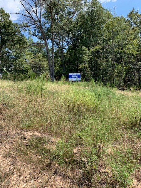
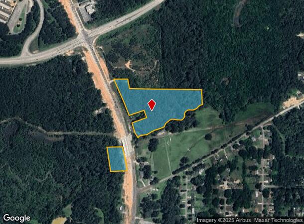
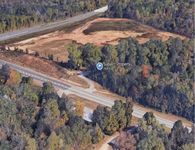
This Property Is For Sale
NEARBY LISTINGS FOR SALE OR LEASE
Property Detail
2681 Unassigned Address Hwy
Atlanta-Sandy Springs-Roswell, GA
Paulding
209.2.3.012.0000
Georgia
Residentialnec
11.45 AC
AE
Douglasville/Lithia Springs
13223C0232C
Atlanta
1,879 SF
DEMOGRAPHICS near 2681 Unassigned Address Hwy
1 Mile
3 Mile
5 Mile
2024 Total Population
1,742
25,080
87,834
2029 Population
2,004
27,993
96,603
Pop Growth 2024-2029
+ 15.04%
+ 11.61%
+ 9.98%
Average Age
40
39
39
2024 Total Households
612
8,954
30,710
HH Growth 2024-2029
+ 15.03%
+ 11.79%
+ 10.16%
Median Household Inc
$74,762
$89,921
$92,101
Avg Household Size
2.70
2.80
2.80
2024 Avg HH Vehicles
2.00
2.00
2.00
Median Home Value
$189,300
$222,506
$238,697
Median Year Built
1991
1995
1996
Nearby Places
- Restaurants
- Banks
- Shops
- Fitness
- Groceries
PUBLIC TRANSPORTATION
AIRPORT
Hartsfield - Jackson Atlanta International
DRIVE
WALK
Distance
Hartsfield - Jackson Atlanta International
51 min
36.6 mi
Freight Ports
Georgia Ports - Savannah
DRIVE
WALK
Distance
Georgia Ports - Savannah
314 min
276.0 mi
Nearby Properties
Address
Land Use
TOTAL SIZE
Lot Size
Zoning
Address
Land Use
TOTAL SIZE
Lot Size
Zoning
69.17 AC
Address
Land Use
TOTAL SIZE
Lot Size
Zoning
93.77 AC
Address
Land Use
TOTAL SIZE
Lot Size
Zoning
15.02 AC
Address
Land Use
TOTAL SIZE
Lot Size
Zoning
238,291 SF
22.51 AC
B2
Address
Land Use
TOTAL SIZE
Lot Size
Zoning
Address
Land Use
TOTAL SIZE
Lot Size
Zoning
21.05 AC
Address
Land Use
TOTAL SIZE
Lot Size
Zoning
141,658 SF
17.36 AC
PSC
Address
Land Use
TOTAL SIZE
Lot Size
Zoning
25.34 AC
Address
Land Use
TOTAL SIZE
Lot Size
Zoning
198,684 SF
21.35 AC
B2
Address
Land Use
TOTAL SIZE
Lot Size
Zoning
27.55 AC
Address
Land Use
TOTAL SIZE
Lot Size
Zoning
171,184 SF
14.63 AC
PSC
Address
Land Use
TOTAL SIZE
Lot Size
Zoning
149,128 SF
108.92 AC
I1
Address
Land Use
TOTAL SIZE
Lot Size
Zoning
133,006 SF
15.53 AC
PSC
Address
Land Use
TOTAL SIZE
Lot Size
Zoning
185,183 SF
6.99 AC
OI
Address
Land Use
TOTAL SIZE
Lot Size
Zoning
103,185 SF
13.41 AC
B2
Address
Land Use
TOTAL SIZE
Lot Size
Zoning
86,556 SF
8.10 AC
PSC
Address
Land Use
TOTAL SIZE
Lot Size
Zoning
68,669 SF
7.95 AC
B1
Address
Land Use
TOTAL SIZE
Lot Size
Zoning
109,540 SF
13.99 AC
B2
Address
Land Use
TOTAL SIZE
Lot Size
Zoning
57,600 SF
2.91 AC
PSC
Address
Land Use
TOTAL SIZE
Lot Size
Zoning
104,552 SF
11.19 AC
I1
Address
Land Use
TOTAL SIZE
Lot Size
Zoning
70,182 SF
7.35 AC
I1
Address
Land Use
TOTAL SIZE
Lot Size
Zoning
50,622 SF
7.89 AC
B2
Address
Land Use
TOTAL SIZE
Lot Size
Zoning
16.72 AC
R-20
Address
Land Use
TOTAL SIZE
Lot Size
Zoning
42,320 SF
4.67 AC
PSC
Address
Land Use
TOTAL SIZE
Lot Size
Zoning
48,248 SF
6.97 AC
PSC
Address
Land Use
TOTAL SIZE
Lot Size
Zoning
101,703 SF
8.95 AC
B2
Address
Land Use
TOTAL SIZE
Lot Size
Zoning
33,396 SF
3.39 AC
MXU
Address
Land Use
TOTAL SIZE
Lot Size
Zoning
52,320 SF
10 AC
Address
Land Use
TOTAL SIZE
Lot Size
Zoning
43,002 SF
7.01 AC
PSC
The World's #1 Commercial Real Estate Marketplace
Connect with us
© 2025 CoStar Group
The information above has been obtained from sources believed reliable. While we do not doubt its accuracy we have not verified it and make no guarantee, warranty or representation about it. It is your responsibility to independently confirm its accuracy and completeness. Any projections, opinions, assumptions, or estimates used are for example only and do not represent the current or future performance of the property. The value of this transaction to you depends on tax and other factors which should be evaluated by your tax, financial, and legal advisors. You and your advisors should conduct a careful, independent investigation of the property to determine to your satisfaction the suitability of the property for your needs.