Property Record
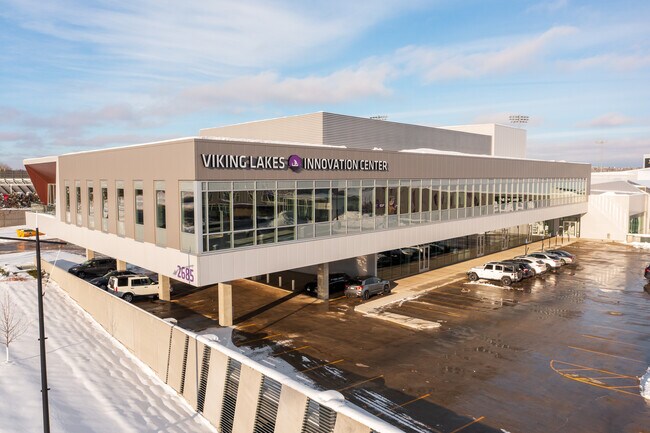
2685 Vikings Cir, Saint Paul, MN 55121

NEARBY LISTINGS FOR SALE OR LEASE
Property Detail
2685 Vikings Cir
Minneapolis-St. Paul-Bloomington, MN-WI
Viking Lakes 2Nd Add
10-82011-01-040
VIKING LAKES 2ND ADD 4 1
Commercialnec
Dakota
X
Minnesota
27037C0105E
40
2024
2 AC
2024
Burnsville/Eagan/Apple Vy
060717
Minneapolis/St Paul
283,463 SF
DEMOGRAPHICS near 2685 Vikings Cir
1 Mile
3 Mile
5 Mile
2024 Total Population
2,504
38,445
159,994
2029 Population
2,560
39,453
161,842
Pop Growth 2024-2029
+ 2.24%
+ 2.62%
+ 1.16%
Average Age
43
41
41
2024 Total Households
1,010
15,831
66,523
HH Growth 2024-2029
+ 2.18%
+ 2.57%
+ 1.10%
Median Household Inc
$126,054
$92,062
$84,836
Avg Household Size
2.40
2.40
2.30
2024 Avg HH Vehicles
2.00
2.00
2.00
Median Home Value
$507,370
$458,009
$325,943
Median Year Built
1990
1987
1979
Nearby Places
Map Layers
Map Styles
 Street
 Aerial
- Restaurants
- Banks
- Shops
- Fitness
- Groceries
PUBLIC TRANSPORTATION
COMMUTER RAIL
St. Paul-Minneapolis (Empire Builder - Amtrak)
DRIVE
WALK
Distance
St. Paul-Minneapolis (Empire Builder - Amtrak)
15 min
9.5 mi
AIRPORT
Minneapolis-St Paul International/Wold-Chamberlain
DRIVE
WALK
Distance
Minneapolis-St Paul International/Wold-Chamberlain
14 min
7.6 mi
Freight Ports
Port Milwaukee
DRIVE
WALK
Distance
Port Milwaukee
370 min
335.0 mi
SALE & LEASE HISTORY
LISTING DATE
SALE/LEASE

Mar 25, 2020
For Lease
Jun 30, 2021
For Lease
Jan 03, 2019
For Lease
Dec 13, 2022
For Lease
Aug 11, 2017
For Lease
Nearby Properties
Address
Land Use
TOTAL SIZE
Lot Size
Zoning
Address
Land Use
TOTAL SIZE
Lot Size
Zoning
479,742 SF
11.35 AC
Address
Land Use
TOTAL SIZE
Lot Size
Zoning
466,503 SF
28.74 AC
Address
Land Use
TOTAL SIZE
Lot Size
Zoning
Address
Land Use
TOTAL SIZE
Lot Size
Zoning
146,085 SF
46.83 AC
Address
Land Use
TOTAL SIZE
Lot Size
Zoning
657,358 SF
17.12 AC
Address
Land Use
TOTAL SIZE
Lot Size
Zoning
264,370 SF
36.39 AC
Address
Land Use
TOTAL SIZE
Lot Size
Zoning
247,470 SF
2.21 AC
Address
Land Use
TOTAL SIZE
Lot Size
Zoning
246,636 SF
7.20 AC
Address
Land Use
TOTAL SIZE
Lot Size
Zoning
293,970 SF
31.92 AC
Address
Land Use
TOTAL SIZE
Lot Size
Zoning
223,583 SF
5.32 AC
Address
Land Use
TOTAL SIZE
Lot Size
Zoning
381,158 SF
11.86 AC
Address
Land Use
TOTAL SIZE
Lot Size
Zoning
317,235 SF
32.38 AC
Address
Land Use
TOTAL SIZE
Lot Size
Zoning
206,818 SF
2.84 AC
Address
Land Use
TOTAL SIZE
Lot Size
Zoning
300,000 SF
18.44 AC
Address
Land Use
TOTAL SIZE
Lot Size
Zoning
314,237 SF
10.63 AC
Address
Land Use
TOTAL SIZE
Lot Size
Zoning
240,316 SF
9.57 AC
Address
Land Use
TOTAL SIZE
Lot Size
Zoning
228,810 SF
6.30 AC
Address
Land Use
TOTAL SIZE
Lot Size
Zoning
Address
Land Use
TOTAL SIZE
Lot Size
Zoning
170,292 SF
2.08 AC
Address
Land Use
TOTAL SIZE
Lot Size
Zoning
247,451 SF
9.57 AC
Address
Land Use
TOTAL SIZE
Lot Size
Zoning
Address
Land Use
TOTAL SIZE
Lot Size
Zoning
278,320 SF
31.12 AC
Address
Land Use
TOTAL SIZE
Lot Size
Zoning
159,341 SF
2.82 AC
Address
Land Use
TOTAL SIZE
Lot Size
Zoning
1,339,582 SF
78.22 AC
Address
Land Use
TOTAL SIZE
Lot Size
Zoning
541,075 SF
88.93 AC
Address
Land Use
TOTAL SIZE
Lot Size
Zoning
293,717 SF
33.30 AC
Address
Land Use
TOTAL SIZE
Lot Size
Zoning
206,503 SF
5.61 AC
Address
Land Use
TOTAL SIZE
Lot Size
Zoning
162,372 SF
9.11 AC
Address
Land Use
TOTAL SIZE
Lot Size
Zoning
482,008 SF
23.78 AC
Address
Land Use
TOTAL SIZE
Lot Size
Zoning
436,701 SF
19.58 AC
The World's #1 Commercial Real Estate Marketplace
Connect with us
© 2026 CoStar Group
The information above has been obtained from sources believed reliable. While we do not doubt its accuracy we have not verified it and make no guarantee, warranty or representation about it. It is your responsibility to independently confirm its accuracy and completeness. Any projections, opinions, assumptions, or estimates used are for example only and do not represent the current or future performance of the property. The value of this transaction to you depends on tax and other factors which should be evaluated by your tax, financial, and legal advisors. You and your advisors should conduct a careful, independent investigation of the property to determine to your satisfaction the suitability of the property for your needs.