Property Record
269 Roxbury Rd, Niantic, CT 06357
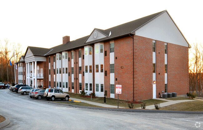

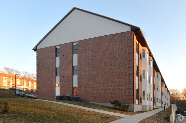
Property Detail
269 Roxbury Rd
ELYM-001000-003002
Southeastern Ct
Apartmenthouse5plusunits
Connecticut
B and X Area of moderate flood hazard, usually the area between the limits of the 100-year and 500-year floods.
4.20 AC
2025
Southwest New London/Lyme
2025
Hartford
716101
Norwich-New London-Willimantic, CT
41,563 SF
NEARBY LISTINGS FOR SALE OR LEASE
DEMOGRAPHICS near 269 Roxbury Rd
1 mile
3 mile
5 mile
2025 Total Population
3,535
17,575
35,006
2030 Population
3,629
18,178
36,153
Pop Growth 2025-2030
+ 2.66%
+ 3.43%
+ 3.28%
Average Age
46
47
47
2025 Total Households
1,383
7,600
14,942
HH Growth 2025-2030
+ 3.40%
+ 3.67%
+ 3.41%
Median Household Inc
$96,978
$105,540
$111,724
Avg Household Size
2.00
2.20
2.20
2025 Avg HH Vehicles
2.00
2.00
2.00
Median Home Value
$369,350
$417,345
$421,179
Median Year Built
1981
1968
1968
Nearby Places
Map Layers
Map Styles
 Street
 Aerial
Transit
 Traffic
 Biking
Places
Listings with unknown addresses are not visible on the map
- Restaurants
- Banks
- Shops
- Fitness
- Groceries
PUBLIC TRANSPORTATION
COMMUTER RAIL
New London (Shore Line East - Shore Line East)
Drive
Walk
Distance
New London (Shore Line East - Shore Line East)
19 min
8.3 mi
Old Saybrook (Shore Line East - Shore Line East)
Drive
Walk
Distance
Old Saybrook (Shore Line East - Shore Line East)
15 min
9.6 mi
Freight Ports
Port of New Haven
Drive
Walk
Distance
Port of New Haven
49 min
37.5 mi
Nearby Properties
Address
Land Use
TOTAL SIZE
Lot Size
Zoning
Address
Land Use
TOTAL SIZE
Lot Size
Zoning
66.17 AC
LI
Address
Land Use
TOTAL SIZE
Lot Size
Zoning
1,256 SF
64.84 AC
R40
Address
Land Use
TOTAL SIZE
Lot Size
Zoning
617.95 AC
Address
Land Use
TOTAL SIZE
Lot Size
Zoning
511.78 AC
R40
Address
Land Use
TOTAL SIZE
Lot Size
Zoning
68.87 AC
GDPP
Address
Land Use
TOTAL SIZE
Lot Size
Zoning
14.76 AC
CA
Address
Land Use
TOTAL SIZE
Lot Size
Zoning
106 AC
R40
Address
Land Use
TOTAL SIZE
Lot Size
Zoning
62,878 SF
6.01 AC
CA
Address
Land Use
TOTAL SIZE
Lot Size
Zoning
122,580 SF
15.18 AC
Address
Land Use
TOTAL SIZE
Lot Size
Zoning
55,906 SF
2.16 AC
CB
Address
Land Use
TOTAL SIZE
Lot Size
Zoning
67,784 SF
5.53 AC
CA
Address
Land Use
TOTAL SIZE
Lot Size
Zoning
18.40 AC
R80
Address
Land Use
TOTAL SIZE
Lot Size
Zoning
10.79 AC
R40
Address
Land Use
TOTAL SIZE
Lot Size
Zoning
23.41 AC
LI
Address
Land Use
TOTAL SIZE
Lot Size
Zoning
3.29 AC
CB
Address
Land Use
TOTAL SIZE
Lot Size
Zoning
56,568 SF
3.65 AC
LI
Address
Land Use
TOTAL SIZE
Lot Size
Zoning
29,830 SF
4.85 AC
LI
Address
Land Use
TOTAL SIZE
Lot Size
Zoning
57,298 SF
2.13 AC
CA
Address
Land Use
TOTAL SIZE
Lot Size
Zoning
11.62 AC
LI80
Address
Land Use
TOTAL SIZE
Lot Size
Zoning
25,088 SF
8.10 AC
LI80
Address
Land Use
TOTAL SIZE
Lot Size
Zoning
2 AC
R40
Address
Land Use
TOTAL SIZE
Lot Size
Zoning
5.13 AC
CM
Address
Land Use
TOTAL SIZE
Lot Size
Zoning
38,837 SF
2.15 AC
R40
Address
Land Use
TOTAL SIZE
Lot Size
Zoning
27,356 SF
0.95 AC
CB
Address
Land Use
TOTAL SIZE
Lot Size
Zoning
1.97 AC
CM
Address
Land Use
TOTAL SIZE
Lot Size
Zoning
43,175 SF
3.83 AC
R40
Address
Land Use
TOTAL SIZE
Lot Size
Zoning
5,098 SF
2.66 AC
R40
Address
Land Use
TOTAL SIZE
Lot Size
Zoning
15,294 SF
1.31 AC
CM
Address
Land Use
TOTAL SIZE
Lot Size
Zoning
5.73 AC
LI
The World's #1 Commercial Real Estate Marketplace
Connect with us
© 2026 CoStar Group
The information above has been obtained from sources believed reliable. While we do not doubt its accuracy we have not verified it and make no guarantee, warranty or representation about it. It is your responsibility to independently confirm its accuracy and completeness. Any projections, opinions, assumptions, or estimates used are for example only and do not represent the current or future performance of the property. The value of this transaction to you depends on tax and other factors which should be evaluated by your tax, financial, and legal advisors. You and your advisors should conduct a careful, independent investigation of the property to determine to your satisfaction the suitability of the property for your needs.