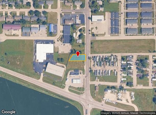
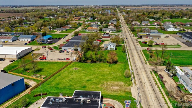
Property Record
269 S Somonauk Rd, Cortland, IL 60112


NEARBY LISTINGS FOR SALE OR LEASE
Property Detail
269 S Somonauk Rd
09-29-300-004
N 75 FT OF E 200 FT OF PT NE 1/4 SW 1/4 LYING N OF RTE 38 & W OF SOMONAUK RD - SEC 29 - TWP 40N - RANGE 5E
Vacantlandnec
DeKalb
X
Illinois
17037C0275E
0.36 AC
2023
Western East/West Corr
2024
Chicago
001600
Chicago-Naperville-Elgin, IL-IN-WI
DEMOGRAPHICS near 269 S Somonauk Rd
1 Mile
3 Mile
5 Mile
2024 Total Population
2,396
10,307
54,664
2029 Population
2,454
10,320
54,570
Pop Growth 2024-2029
+ 2.42%
+ 0.13%
(0.17%)
Average Age
37
37
36
2024 Total Households
850
3,966
21,254
HH Growth 2024-2029
+ 2.24%
(0.15%)
(0.16%)
Median Household Inc
$87,298
$66,489
$56,528
Avg Household Size
2.70
2.50
2.30
2024 Avg HH Vehicles
2.00
2.00
2.00
Median Home Value
$174,663
$157,323
$181,624
Median Year Built
1998
1974
1977
Nearby Places
Map Layers
Map Styles
 Street
 Aerial
- Restaurants
- Banks
- Shops
- Fitness
- Groceries
PUBLIC TRANSPORTATION
AIRPORT
Chicago/Rockford International
DRIVE
WALK
Distance
Chicago/Rockford International
58 min
43.2 mi
SALE & LEASE HISTORY
LISTING DATE
SALE/LEASE

May 18, 2023
For Sale
Mar 20, 2024
For Sale
Nearby Properties
Address
Land Use
TOTAL SIZE
Lot Size
Zoning
Address
Land Use
TOTAL SIZE
Lot Size
Zoning
227.72 AC
Address
Land Use
TOTAL SIZE
Lot Size
Zoning
49.71 AC
Address
Land Use
TOTAL SIZE
Lot Size
Zoning
58.65 AC
Address
Land Use
TOTAL SIZE
Lot Size
Zoning
49.73 AC
Address
Land Use
TOTAL SIZE
Lot Size
Zoning
98.56 AC
Address
Land Use
TOTAL SIZE
Lot Size
Zoning
94.65 AC
Address
Land Use
TOTAL SIZE
Lot Size
Zoning
47.87 AC
Address
Land Use
TOTAL SIZE
Lot Size
Zoning
257.54 AC
Address
Land Use
TOTAL SIZE
Lot Size
Zoning
21.61 AC
Address
Land Use
TOTAL SIZE
Lot Size
Zoning
25.70 AC
Address
Land Use
TOTAL SIZE
Lot Size
Zoning
20.83 AC
Address
Land Use
TOTAL SIZE
Lot Size
Zoning
23.25 AC
Address
Land Use
TOTAL SIZE
Lot Size
Zoning
202,500 SF
15.65 AC
Address
Land Use
TOTAL SIZE
Lot Size
Zoning
8.78 AC
Address
Land Use
TOTAL SIZE
Lot Size
Zoning
240 SF
7.46 AC
Address
Land Use
TOTAL SIZE
Lot Size
Zoning
11.54 AC
A1
Address
Land Use
TOTAL SIZE
Lot Size
Zoning
31.11 AC
A1
Address
Land Use
TOTAL SIZE
Lot Size
Zoning
7.57 AC
Address
Land Use
TOTAL SIZE
Lot Size
Zoning
9.66 AC
Address
Land Use
TOTAL SIZE
Lot Size
Zoning
16.23 AC
Address
Land Use
TOTAL SIZE
Lot Size
Zoning
2.87 AC
Address
Land Use
TOTAL SIZE
Lot Size
Zoning
4.91 AC
Address
Land Use
TOTAL SIZE
Lot Size
Zoning
92.65 AC
Address
Land Use
TOTAL SIZE
Lot Size
Zoning
9.12 AC
Address
Land Use
TOTAL SIZE
Lot Size
Zoning
2.08 AC
Address
Land Use
TOTAL SIZE
Lot Size
Zoning
18 AC
MC
Address
Land Use
TOTAL SIZE
Lot Size
Zoning
Address
Land Use
TOTAL SIZE
Lot Size
Zoning
1.63 AC
Address
Land Use
TOTAL SIZE
Lot Size
Zoning
1.12 AC
Address
Land Use
TOTAL SIZE
Lot Size
Zoning
28,773 SF
20 AC
The World's #1 Commercial Real Estate Marketplace
Connect with us
© 2025 CoStar Group
The information above has been obtained from sources believed reliable. While we do not doubt its accuracy we have not verified it and make no guarantee, warranty or representation about it. It is your responsibility to independently confirm its accuracy and completeness. Any projections, opinions, assumptions, or estimates used are for example only and do not represent the current or future performance of the property. The value of this transaction to you depends on tax and other factors which should be evaluated by your tax, financial, and legal advisors. You and your advisors should conduct a careful, independent investigation of the property to determine to your satisfaction the suitability of the property for your needs.