Property Record
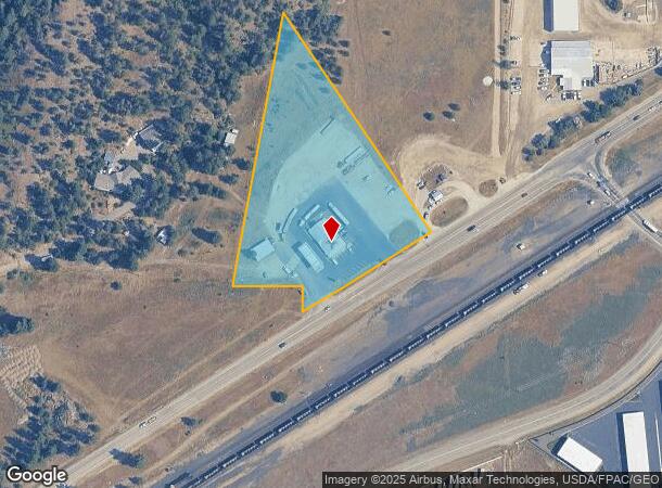
26913 W Highway 53, Hauser, ID 83854


NEARBY LISTINGS FOR SALE OR LEASE
Property Detail
26913 W Highway 53
51N05W196520
TAX#20190, TAX#20188 [IN GL4 SEC 19], TAX#20191 [IN GL1 SEC 30] 1951N05W
Gasolinefuelbulkstorage
Kootenai
X
Idaho
53063C0610D
3.97 AC
2025
Post Falls
2025
Coeur D'Alene
000301
Coeur d'Alene, ID
3,678 SF
DEMOGRAPHICS near 26913 W Highway 53
1 Mile
3 Mile
5 Mile
2024 Total Population
435
14,329
44,060
2029 Population
512
16,933
51,448
Pop Growth 2024-2029
+ 17.70%
+ 18.17%
+ 16.77%
Average Age
45
39
39
2024 Total Households
174
5,308
16,352
HH Growth 2024-2029
+ 17.24%
+ 17.84%
+ 16.53%
Median Household Inc
$70,928
$76,288
$71,952
Avg Household Size
2.50
2.60
2.60
2024 Avg HH Vehicles
3.00
2.00
2.00
Median Home Value
$636,598
$469,478
$405,069
Median Year Built
2000
2005
1999
Nearby Places
Map Layers
Map Styles
 Street
 Aerial
- Restaurants
- Banks
- Shops
- Fitness
- Groceries
PUBLIC TRANSPORTATION
AIRPORT
Spokane International
DRIVE
WALK
Distance
Spokane International
39 min
26.7 mi
Freight Ports
Port of Everett
DRIVE
WALK
Distance
Port of Everett
367 min
322.3 mi
Nearby Properties
Address
Land Use
TOTAL SIZE
Lot Size
Zoning
Address
Land Use
TOTAL SIZE
Lot Size
Zoning
182,288 SF
45.50 AC
MZ
Address
Land Use
TOTAL SIZE
Lot Size
Zoning
150,900 SF
7.24 AC
AG
Address
Land Use
TOTAL SIZE
Lot Size
Zoning
235,906 SF
13.17 AC
Address
Land Use
TOTAL SIZE
Lot Size
Zoning
25,698 SF
11.33 AC
Address
Land Use
TOTAL SIZE
Lot Size
Zoning
465,080 SF
31.43 AC
Address
Land Use
TOTAL SIZE
Lot Size
Zoning
145,377 SF
35.35 AC
Address
Land Use
TOTAL SIZE
Lot Size
Zoning
26,619 SF
15 AC
Address
Land Use
TOTAL SIZE
Lot Size
Zoning
165,984 SF
9.61 AC
Address
Land Use
TOTAL SIZE
Lot Size
Zoning
156,211 SF
17.09 AC
Address
Land Use
TOTAL SIZE
Lot Size
Zoning
199,920 SF
18.36 AC
COMDEV
Address
Land Use
TOTAL SIZE
Lot Size
Zoning
64,648 SF
14.82 AC
AG
Address
Land Use
TOTAL SIZE
Lot Size
Zoning
60,246 SF
3.67 AC
Address
Land Use
TOTAL SIZE
Lot Size
Zoning
115,992 SF
6.87 AC
Address
Land Use
TOTAL SIZE
Lot Size
Zoning
49,802 SF
9.86 AC
Address
Land Use
TOTAL SIZE
Lot Size
Zoning
31,986 SF
15.98 AC
Address
Land Use
TOTAL SIZE
Lot Size
Zoning
70,560 SF
14.69 AC
COMDEV
Address
Land Use
TOTAL SIZE
Lot Size
Zoning
108,441 SF
10.01 AC
COM
Address
Land Use
TOTAL SIZE
Lot Size
Zoning
66,603 SF
37.87 AC
R-5
Address
Land Use
TOTAL SIZE
Lot Size
Zoning
34,688 SF
5.50 AC
Address
Land Use
TOTAL SIZE
Lot Size
Zoning
41,462 SF
10 AC
Address
Land Use
TOTAL SIZE
Lot Size
Zoning
41,410 SF
64.25 AC
IND
Address
Land Use
TOTAL SIZE
Lot Size
Zoning
9,011 SF
10.54 AC
Address
Land Use
TOTAL SIZE
Lot Size
Zoning
63,756 SF
4.58 AC
Address
Land Use
TOTAL SIZE
Lot Size
Zoning
41,876 SF
7.98 AC
Address
Land Use
TOTAL SIZE
Lot Size
Zoning
52,368 SF
3.92 AC
Address
Land Use
TOTAL SIZE
Lot Size
Zoning
40,016 SF
5.50 AC
Address
Land Use
TOTAL SIZE
Lot Size
Zoning
67,250 SF
16.75 AC
AG
Address
Land Use
TOTAL SIZE
Lot Size
Zoning
2,028 SF
37.63 AC
Address
Land Use
TOTAL SIZE
Lot Size
Zoning
79,232 SF
6.06 AC
The World's #1 Commercial Real Estate Marketplace
Connect with us
© 2026 CoStar Group
The information above has been obtained from sources believed reliable. While we do not doubt its accuracy we have not verified it and make no guarantee, warranty or representation about it. It is your responsibility to independently confirm its accuracy and completeness. Any projections, opinions, assumptions, or estimates used are for example only and do not represent the current or future performance of the property. The value of this transaction to you depends on tax and other factors which should be evaluated by your tax, financial, and legal advisors. You and your advisors should conduct a careful, independent investigation of the property to determine to your satisfaction the suitability of the property for your needs.