Property Record
2693 E Graystone Rd, Sherman, TX 75090
Property Detail
2693 E Graystone Rd
118482
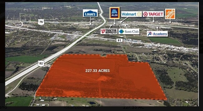
G-0811 MCGLOTHLIN SAMUEL M A-G0811, ACRES 49.72
Farms
GRAYSON
B and X Area of moderate flood hazard, usually the area between the limits of the 100-year and 500-year floods.
Texas
2024
19.96 AC
2025
Sherman
001500
Other Market Areas
2,129 SF
Sherman-Denison, TX
NEARBY LISTINGS FOR SALE OR LEASE
DEMOGRAPHICS near 2693 E Graystone Rd
1 mile
3 mile
5 mile
2025 Total Population
1,517
27,818
54,072
2030 Population
1,639
30,204
58,803
Pop Growth 2025-2030
+ 8.04%
+ 8.58%
+ 8.75%
Average Age
37
37
39
2025 Total Households
569
10,142
20,763
HH Growth 2025-2030
+ 7.91%
+ 8.63%
+ 8.82%
Median Household Inc
$43,055
$54,872
$58,551
Avg Household Size
2.60
2.50
2.50
2025 Avg HH Vehicles
2.00
2.00
2.00
Median Home Value
$253,301
$210,587
$253,107
Median Year Built
1976
1974
1980
Nearby Places
Map Layers
Map Styles
 Street
 Aerial
Transit
 Traffic
 Biking
Places
Listings with unknown addresses are not visible on the map
- Restaurants
- Banks
- Shops
- Fitness
- Groceries
SALE & LEASE HISTORY
LISTING DATE
SALE/LEASE

Nov 27, 2021
For Sale
Nearby Properties
Address
Land Use
TOTAL SIZE
Lot Size
Zoning
Address
Land Use
TOTAL SIZE
Lot Size
Zoning
618,286 SF
33.55 AC
Address
Land Use
TOTAL SIZE
Lot Size
Zoning
476,941 SF
29.79 AC
Address
Land Use
TOTAL SIZE
Lot Size
Zoning
304,650 SF
10.61 AC
Address
Land Use
TOTAL SIZE
Lot Size
Zoning
260,648 SF
20.20 AC
Address
Land Use
TOTAL SIZE
Lot Size
Zoning
253,076 SF
36.13 AC
Address
Land Use
TOTAL SIZE
Lot Size
Zoning
121,512 SF
Address
Land Use
TOTAL SIZE
Lot Size
Zoning
61,660 SF
6.50 AC
Address
Land Use
TOTAL SIZE
Lot Size
Zoning
175,388 SF
11.46 AC
Address
Land Use
TOTAL SIZE
Lot Size
Zoning
81,100 SF
1.13 AC
Address
Land Use
TOTAL SIZE
Lot Size
Zoning
170,359 SF
9.64 AC
Address
Land Use
TOTAL SIZE
Lot Size
Zoning
151,714 SF
9.13 AC
Address
Land Use
TOTAL SIZE
Lot Size
Zoning
39,850 SF
5.32 AC
Address
Land Use
TOTAL SIZE
Lot Size
Zoning
297,962 SF
51 AC
Address
Land Use
TOTAL SIZE
Lot Size
Zoning
186,834 SF
10.51 AC
Address
Land Use
TOTAL SIZE
Lot Size
Zoning
158,460 SF
8.69 AC
Address
Land Use
TOTAL SIZE
Lot Size
Zoning
81,577 SF
9.12 AC
Address
Land Use
TOTAL SIZE
Lot Size
Zoning
141,330 SF
15 AC
Address
Land Use
TOTAL SIZE
Lot Size
Zoning
171,840 SF
23.02 AC
Address
Land Use
TOTAL SIZE
Lot Size
Zoning
101,511 SF
4.91 AC
Address
Land Use
TOTAL SIZE
Lot Size
Zoning
83,418 SF
Address
Land Use
TOTAL SIZE
Lot Size
Zoning
127,848 SF
9.60 AC
Address
Land Use
TOTAL SIZE
Lot Size
Zoning
170,455 SF
22.78 AC
Address
Land Use
TOTAL SIZE
Lot Size
Zoning
204,000 SF
21.91 AC
Address
Land Use
TOTAL SIZE
Lot Size
Zoning
69,338 SF
6.90 AC
Address
Land Use
TOTAL SIZE
Lot Size
Zoning
94,560 SF
8.74 AC
Address
Land Use
TOTAL SIZE
Lot Size
Zoning
103,742 SF
17.73 AC
Address
Land Use
TOTAL SIZE
Lot Size
Zoning
164,420 SF
8.75 AC
Address
Land Use
TOTAL SIZE
Lot Size
Zoning
162,000 SF
7.74 AC
Address
Land Use
TOTAL SIZE
Lot Size
Zoning
108,501 SF
5.15 AC
Address
Land Use
TOTAL SIZE
Lot Size
Zoning
87,421 SF
7.09 AC
The World's #1 Commercial Real Estate Marketplace
Connect with us
© 2026 CoStar Group
The information above has been obtained from sources believed reliable. While we do not doubt its accuracy we have not verified it and make no guarantee, warranty or representation about it. It is your responsibility to independently confirm its accuracy and completeness. Any projections, opinions, assumptions, or estimates used are for example only and do not represent the current or future performance of the property. The value of this transaction to you depends on tax and other factors which should be evaluated by your tax, financial, and legal advisors. You and your advisors should conduct a careful, independent investigation of the property to determine to your satisfaction the suitability of the property for your needs.