Property Record
2695 Interstate 10 Ave E, Beaumont, TX 77702
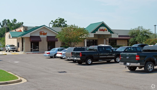

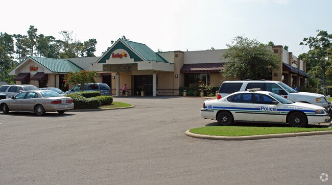
Property Detail
2695 Interstate 10 Ave E
Beaumont-Port Arthur, TX
REED EMMA W45 LT 9 ALL LT 10- 21 & W45 LT 22 BLK 1 & TR A OF ABANDONED BEECH ST 2.427AC
054750-000-000100-00000
JEFFERSON
Commercialnec
Texas
2024
9
2025
2.43 AC
001100
Downtown Beaumont
10,282 SF
Beaumont/Port Arthur
NEARBY LISTINGS FOR SALE OR LEASE
DEMOGRAPHICS near 2695 Interstate 10 Ave E
1 mile
3 mile
5 mile
2024 Total Population
7,762
60,199
106,675
2029 Population
7,776
60,109
106,483
Pop Growth 2024-2029
+ 0.18%
(0.15%)
(0.18%)
Average Age
38
39
39
2024 Total Households
3,232
23,737
42,501
HH Growth 2024-2029
+ 0.09%
(0.19%)
(0.21%)
Median Household Inc
$60,764
$53,750
$56,867
Avg Household Size
2.30
2.40
2.40
2024 Avg HH Vehicles
2.00
2.00
2.00
Median Home Value
$165,017
$168,309
$163,454
Median Year Built
1964
1973
1976
Nearby Places
Map Layers
Map Styles
 Street
 Aerial
Transit
 Traffic
 Biking
Places
Listings with unknown addresses are not visible on the map
- Restaurants
- Banks
- Shops
- Fitness
- Groceries
PUBLIC TRANSPORTATION
COMMUTER RAIL
Drive
Walk
Distance
3 min
1.4 mi
Nearby Properties
Address
Land Use
TOTAL SIZE
Lot Size
Zoning
Address
Land Use
TOTAL SIZE
Lot Size
Zoning
425,204 SF
6.99 AC
Address
Land Use
TOTAL SIZE
Lot Size
Zoning
163,287 SF
5.46 AC
Address
Land Use
TOTAL SIZE
Lot Size
Zoning
130,658 SF
8.03 AC
Address
Land Use
TOTAL SIZE
Lot Size
Zoning
86,128 SF
5.58 AC
Address
Land Use
TOTAL SIZE
Lot Size
Zoning
2.07 AC
Address
Land Use
TOTAL SIZE
Lot Size
Zoning
662,961 SF
34.38 AC
Address
Land Use
TOTAL SIZE
Lot Size
Zoning
241,242 SF
24.31 AC
Address
Land Use
TOTAL SIZE
Lot Size
Zoning
185,378 SF
2.76 AC
Address
Land Use
TOTAL SIZE
Lot Size
Zoning
145,925 SF
23.56 AC
Address
Land Use
TOTAL SIZE
Lot Size
Zoning
170,424 SF
5.81 AC
Address
Land Use
TOTAL SIZE
Lot Size
Zoning
171,908 SF
8.22 AC
Address
Land Use
TOTAL SIZE
Lot Size
Zoning
96,502 SF
1.46 AC
Address
Land Use
TOTAL SIZE
Lot Size
Zoning
56,223 SF
1.93 AC
Address
Land Use
TOTAL SIZE
Lot Size
Zoning
110,109 SF
6 AC
Address
Land Use
TOTAL SIZE
Lot Size
Zoning
125,913 SF
12.09 AC
Address
Land Use
TOTAL SIZE
Lot Size
Zoning
155,026 SF
14.82 AC
Address
Land Use
TOTAL SIZE
Lot Size
Zoning
203,338 SF
23.09 AC
Address
Land Use
TOTAL SIZE
Lot Size
Zoning
129,819 SF
6.83 AC
Address
Land Use
TOTAL SIZE
Lot Size
Zoning
154,011 SF
11.68 AC
Address
Land Use
TOTAL SIZE
Lot Size
Zoning
110,091 SF
11.02 AC
Address
Land Use
TOTAL SIZE
Lot Size
Zoning
266,107 SF
10.38 AC
Address
Land Use
TOTAL SIZE
Lot Size
Zoning
124,434 SF
2.16 AC
Address
Land Use
TOTAL SIZE
Lot Size
Zoning
35,901 SF
2.71 AC
Address
Land Use
TOTAL SIZE
Lot Size
Zoning
250,157 SF
17.65 AC
Address
Land Use
TOTAL SIZE
Lot Size
Zoning
79,125 SF
8.09 AC
Address
Land Use
TOTAL SIZE
Lot Size
Zoning
70,043 SF
7.81 AC
Address
Land Use
TOTAL SIZE
Lot Size
Zoning
134,870 SF
18.86 AC
Address
Land Use
TOTAL SIZE
Lot Size
Zoning
81,868 SF
8.05 AC
Address
Land Use
TOTAL SIZE
Lot Size
Zoning
139,251 SF
6.25 AC
Address
Land Use
TOTAL SIZE
Lot Size
Zoning
65,335 SF
11.51 AC
The World's #1 Commercial Real Estate Marketplace
Connect with us
© 2026 CoStar Group
The information above has been obtained from sources believed reliable. While we do not doubt its accuracy we have not verified it and make no guarantee, warranty or representation about it. It is your responsibility to independently confirm its accuracy and completeness. Any projections, opinions, assumptions, or estimates used are for example only and do not represent the current or future performance of the property. The value of this transaction to you depends on tax and other factors which should be evaluated by your tax, financial, and legal advisors. You and your advisors should conduct a careful, independent investigation of the property to determine to your satisfaction the suitability of the property for your needs.