Property Record
2699 Stirling Rd, Fort Lauderdale, FL 33312
This Property Is For Sale
NEARBY LISTINGS FOR SALE OR LEASE
Property Detail
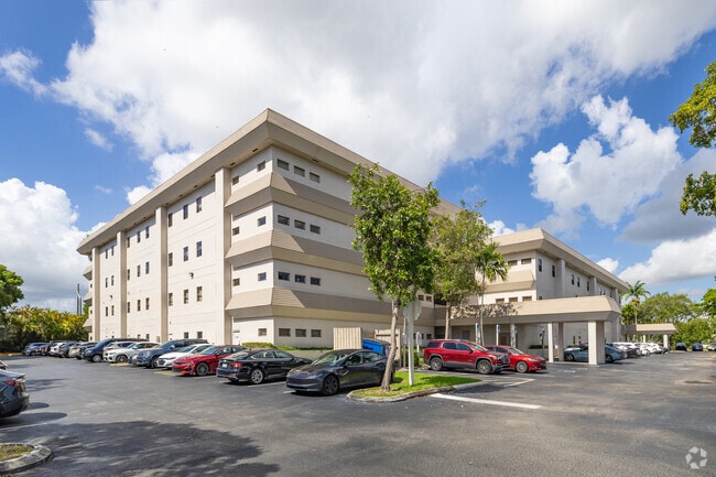
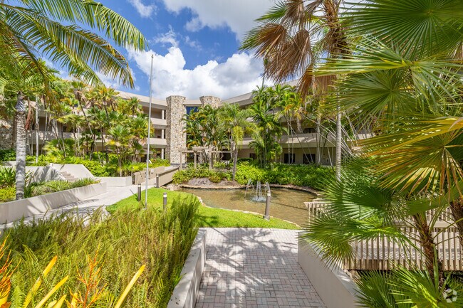
2699 Stirling Rd
50-42-32-AA-0270
Emerald Park Office Center
Officebuilding
EMERALD PARK OFFICE CENTER CONDO UNIT 203 BLDG B PER AMCDO CIN #114480297
AE
Broward
12011C0566J
Florida
2024
203
2025
Fort Lauderdale
080402
South Florida
1,092 SF
Fort Lauderdale-Pompano Beach-Deerfield Beach, FL
DEMOGRAPHICS near 2699 Stirling Rd
1 Mile
3 Mile
5 Mile
2024 Total Population
13,679
111,914
341,435
2029 Population
13,831
111,686
340,170
Pop Growth 2024-2029
+ 1.11%
(0.20%)
(0.37%)
Average Age
41
41
41
2024 Total Households
5,279
44,753
133,337
HH Growth 2024-2029
+ 0.49%
(0.60%)
(0.60%)
Median Household Inc
$79,277
$58,019
$58,487
Avg Household Size
2.50
2.40
2.40
2024 Avg HH Vehicles
2.00
2.00
2.00
Median Home Value
$345,159
$365,323
$338,408
Median Year Built
1979
1972
1972
Nearby Places
- Restaurants
- Banks
- Shops
- Fitness
- Groceries
PUBLIC TRANSPORTATION
COMMUTER RAIL
Fort Lauderdale/Hollywood International Airport (Mangonia Park - Miami Airport - Tri-Rail, Tri-County Commuter - Tri-Rail, West Palm Beach - MiamiCentral - Tri-Rail)
DRIVE
WALK
Distance
Fort Lauderdale/Hollywood International Airport (Mangonia Park - Miami Airport - Tri-Rail, Tri-County Commuter - Tri-Rail, West Palm Beach - MiamiCentral - Tri-Rail)
5 min
1.9 mi
Sheridan Street (Tri-County Commuter - South Florida Regional Transportation Authority (Tri-Rail))
DRIVE
WALK
Distance
Sheridan Street (Tri-County Commuter - South Florida Regional Transportation Authority (Tri-Rail))
6 min
1.9 mi
AIRPORT
Fort Lauderdale/Hollywood International
DRIVE
WALK
Distance
Fort Lauderdale/Hollywood International
8 min
3.1 mi
Miami International
DRIVE
WALK
Distance
Miami International
43 min
26.7 mi
Freight Ports
Port Everglades
DRIVE
WALK
Distance
Port Everglades
11 min
6.0 mi
Nearby Properties
Address
Land Use
TOTAL SIZE
Lot Size
Zoning
Address
Land Use
TOTAL SIZE
Lot Size
Zoning
4,515,106 SF
887.02 AC
AT
Address
Land Use
TOTAL SIZE
Lot Size
Zoning
4,212,940 SF
69.36 AC
N/A
Address
Land Use
TOTAL SIZE
Lot Size
Zoning
3,629,204 SF
159.43 AC
AT
Address
Land Use
TOTAL SIZE
Lot Size
Zoning
2,786,552 SF
25.77 AC
HD
Address
Land Use
TOTAL SIZE
Lot Size
Zoning
964,376 SF
258.71 AC
AT
Address
Land Use
TOTAL SIZE
Lot Size
Zoning
654,212 SF
3.59 AC
Address
Land Use
TOTAL SIZE
Lot Size
Zoning
272,634 SF
32.39 AC
PMUD
Address
Land Use
TOTAL SIZE
Lot Size
Zoning
376,559 SF
14.53 AC
PD
Address
Land Use
TOTAL SIZE
Lot Size
Zoning
615,846 SF
2.06 AC
CC
Address
Land Use
TOTAL SIZE
Lot Size
Zoning
828,208 SF
44.48 AC
PMUD
Address
Land Use
TOTAL SIZE
Lot Size
Zoning
339,273 SF
20.48 AC
RM-16
Address
Land Use
TOTAL SIZE
Lot Size
Zoning
296,691 SF
1.86 AC
PMUD
Address
Land Use
TOTAL SIZE
Lot Size
Zoning
326,240 SF
45.28 AC
N/A
Address
Land Use
TOTAL SIZE
Lot Size
Zoning
218,137 SF
7.13 AC
RM-2
Address
Land Use
TOTAL SIZE
Lot Size
Zoning
385,242 SF
66.40 AC
N/A
Address
Land Use
TOTAL SIZE
Lot Size
Zoning
291,551 SF
29.64 AC
C-3
Address
Land Use
TOTAL SIZE
Lot Size
Zoning
379,906 SF
39.73 AC
N/A
Address
Land Use
TOTAL SIZE
Lot Size
Zoning
447,673 SF
10.01 AC
PUD
Address
Land Use
TOTAL SIZE
Lot Size
Zoning
287,160 SF
16.39 AC
RM-18
Address
Land Use
TOTAL SIZE
Lot Size
Zoning
313,850 SF
0.80 AC
Address
Land Use
TOTAL SIZE
Lot Size
Zoning
312,636 SF
24.06 AC
I-G
Address
Land Use
TOTAL SIZE
Lot Size
Zoning
247,174 SF
9.03 AC
RM-2
Address
Land Use
TOTAL SIZE
Lot Size
Zoning
552,737 SF
11.76 AC
C-4
Address
Land Use
TOTAL SIZE
Lot Size
Zoning
370,172 SF
24.52 AC
GU
Address
Land Use
TOTAL SIZE
Lot Size
Zoning
221,179 SF
25.86 AC
EDBB-MU
Address
Land Use
TOTAL SIZE
Lot Size
Zoning
289,524 SF
39.20 AC
GU
Address
Land Use
TOTAL SIZE
Lot Size
Zoning
480 SF
2.43 AC
PMUD-SL
Address
Land Use
TOTAL SIZE
Lot Size
Zoning
214,659 SF
16.49 AC
PUD-R
Address
Land Use
TOTAL SIZE
Lot Size
Zoning
197,137 SF
50.37 AC
PUD
Address
Land Use
TOTAL SIZE
Lot Size
Zoning
155,686 SF
10.35 AC
PRD-1
The World's #1 Commercial Real Estate Marketplace
Connect with us
© 2025 CoStar Group
The information above has been obtained from sources believed reliable. While we do not doubt its accuracy we have not verified it and make no guarantee, warranty or representation about it. It is your responsibility to independently confirm its accuracy and completeness. Any projections, opinions, assumptions, or estimates used are for example only and do not represent the current or future performance of the property. The value of this transaction to you depends on tax and other factors which should be evaluated by your tax, financial, and legal advisors. You and your advisors should conduct a careful, independent investigation of the property to determine to your satisfaction the suitability of the property for your needs.