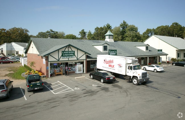
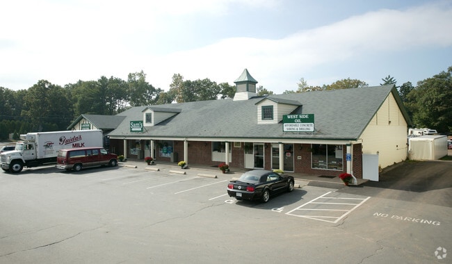
Property Record
27 Babbs Rd, West Suffield, CT 06093

Property Detail
27 Babbs Rd
SUFF-000006H-000001-000142
Capitol
Commercialnec
Connecticut
NC
142
B and X Area of moderate flood hazard, usually the area between the limits of the 100-year and 500-year floods.
2.20 AC
2025
Northwest Outlying
2025
Hartford
477200
Hartford-West Hartford-East Hartford, CT
NEARBY LISTINGS FOR SALE OR LEASE
DEMOGRAPHICS near 27 Babbs Rd
1 mile
3 mile
5 mile
2025 Total Population
1,545
9,076
24,261
2030 Population
1,585
9,184
24,571
Pop Growth 2025-2030
+ 2.59%
+ 1.19%
+ 1.28%
Average Age
44
45
44
2025 Total Households
619
3,720
9,627
HH Growth 2025-2030
+ 2.42%
+ 1.10%
+ 1.23%
Median Household Inc
$137,132
$112,146
$112,720
Avg Household Size
2.50
2.40
2.50
2025 Avg HH Vehicles
2.00
2.00
2.00
Median Home Value
$427,884
$390,740
$390,928
Median Year Built
1974
1973
1974
Nearby Places
Map Layers
Map Styles
 Street
 Aerial
Transit
 Traffic
 Biking
Places
Listings with unknown addresses are not visible on the map
- Restaurants
- Banks
- Shops
- Fitness
- Groceries
PUBLIC TRANSPORTATION
AIRPORT
Bradley International
Drive
Walk
Distance
Bradley International
25 min
10.2 mi
Freight Ports
Port of New Haven
Drive
Walk
Distance
Port of New Haven
85 min
60.6 mi
Nearby Properties
Address
Land Use
TOTAL SIZE
Lot Size
Zoning
Address
Land Use
TOTAL SIZE
Lot Size
Zoning
92,866 SF
32 AC
R20A
Address
Land Use
TOTAL SIZE
Lot Size
Zoning
185,556 SF
64.01 AC
R-20A
Address
Land Use
TOTAL SIZE
Lot Size
Zoning
4,628 SF
16.01 AC
R-20
Address
Land Use
TOTAL SIZE
Lot Size
Zoning
27,730 SF
17 AC
BR
Address
Land Use
TOTAL SIZE
Lot Size
Zoning
2,684 SF
17.01 AC
BR
Address
Land Use
TOTAL SIZE
Lot Size
Zoning
57,159 SF
7.07 AC
B
Address
Land Use
TOTAL SIZE
Lot Size
Zoning
31,216 SF
9.20 AC
I
Address
Land Use
TOTAL SIZE
Lot Size
Zoning
2,183 SF
5.59 AC
BR
Address
Land Use
TOTAL SIZE
Lot Size
Zoning
5,501 SF
7.70 AC
R-20
Address
Land Use
TOTAL SIZE
Lot Size
Zoning
45,840 SF
3.46 AC
B
Address
Land Use
TOTAL SIZE
Lot Size
Zoning
11,304 SF
0.52 AC
BR
Address
Land Use
TOTAL SIZE
Lot Size
Zoning
12,847 SF
2.25 AC
B
Address
Land Use
TOTAL SIZE
Lot Size
Zoning
9,574 SF
5.80 AC
R-40
Address
Land Use
TOTAL SIZE
Lot Size
Zoning
1,819 SF
3.45 AC
B
Address
Land Use
TOTAL SIZE
Lot Size
Zoning
10,900 SF
6.97 AC
NC
Address
Land Use
TOTAL SIZE
Lot Size
Zoning
160.37 AC
FP
Address
Land Use
TOTAL SIZE
Lot Size
Zoning
35,478 SF
3.10 AC
BR
Address
Land Use
TOTAL SIZE
Lot Size
Zoning
9,992 SF
31.41 AC
R-40
Address
Land Use
TOTAL SIZE
Lot Size
Zoning
2.89 AC
R30
Address
Land Use
TOTAL SIZE
Lot Size
Zoning
5,568 SF
5.51 AC
R-40
Address
Land Use
TOTAL SIZE
Lot Size
Zoning
3,616 SF
1.70 AC
R-40
Address
Land Use
TOTAL SIZE
Lot Size
Zoning
18,373 SF
2.40 AC
BR
Address
Land Use
TOTAL SIZE
Lot Size
Zoning
4,015 SF
1.11 AC
B
Address
Land Use
TOTAL SIZE
Lot Size
Zoning
134.68 AC
R90
Address
Land Use
TOTAL SIZE
Lot Size
Zoning
10,537 SF
6.40 AC
BR
Address
Land Use
TOTAL SIZE
Lot Size
Zoning
195.11 AC
R45
Address
Land Use
TOTAL SIZE
Lot Size
Zoning
3,120 SF
1.77 AC
I
Address
Land Use
TOTAL SIZE
Lot Size
Zoning
3,906 SF
6.89 AC
R90
Address
Land Use
TOTAL SIZE
Lot Size
Zoning
2.34 AC
B
The World's #1 Commercial Real Estate Marketplace
Connect with us
© 2026 CoStar Group
The information above has been obtained from sources believed reliable. While we do not doubt its accuracy we have not verified it and make no guarantee, warranty or representation about it. It is your responsibility to independently confirm its accuracy and completeness. Any projections, opinions, assumptions, or estimates used are for example only and do not represent the current or future performance of the property. The value of this transaction to you depends on tax and other factors which should be evaluated by your tax, financial, and legal advisors. You and your advisors should conduct a careful, independent investigation of the property to determine to your satisfaction the suitability of the property for your needs.