Property Record
27 Colma Blvd, Daly City, CA 94014


NEARBY LISTINGS FOR SALE OR LEASE
Property Detail
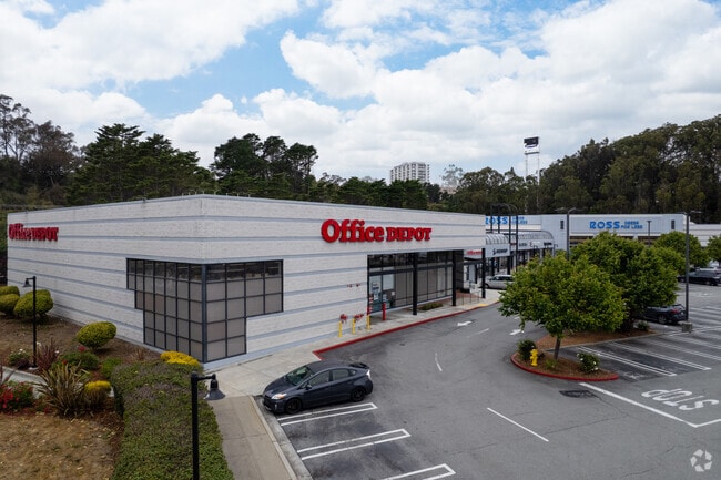
27 Colma Blvd
San Francisco-San Mateo-Redwood City, CA
280 Metro Center Map No 1
008-322-480
LOT 6 & PTN PARCEL A 280 METRO CENTER MAP NO 1 RSM 114/15-20
Regionalshoppingcenterormallwithanchorstore
San Mateo
X
California
06081C0037E
6
2024
1.81 AC
2025
Brisbane/Daly City
600502
San Francisco
60,764 SF
DEMOGRAPHICS near 27 Colma Blvd
1 mile
3 mile
5 mile
2024 Total Population
26,459
194,889
417,428
2029 Population
25,140
182,677
387,857
Pop Growth 2024-2029
(4.99%)
(6.27%)
(7.08%)
Average Age
42
43
43
2024 Total Households
8,233
61,251
136,233
HH Growth 2024-2029
(5.17%)
(6.46%)
(7.35%)
Median Household Inc
$99,505
$109,504
$116,027
Avg Household Size
3.10
3.00
2.90
2024 Avg HH Vehicles
2.00
2.00
2.00
Median Home Value
$932,951
$1,033,209
$1,066,272
Median Year Built
1972
1962
1957
Nearby Places
Map Layers
Map Styles
 Street
 Aerial
Transit
 Traffic
 Biking
Places
Listings with unknown addresses are not visible on the map
- Restaurants
- Banks
- Shops
- Fitness
- Groceries
PUBLIC TRANSPORTATION
COMMUTER RAIL
South San Francisco (Caltrain - Caltrain (Caltrain))
Drive
Walk
Distance
South San Francisco (Caltrain - Caltrain (Caltrain))
12 min
5.2 mi
Drive
Walk
Distance
11 min
5.3 mi
AIRPORT
San Francisco International
Drive
Walk
Distance
San Francisco International
17 min
7.8 mi
Metro Oakland International
Drive
Walk
Distance
Metro Oakland International
44 min
29.4 mi
Freight Ports
Port of San Francisco
Drive
Walk
Distance
Port of San Francisco
20 min
12.8 mi
SALE & LEASE HISTORY
LISTING DATE
SALE/LEASE

Sep 25, 2016
For Lease
Nearby Properties
Address
Land Use
TOTAL SIZE
Lot Size
Zoning
Address
Land Use
TOTAL SIZE
Lot Size
Zoning
53.85 AC
Address
Land Use
TOTAL SIZE
Lot Size
Zoning
312,191 SF
2.74 AC
Address
Land Use
TOTAL SIZE
Lot Size
Zoning
167,105 SF
2.07 AC
C10000
Address
Land Use
TOTAL SIZE
Lot Size
Zoning
42.95 AC
Address
Land Use
TOTAL SIZE
Lot Size
Zoning
447,674 SF
21.51 AC
Address
Land Use
TOTAL SIZE
Lot Size
Zoning
178,110 SF
1.67 AC
Address
Land Use
TOTAL SIZE
Lot Size
Zoning
Address
Land Use
TOTAL SIZE
Lot Size
Zoning
10.62 AC
Address
Land Use
TOTAL SIZE
Lot Size
Zoning
Address
Land Use
TOTAL SIZE
Lot Size
Zoning
187,865 SF
3.54 AC
Address
Land Use
TOTAL SIZE
Lot Size
Zoning
209,692 SF
8.20 AC
R30000
Address
Land Use
TOTAL SIZE
Lot Size
Zoning
2,011 SF
2.49 AC
Address
Land Use
TOTAL SIZE
Lot Size
Zoning
12.83 AC
PD0000
Address
Land Use
TOTAL SIZE
Lot Size
Zoning
156,904 SF
5.66 AC
R30000
Address
Land Use
TOTAL SIZE
Lot Size
Zoning
175,618 SF
2.44 AC
Address
Land Use
TOTAL SIZE
Lot Size
Zoning
181,172 SF
2.11 AC
Address
Land Use
TOTAL SIZE
Lot Size
Zoning
108,917 SF
4.61 AC
PD0004
Address
Land Use
TOTAL SIZE
Lot Size
Zoning
153,054 SF
15.13 AC
Address
Land Use
TOTAL SIZE
Lot Size
Zoning
141,956 SF
1.74 AC
Address
Land Use
TOTAL SIZE
Lot Size
Zoning
52.30 AC
ID
Address
Land Use
TOTAL SIZE
Lot Size
Zoning
73.91 AC
Address
Land Use
TOTAL SIZE
Lot Size
Zoning
128,506 SF
2.17 AC
Address
Land Use
TOTAL SIZE
Lot Size
Zoning
206.09 AC
Address
Land Use
TOTAL SIZE
Lot Size
Zoning
67,432 SF
4.55 AC
CL00C1
Address
Land Use
TOTAL SIZE
Lot Size
Zoning
113,136 SF
9.09 AC
G10000
Address
Land Use
TOTAL SIZE
Lot Size
Zoning
113,782 SF
2.90 AC
Address
Land Use
TOTAL SIZE
Lot Size
Zoning
6.80 AC
RM1
Address
Land Use
TOTAL SIZE
Lot Size
Zoning
257,754 SF
1.37 AC
Address
Land Use
TOTAL SIZE
Lot Size
Zoning
63,943 SF
0.77 AC
Address
Land Use
TOTAL SIZE
Lot Size
Zoning
75,559 SF
2.48 AC
R30000
The World's #1 Commercial Real Estate Marketplace
Connect with us
© 2026 CoStar Group
The information above has been obtained from sources believed reliable. While we do not doubt its accuracy we have not verified it and make no guarantee, warranty or representation about it. It is your responsibility to independently confirm its accuracy and completeness. Any projections, opinions, assumptions, or estimates used are for example only and do not represent the current or future performance of the property. The value of this transaction to you depends on tax and other factors which should be evaluated by your tax, financial, and legal advisors. You and your advisors should conduct a careful, independent investigation of the property to determine to your satisfaction the suitability of the property for your needs.