Property Record
27 E Nc Hwy Hwy, Iron Station, NC 28080

NEARBY LISTINGS FOR SALE OR LEASE
-
-
View all Iron Station listings for sale on LoopNet.com
Property Detail
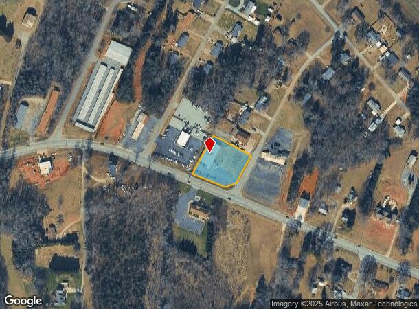
27 E Nc Hwy Hwy
Charlotte-Concord-Gastonia, NC-SC
Shrum
25575
2 WILLIAM STEWART
Storebuilding
Lincoln
2025
North Carolina
2025
0.87 AC
071001
Lincoln County
6,000 SF
Charlotte
DEMOGRAPHICS near 27 E Nc Hwy Hwy
1 Mile
3 Mile
5 Mile
2024 Total Population
2,132
14,576
34,543
2029 Population
2,472
16,905
40,193
Pop Growth 2024-2029
+ 15.95%
+ 15.98%
+ 16.36%
Average Age
44
42
42
2024 Total Households
864
5,815
13,949
HH Growth 2024-2029
+ 16.20%
+ 16.30%
+ 16.70%
Median Household Inc
$75,331
$61,008
$59,851
Avg Household Size
2.40
2.40
2.40
2024 Avg HH Vehicles
2.00
2.00
2.00
Median Home Value
$227,750
$193,855
$188,596
Median Year Built
1986
1987
1985
Nearby Places
Map Layers
Map Styles
 Street
 Aerial
- Restaurants
- Banks
- Shops
- Fitness
- Groceries
PUBLIC TRANSPORTATION
AIRPORT
Charlotte/Douglas International
DRIVE
WALK
Distance
Charlotte/Douglas International
49 min
27.4 mi
Concord-Padgett Regional
DRIVE
WALK
Distance
Concord-Padgett Regional
52 min
37.4 mi
Freight Ports
North Charleston Terminal
DRIVE
WALK
Distance
North Charleston Terminal
261 min
223.4 mi
Nearby Properties
Address
Land Use
TOTAL SIZE
Lot Size
Zoning
Address
Land Use
TOTAL SIZE
Lot Size
Zoning
172,724 SF
55.65 AC
O-I CU
Address
Land Use
TOTAL SIZE
Lot Size
Zoning
88,878 SF
7.21 AC
O-I
Address
Land Use
TOTAL SIZE
Lot Size
Zoning
29,244 SF
15.15 AC
R-O CU
Address
Land Use
TOTAL SIZE
Lot Size
Zoning
6,144 SF
13.26 AC
P-B & RMF
Address
Land Use
TOTAL SIZE
Lot Size
Zoning
393,708 SF
270.27 AC
I-G & R-SF
Address
Land Use
TOTAL SIZE
Lot Size
Zoning
189,220 SF
23.64 AC
P-B CU
Address
Land Use
TOTAL SIZE
Lot Size
Zoning
80,509 SF
16.23 AC
P-B CU
Address
Land Use
TOTAL SIZE
Lot Size
Zoning
36,448 SF
7.73 AC
RMF
Address
Land Use
TOTAL SIZE
Lot Size
Zoning
10,120 SF
23.38 AC
G-B & P-B
Address
Land Use
TOTAL SIZE
Lot Size
Zoning
42,405 SF
34.47 AC
GMC
Address
Land Use
TOTAL SIZE
Lot Size
Zoning
53,917 SF
20.36 AC
R-T
Address
Land Use
TOTAL SIZE
Lot Size
Zoning
39,860 SF
3.71 AC
O-I
Address
Land Use
TOTAL SIZE
Lot Size
Zoning
120,810 SF
16.90 AC
G-B CU
Address
Land Use
TOTAL SIZE
Lot Size
Zoning
40,203 SF
3.37 AC
P-B
Address
Land Use
TOTAL SIZE
Lot Size
Zoning
11,248 SF
5.23 AC
G-B & R-8
Address
Land Use
TOTAL SIZE
Lot Size
Zoning
41,016 SF
4 AC
G-B
Address
Land Use
TOTAL SIZE
Lot Size
Zoning
42,882 SF
10.52 AC
P-B
Address
Land Use
TOTAL SIZE
Lot Size
Zoning
36,100 SF
3.38 AC
R-8
Address
Land Use
TOTAL SIZE
Lot Size
Zoning
522,930 SF
25.71 AC
GMC & O-I
Address
Land Use
TOTAL SIZE
Lot Size
Zoning
22,870 SF
10.60 AC
R-O
Address
Land Use
TOTAL SIZE
Lot Size
Zoning
16,480 SF
12.20 AC
O-I
Address
Land Use
TOTAL SIZE
Lot Size
Zoning
30,532 SF
3.50 AC
O-I
Address
Land Use
TOTAL SIZE
Lot Size
Zoning
11,834 SF
5.27 AC
P-B
Address
Land Use
TOTAL SIZE
Lot Size
Zoning
29,162 SF
7.03 AC
P-B
Address
Land Use
TOTAL SIZE
Lot Size
Zoning
52,730 SF
5.85 AC
G-B
Address
Land Use
TOTAL SIZE
Lot Size
Zoning
37,901 SF
1.67 AC
P-B
Address
Land Use
TOTAL SIZE
Lot Size
Zoning
14,466 SF
1.73 AC
G-B
Address
Land Use
TOTAL SIZE
Lot Size
Zoning
8,936 SF
9.04 AC
R-T
Address
Land Use
TOTAL SIZE
Lot Size
Zoning
10,630 SF
3.21 AC
R-8 & R-25
Address
Land Use
TOTAL SIZE
Lot Size
Zoning
17,156 SF
2.22 AC
O-I
The World's #1 Commercial Real Estate Marketplace
Connect with us
© 2025 CoStar Group
The information above has been obtained from sources believed reliable. While we do not doubt its accuracy we have not verified it and make no guarantee, warranty or representation about it. It is your responsibility to independently confirm its accuracy and completeness. Any projections, opinions, assumptions, or estimates used are for example only and do not represent the current or future performance of the property. The value of this transaction to you depends on tax and other factors which should be evaluated by your tax, financial, and legal advisors. You and your advisors should conduct a careful, independent investigation of the property to determine to your satisfaction the suitability of the property for your needs.