Property Record
27 Main St, Terryville, CT 06786
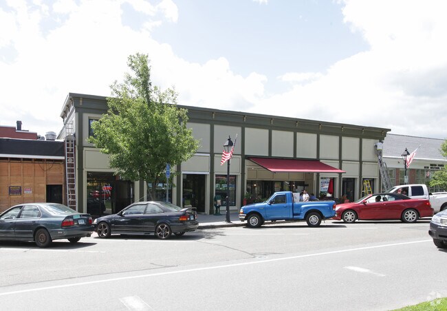
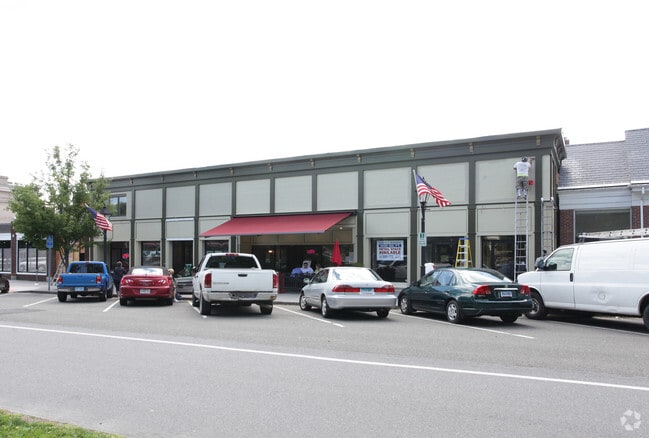
Property Detail
27 Main St
PLYM-000042-000096-000005A
Naugatuck Vly
Officebuilding
Connecticut
C
1
2024
0.57 AC
2025
New Milford/SW Litchfield
360400
Hartford
4,296 SF
Torrington, CT
NEARBY LISTINGS FOR SALE OR LEASE
DEMOGRAPHICS near 27 Main St
1 mile
3 mile
5 mile
2025 Total Population
6,449
20,496
32,486
2030 Population
6,613
21,127
33,660
Pop Growth 2025-2030
+ 2.54%
+ 3.08%
+ 3.61%
Average Age
42
43
44
2025 Total Households
2,757
8,040
12,778
HH Growth 2025-2030
+ 2.39%
+ 2.97%
+ 3.55%
Median Household Inc
$77,676
$96,411
$105,839
Avg Household Size
2.30
2.50
2.50
2025 Avg HH Vehicles
2.00
2.00
2.00
Median Home Value
$330,861
$380,083
$428,665
Median Year Built
1970
1975
1974
Nearby Places
Map Layers
Map Styles
 Street
 Aerial
Transit
 Traffic
 Biking
Places
Listings with unknown addresses are not visible on the map
- Restaurants
- Banks
- Shops
- Fitness
- Groceries
PUBLIC TRANSPORTATION
AIRPORT
Bradley International
Drive
Walk
Distance
Bradley International
59 min
33.3 mi
Tweed/New Haven
Drive
Walk
Distance
Tweed/New Haven
54 min
35.9 mi
Freight Ports
Port of New Haven
Drive
Walk
Distance
Port of New Haven
50 min
33.6 mi
SALE & LEASE HISTORY
LISTING DATE
SALE/LEASE

Jan 18, 2023
For Lease
Nearby Properties
Address
Land Use
TOTAL SIZE
Lot Size
Zoning
Address
Land Use
TOTAL SIZE
Lot Size
Zoning
139 AC
IP-25
Address
Land Use
TOTAL SIZE
Lot Size
Zoning
121,917 SF
28.60 AC
R-15
Address
Land Use
TOTAL SIZE
Lot Size
Zoning
171,826 SF
36.60 AC
R-15
Address
Land Use
TOTAL SIZE
Lot Size
Zoning
62,232 SF
0.90 AC
BD-1
Address
Land Use
TOTAL SIZE
Lot Size
Zoning
169,727 SF
23.90 AC
R-25
Address
Land Use
TOTAL SIZE
Lot Size
Zoning
4,000 SF
13.78 AC
BG
Address
Land Use
TOTAL SIZE
Lot Size
Zoning
120,801 SF
8.35 AC
R-40
Address
Land Use
TOTAL SIZE
Lot Size
Zoning
51,851 SF
1.32 AC
BD-1
Address
Land Use
TOTAL SIZE
Lot Size
Zoning
47,218 SF
3.62 AC
BD-1
Address
Land Use
TOTAL SIZE
Lot Size
Zoning
3.35 AC
RA2
Address
Land Use
TOTAL SIZE
Lot Size
Zoning
80,776 SF
2.49 AC
BD-1
Address
Land Use
TOTAL SIZE
Lot Size
Zoning
60,935 SF
0.92 AC
BD-1
Address
Land Use
TOTAL SIZE
Lot Size
Zoning
134,955 SF
3.30 AC
BD-2
Address
Land Use
TOTAL SIZE
Lot Size
Zoning
63,101 SF
15.50 AC
R-25
Address
Land Use
TOTAL SIZE
Lot Size
Zoning
45,377 SF
91.90 AC
R-40
Address
Land Use
TOTAL SIZE
Lot Size
Zoning
68,520 SF
2 AC
BD-1
Address
Land Use
TOTAL SIZE
Lot Size
Zoning
47,271 SF
1.32 AC
R-15/B
Address
Land Use
TOTAL SIZE
Lot Size
Zoning
9,430 SF
3.91 AC
R-15
Address
Land Use
TOTAL SIZE
Lot Size
Zoning
28,480 SF
5.50 AC
A
Address
Land Use
TOTAL SIZE
Lot Size
Zoning
81,741 SF
2.76 AC
R-15/R
Address
Land Use
TOTAL SIZE
Lot Size
Zoning
49,977 SF
15.56 AC
R-25
Address
Land Use
TOTAL SIZE
Lot Size
Zoning
38,542 SF
1.96 AC
BD-1
Address
Land Use
TOTAL SIZE
Lot Size
Zoning
205,964 SF
14.35 AC
IP-3
Address
Land Use
TOTAL SIZE
Lot Size
Zoning
3,806 SF
1.39 AC
R-15/B
Address
Land Use
TOTAL SIZE
Lot Size
Zoning
48,785 SF
2.75 AC
BD-1
Address
Land Use
TOTAL SIZE
Lot Size
Zoning
38,481 SF
1.98 AC
R-15/R
Address
Land Use
TOTAL SIZE
Lot Size
Zoning
18,704 SF
1.37 AC
R-15/R
Address
Land Use
TOTAL SIZE
Lot Size
Zoning
6,630 SF
2.95 AC
R-15/B
Address
Land Use
TOTAL SIZE
Lot Size
Zoning
80,861 SF
3.19 AC
BD-1
Address
Land Use
TOTAL SIZE
Lot Size
Zoning
58,804 SF
15 AC
BD-1/I
The World's #1 Commercial Real Estate Marketplace
Connect with us
© 2026 CoStar Group
The information above has been obtained from sources believed reliable. While we do not doubt its accuracy we have not verified it and make no guarantee, warranty or representation about it. It is your responsibility to independently confirm its accuracy and completeness. Any projections, opinions, assumptions, or estimates used are for example only and do not represent the current or future performance of the property. The value of this transaction to you depends on tax and other factors which should be evaluated by your tax, financial, and legal advisors. You and your advisors should conduct a careful, independent investigation of the property to determine to your satisfaction the suitability of the property for your needs.