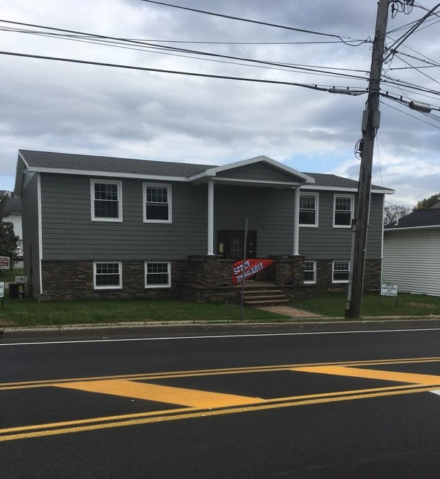
Property Record
27 Maple Ave, Victor, NY 14564

Property Detail
27 Maple Ave
324801-028-006-0001-006-100
0.22 ACRE
Officebuilding
Ontario
B
New York
B and X Area of moderate flood hazard, usually the area between the limits of the 100-year and 500-year floods.
6.100
2025
0.20 AC
2025
Southeast
050105
Rochester
2,800 SF
Rochester, NY
NEARBY LISTINGS FOR SALE OR LEASE
DEMOGRAPHICS near 27 Maple Ave
1 mile
3 mile
5 mile
2025 Total Population
4,114
18,118
32,965
2030 Population
4,058
18,094
32,952
Pop Growth 2025-2030
(1.36%)
(0.13%)
(0.04%)
Average Age
43
44
43
2025 Total Households
1,642
7,478
13,007
HH Growth 2025-2030
(1.52%)
(0.36%)
(0.26%)
Median Household Inc
$106,250
$87,276
$101,275
Avg Household Size
2.50
2.40
2.50
2025 Avg HH Vehicles
2.00
2.00
2.00
Median Home Value
$341,006
$335,430
$331,407
Median Year Built
1982
1996
1992
Nearby Places
Map Layers
Map Styles
 Street
 Aerial
Layers
 Traffic
 Biking
Places
Listings with unknown addresses are not visible on the map
- Restaurants
- Banks
- Shops
- Fitness
- Groceries
PUBLIC TRANSPORTATION
AIRPORT
Frederick Douglass/Greater Rochester International
Drive
Walk
Distance
Frederick Douglass/Greater Rochester International
31 min
20.1 mi
Freight Ports
Albany, NY Port
Drive
Walk
Distance
Albany, NY Port
250 min
210.8 mi
SALE & LEASE HISTORY
LISTING DATE
SALE/LEASE

Oct 20, 2018
For Lease
Jun 19, 2017
For Lease
Feb 21, 2017
For Sale
Nearby Properties
Address
Land Use
TOTAL SIZE
Lot Size
Zoning
Address
Land Use
TOTAL SIZE
Lot Size
Zoning
385,152 SF
124.20 AC
R1-C
Address
Land Use
TOTAL SIZE
Lot Size
Zoning
239,694 SF
94.46 AC
COMM
Address
Land Use
TOTAL SIZE
Lot Size
Zoning
3,864 SF
67.50 AC
MH
Address
Land Use
TOTAL SIZE
Lot Size
Zoning
Address
Land Use
TOTAL SIZE
Lot Size
Zoning
225,200 SF
26.80 AC
06 - INDUS
Address
Land Use
TOTAL SIZE
Lot Size
Zoning
551 SF
23.47 AC
R2-B
Address
Land Use
TOTAL SIZE
Lot Size
Zoning
Address
Land Use
TOTAL SIZE
Lot Size
Zoning
86,970 SF
25.70 AC
R-1
Address
Land Use
TOTAL SIZE
Lot Size
Zoning
16,965 SF
9.90 AC
PDD
Address
Land Use
TOTAL SIZE
Lot Size
Zoning
3,864 SF
69.30 AC
MD
Address
Land Use
TOTAL SIZE
Lot Size
Zoning
8,400 SF
19 AC
03 - MULTI
Address
Land Use
TOTAL SIZE
Lot Size
Zoning
3,792 SF
24.50 AC
03 - MULTI
Address
Land Use
TOTAL SIZE
Lot Size
Zoning
8,298 SF
10.10 AC
06 - INDUS
Address
Land Use
TOTAL SIZE
Lot Size
Zoning
5,539 SF
15.20 AC
06 - INDUS
Address
Land Use
TOTAL SIZE
Lot Size
Zoning
3,864 SF
39 AC
MH
Address
Land Use
TOTAL SIZE
Lot Size
Zoning
Address
Land Use
TOTAL SIZE
Lot Size
Zoning
192,576 SF
14 AC
R-1
Address
Land Use
TOTAL SIZE
Lot Size
Zoning
Address
Land Use
TOTAL SIZE
Lot Size
Zoning
202,696 SF
3 AC
I
Address
Land Use
TOTAL SIZE
Lot Size
Zoning
3,791 SF
12.10 AC
06 - INDUS
Address
Land Use
TOTAL SIZE
Lot Size
Zoning
460 SF
49 AC
03 - MULTI
Address
Land Use
TOTAL SIZE
Lot Size
Zoning
67,898 SF
14.50 AC
LI
Address
Land Use
TOTAL SIZE
Lot Size
Zoning
51,151 SF
14.20 AC
05 - COMME
Address
Land Use
TOTAL SIZE
Lot Size
Zoning
150,192 SF
20 AC
PDD
Address
Land Use
TOTAL SIZE
Lot Size
Zoning
4,812 SF
16.20 AC
PDD
Address
Land Use
TOTAL SIZE
Lot Size
Zoning
71,884 SF
4.97 AC
LI
Address
Land Use
TOTAL SIZE
Lot Size
Zoning
8,824 SF
15 AC
03 - MULTI
Address
Land Use
TOTAL SIZE
Lot Size
Zoning
74,567 SF
7.40 AC
C-LI
Address
Land Use
TOTAL SIZE
Lot Size
Zoning
197,263 SF
24.84 AC
I
Address
Land Use
TOTAL SIZE
Lot Size
Zoning
14,523 SF
239.20 AC
R2-C
The World's #1 Commercial Real Estate Marketplace
Connect with us
© 2026 CoStar Group
The information above has been obtained from sources believed reliable. While we do not doubt its accuracy we have not verified it and make no guarantee, warranty or representation about it. It is your responsibility to independently confirm its accuracy and completeness. Any projections, opinions, assumptions, or estimates used are for example only and do not represent the current or future performance of the property. The value of this transaction to you depends on tax and other factors which should be evaluated by your tax, financial, and legal advisors. You and your advisors should conduct a careful, independent investigation of the property to determine to your satisfaction the suitability of the property for your needs.